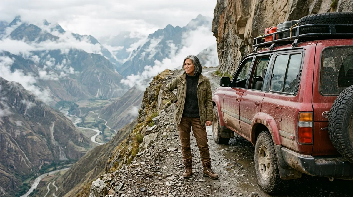
Your engine dies with a sharp metal ping four thousand meters up, surrounded by sheer rock faces and fog so thick you cannot see the edge of your own bumper.
Mobile signals vanish entirely, emergency services are days away, and the temperature drops below freezing the moment the sun slips behind the jagged peaks. Most travel blogs romanticize extreme road trips as carefree adventures, but the reality of driving these routes alone involves calculated risk environments where mechanical failure, volatile weather, and unrelenting gravity compound rapidly without a co-driver to share the load.
⚠️ COMMON MISTAKE
The Solo Penalty on Remote Routes
Assuming a reliable mobile phone and standard roadside assistance will save you in deep canyon zones is a fatal oversight.
The Mechanics of Isolation: Why Extreme Roads Demand a Copilot
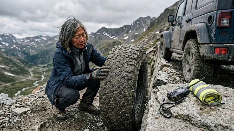
Driver fatigue loops trap solo motorists on long stretches because cognitive load cannot be split between active navigation and vehicle monitoring.
You miss micro-sleep warnings and sudden environmental hazards when you shoulder 100 percent of the driving stress for twelve straight hours. High-altitude mountain passes introduce severe mechanical hurdles that test both machine and operator.
Vapor lock stalls fuel lines in thin air, extreme brake fade destroys friction pads on prolonged descents, and razor-sharp shale slices through tire sidewalls without warning.
Satellite dead zones render standard mobile phones useless.
You must rely on dedicated satellite messengers and dual-battery setups to maintain an emergency lifeline when traversing deep mountain canyons.
The Brutal Statistics of Solo Driving
Metrics from global mountain rescue authorities
Yungas Road: Navigating Bolivia’s Route of Death
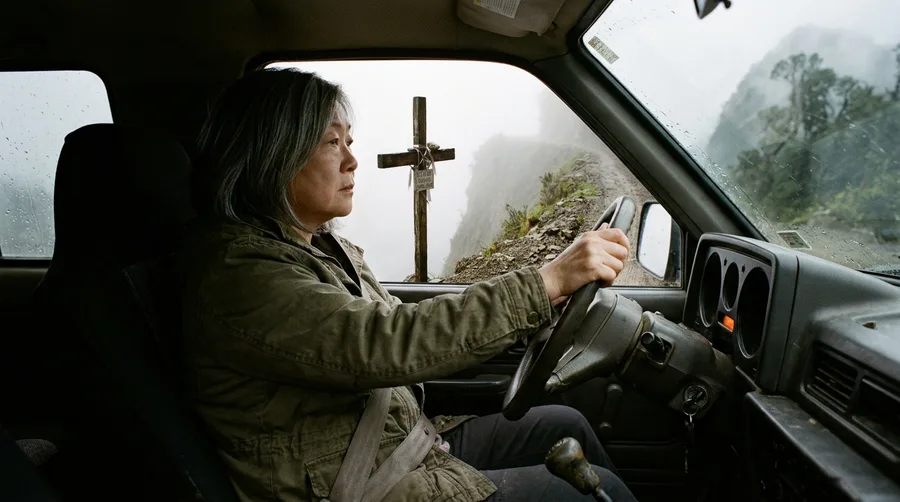
South America presents some of the most unforgiving terrain on the planet, led by a legendary descent that earned its grim moniker honestly.
El Camino de la Muerte drops over three thousand meters from the cold altiplano of La Paz down to the humid jungle basin of Coroico.
The single-lane dirt track hugs sheer vertical drop-offs exceeding six hundred meters with zero guardrails to catch a sliding wheel.
Cascading seasonal waterfalls cross the road surface directly, creating slick mud patches while dense fog banks reduce forward visibility to less than two meters.
Local driving customs dictate that uphill traffic maintains the right-of-way and hugs the outer edge of the cliff to let downhill vehicles pass safely.
Yungas Road Then vs. Now
Historical Route
- Heavy commercial bus traffic sharing single lanes
- Zero modern safety barriers or guardrails
- Frequent multi-vehicle pileups from brake failure
- Limited emergency communications
Modern Reality
- Commercial traffic diverted to paved bypass
- Dominated by adventure cyclists and tourist 4x4s
- Stricter seasonal weather monitoring
- Established local guide networks
Guoliang Tunnel Road: Carving Through the Taihang Mountains
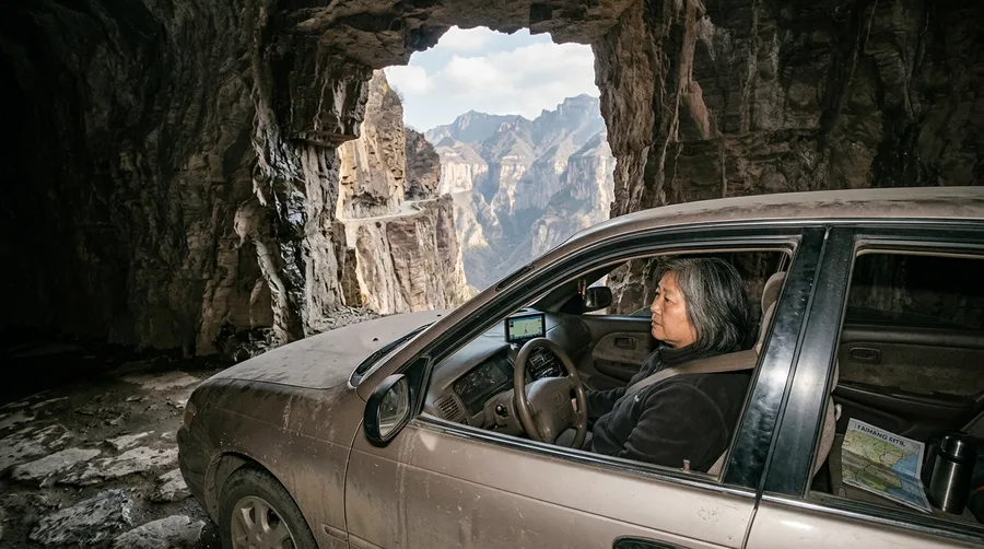
Human engineering met sheer stubbornness in China when thirteen local villagers spent five years hand-chiseling a tunnel through vertical limestone.
The resulting passage spans 1.2 kilometers directly into the face of the Taihang Mountains.
Asymmetrical stone windows cut into the rock wall offer terrifying views of the abyss below while providing natural light to the dark interior.
Driving this tunnel alone creates intense spatial disorientation and severe tunnel vision.
The limestone floor stays polished and slick from damp mountain air, and meeting an oncoming tour bus inside an unlit bore requires reversing blindly into tight rock niches.
⛏️ Evolution of Guoliang Tunnel Safety
Hand Excavation
Villagers use hammers and hand-drills to carve the original path.
Opening
The tunnel opens to foot and light agricultural traffic in 1977.
Global Discovery
International adventure travelers discover the precipitous route.
Modern Regulation
Local authorities implement strict vehicle size limits and traffic lights.
When you drive alone on a shelf road, every single miscalculation belongs entirely to you.
— Mountain Rescue Operations Veteran
Dalton Highway: Sub-Arctic Isolation and Haul Road Hazards
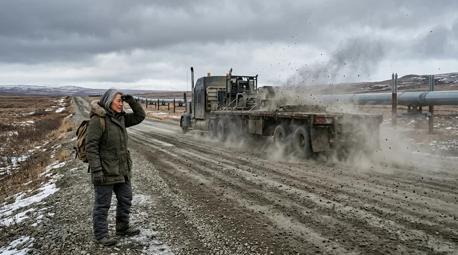
Alaska Route 11 stretches 414 miles across the desolate Arctic tundra, running parallel to the Trans-Alaska Pipeline with only three small settlements along the entire corridor.
Gravel surfaces kick up dense clouds of dust and flying stones that crack windshields instantly when passing massive eighteen-wheelers.
Industrial transport trucks hold absolute right-of-way, and pulling over requires extreme caution on soft shoulders that can swallow a tire.
Sub-arctic winter temperatures drop low enough to freeze exposed human flesh in seconds.
Fuel gelling and sudden whiteout blizzards turn a standard transport drive into a life-threatening thermal survival scenario.
💡 PRO TIP
Haul Road Survival Equipment
Keep a winter rated sleeping bag, chemical hand warmers, and a multi fuel stove inside the cabin rather than the truck bed.
Arctic Vehicle Prep Budget
Zoji La Pass: Navigating Himalayan Instability
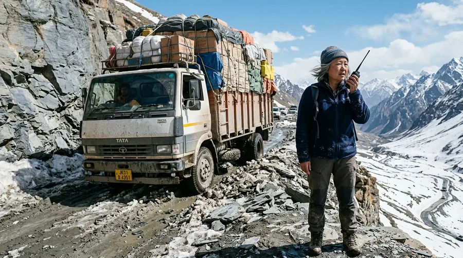
Connecting the Kashmir valley to Ladakh, Zoji La Pass sits at 3,528 meters above sea level across unstable, crumbling slate slopes.
High-velocity wind gusts whip across open ridges while unpredictable avalanches sweep the narrow tracks clean without warning.
Summer brings sudden flash mudslides that wash away entire road sections, stranding motorists for days in sub-freezing altitude.
Traffic management on the pass is chaotic and terrifying.
Navigating gridlock alongside reckless military convoys and overloaded commercial trucks on crumbling outer edges leaves zero room for driver error.
Essential Zoji La Gear
The Solo Explorer's Readiness Timeline
The Engineering Consensus: Where Road Safety Experts Agree
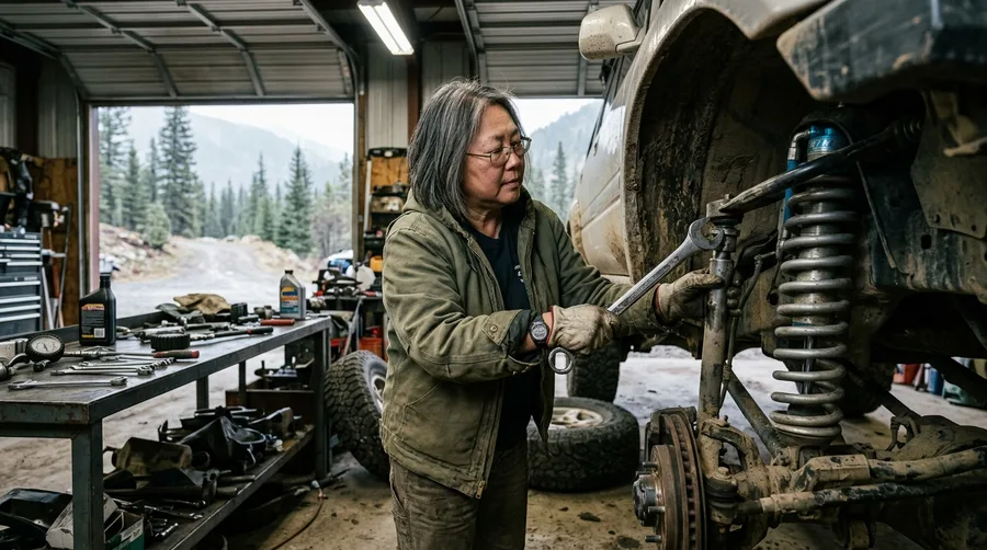
Civil engineers and search-and-rescue specialists share a unified stance on extreme shelf roads.
Infrastructure design cannot eliminate human error in remote environments, making self-regulation the ultimate safety buffer.
Real-time tire pressure monitoring, heavy-duty suspension upgrades, and mechanical redundancy are non-negotiable standards for anyone traveling alone.
Recognizing when weather or mechanical degradation crosses the threshold from adventure into survival crisis is a vital skill.
Turning back early is always safer than gambling with worsening conditions.
Risk Factors in Remote Driving
Primary causes of solo motorist stranding
The Solo Driver’s Pre-Trip Self-Assessment
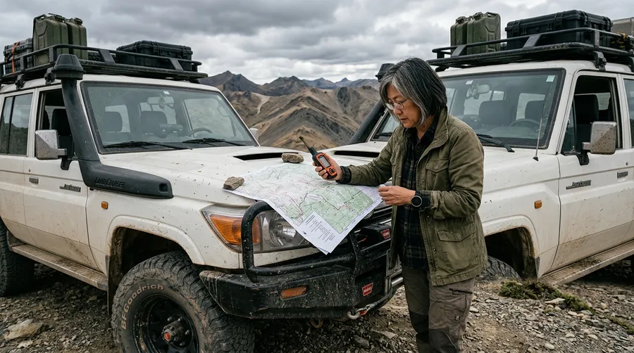
Assess your own psychological readiness and stress management limits before committing to isolated terrain.
Build a structured contingency plan that accounts for unexpected delays, vehicle immobilization, and harsh weather exposure.
Verify your vehicle’s ground clearance, low-range gearing, and winch capabilities before departure.
Log strict satellite check-in times with a designated contact at home.
Establish an automatic rescue trigger protocol if you fail to check in within a defined time window.
🌱 GROWING TIP
Establish Contact Protocols
Always set a hard turnaround time with your emergency contact before entering dead zones, and stick to it regardless of your progress.
Frequently Asked Questions
What is the safest type of vehicle for driving remote mountain passes alone?
A four-wheel-drive vehicle with high ground clearance, robust diesel torque, manual or selectable locking differentials, and heavy-duty all-terrain tires provides the necessary mechanical reliability.
Do satellite messengers work reliably on high-altitude shelf roads?
Satellite messengers require a clear line of sight to the sky. Deep canyon walls and steep mountain cliffs can block signals temporarily, so you must transmit messages only when stopped in open clearings.
How do you handle oncoming traffic on a single-lane cliffside road?
Local convention dictates that the vehicle traveling uphill has the right-of-way because it maintains better traction control. The downhill driver must back up to the nearest wider turnout.
What emergency supplies should be kept inside the cabin rather than the truck bed?
Drinking water, communication devices, core thermoregulation gear, and first-aid kits must stay inside the cabin so they remain instantly accessible if the vehicle suffers a rollover or slide.
Navigating the Edge Without a Net
Conquering extreme roads is never about proving fearlessness or testing fate against impossible odds.
True exploration demands absolute respect for the unforgiving physics of isolation and terrain. Preparation, humility, and the absolute willingness to turn back remain your greatest survival assets when driving alone at the edge of the world.