The Appalachian Trail gets filed under six months and a thousand miles. The better number for a free afternoon is 3.5 hours.
From 1 p.m. to 5 p.m., May through October, you have that much usable daylight on trail, and a chain of day segments sits within a short drive of a paved or gravel road and a small-to-medium lot.
You pick one by round-trip miles, elevation gain, moving time and how easily you get to the trailhead, not by end-to-end ambition. Walk a grassy bald on the NC/TN line, scramble a rock gap in Harriman, stand on Massachusetts’ highest summit, or stare down at the Potomac from a cliff, provided the climb and the trail time leave margin inside the window.
By the end you can name your trailhead, quote the round-trip miles, gain and hours on foot, and check closures, parking and weather with the Appalachian Trail Conservancy or the managing park. An afternoon worth remembering comes from matching segment to window, not from sampling the thru-hike.
Quick Tips Before You Start
Start at 1 p.m. sharp
The 3.5-hour window is real. A 1:30 start cuts your turnaround margin to two hours.
Carry one liter
A liter covers 2 to 3 hours of moderate climbing. Refill points on the AT are not guaranteed.
Download the map
Cell service drops on most of these segments. Use an offline app or print the ATC segment map.
Pack a rain shell
Exposed balds and ridges catch afternoon storms. A shell weighs less than a pound.
Arrive before 2 p.m.
Weekend trailhead lots fill by midday. Before 2 p.m. is your best parking window.
Check closures first
Verify trail, road and parking status with the Appalachian Trail Conservancy or the managing park.
1. Andrew’s Bald from Clingmans Dome
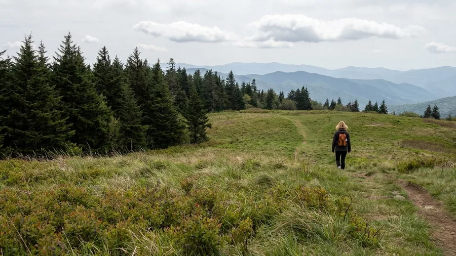
It trades a paved overlook crowd for a climb that ends somewhere quieter. From the Clingmans Dome lot, the route runs 3.6 miles round trip with about 500 ft of gain, and roughly two hours on trail gets you there and back, so you are walking under spruce-fir cover before the first clearing opens.
The forest breaks onto grass all at once, and the bald sits right on the NC/TN line with mountain views on both sides. Walk it early in the afternoon: the lot at Clingmans Dome fills and competes with your 1 p.m. start, so a prompt arrival buys the parking. Two hours of trail time leaves about 1.5 hours of the 3.5-hour window for the bald itself, the turnaround and the drive out.
💡 Tip: The bald is exposed. If the forecast shows afternoon storms, save this one for a clear morning.
| Trail segment | State | Round-trip miles | Elevation gain (ft) | Time on trail | Best for |
|---|---|---|---|---|---|
| Andrew’s Bald from Clingmans Dome | NC/TN | 3.6 | 500 | 2 hrs | Classic AT bald |
| Max Patch Grass Balds Loop | NC | 2.4 | 360 | 1–1.5 hrs | Easiest big view |
| Grayson Highlands Wilburn Ridge | VA | 3.5 | 600 | 2–2.5 hrs | Ponies and ridge |
| Humpback Rocks via AT | VA | 2.0 | 700 | 1–1.5 hrs | Big Virginia overlook |
| Annapolis Rock Out-and-Back | MD | 4.0 | 600 | 2–2.5 hrs | Cliff view |
| Weverton Cliffs Quick Climb | MD | 2.5 | 500 | 1–1.5 hrs | River view |
| Bear Mountain Loop via AT | NY | 3.9 | 900 | 2.5–3 hrs | Variety: tower, lake, ridge |
| Harriman Lemon Squeezer | NY | 3.5 | 500 | 2–2.5 hrs | Rock scramble |
| Mount Greylock Summit via AT | MA | 3.0 | 700 | 1.5–2 hrs | State high point |
| Lonesome Lake Hut Out-and-Back | NH | 3.0 | 1,000 | 2–2.5 hrs | Hut and lake view |
| Mount Minsi via AT | PA | 3.0 | 800 | 2–2.5 hrs | River-gap view |
| Stony Man via AT | VA | 1.6 | 340 | 45 min–1 hr | Shortest summit walk |
| Roan Mountain Grassy Ridge | NC/TN | 4.0 | 700 | 2.5–3 hrs | Open sky |
| Mahoosuc Notch Short Scramble | ME | 2.5 | 400 | 2–3 hrs | Famous rock scramble |
2. Max Patch Grass Balds Loop
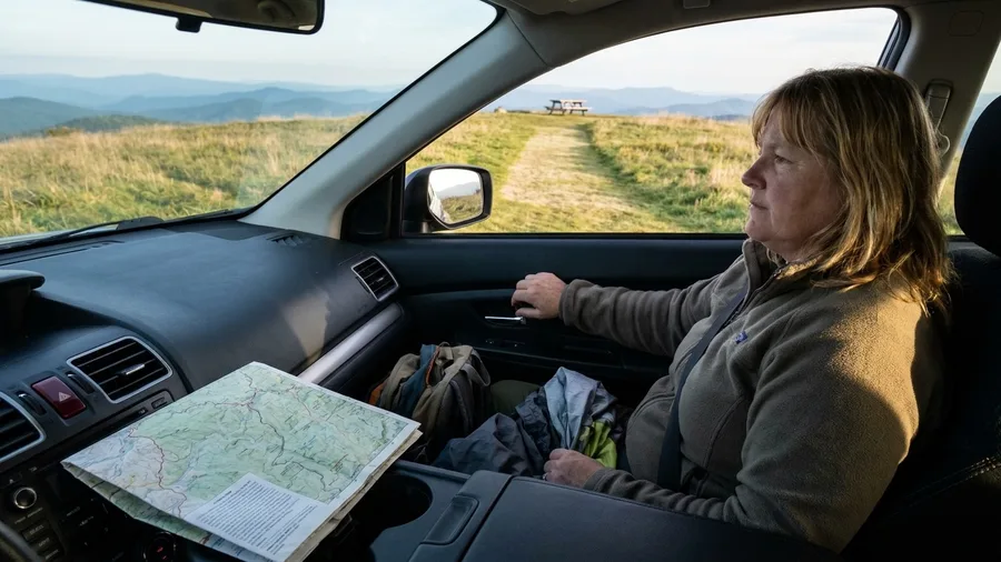
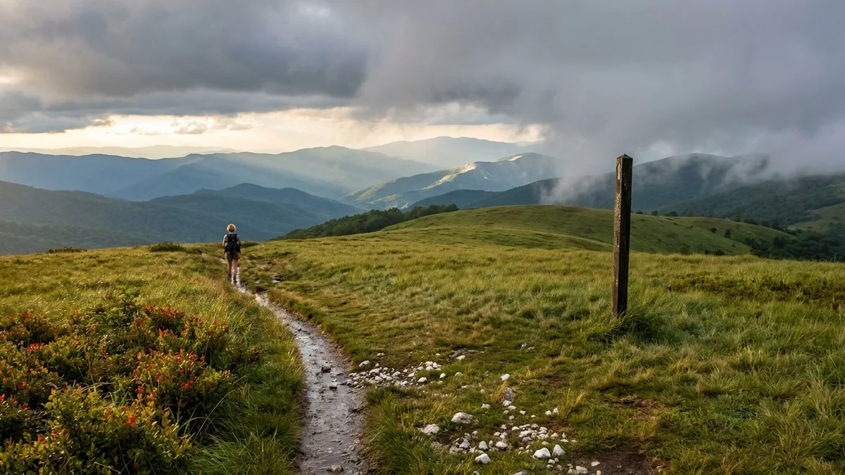
This is the one to take if your start slips toward 1 p.m. and you still want sky. The Max Patch loop is 2.4 miles around with 360 ft of climb, and a steady walker covers it in 1 to 1.5 hours, leaving more than two hours of the afternoon in hand. That is why it outranks a longer ridge walk for a packed day: you climb almost nothing for a view that feels like a summit.
The loop runs over open grass balds, and the mowed path keeps footing easy the whole way, so a six-year-old or a grandparent can walk it without a scramble. A picnic table near the top makes a natural lunch turnaround: eat, then walk the loop and you can be back at the car inside 90 minutes. But the gravel approach road narrows for the last stretch, the lot is small, and a high start eats into your margin.
The exposed bald is also the risk. Wind and a fast-moving afternoon thunderstorm cross open grass with no shelter, so check the forecast before turning onto the gravel, and carry a rain shell even if the sky looks clear. Arrive late morning or early afternoon and the lot turns over regularly.
💡 Tip: No water and no shelter on the bald. Carry everything you need from the car.
⚠️ COMMON MISTAKE
The 1 p.m. start is not a suggestion
The most common afternoon mistake is treating the 3.5-hour window as flexible. It isn't. Add the drive in, the parking search, and the drive out, and a trail that takes 2.5 hours on foot eats nearly all of it. Pick a segment whose on-trail time is under 2.5 hours unless you're starting at noon.
3. Grayson Highlands Wilburn Ridge Walk
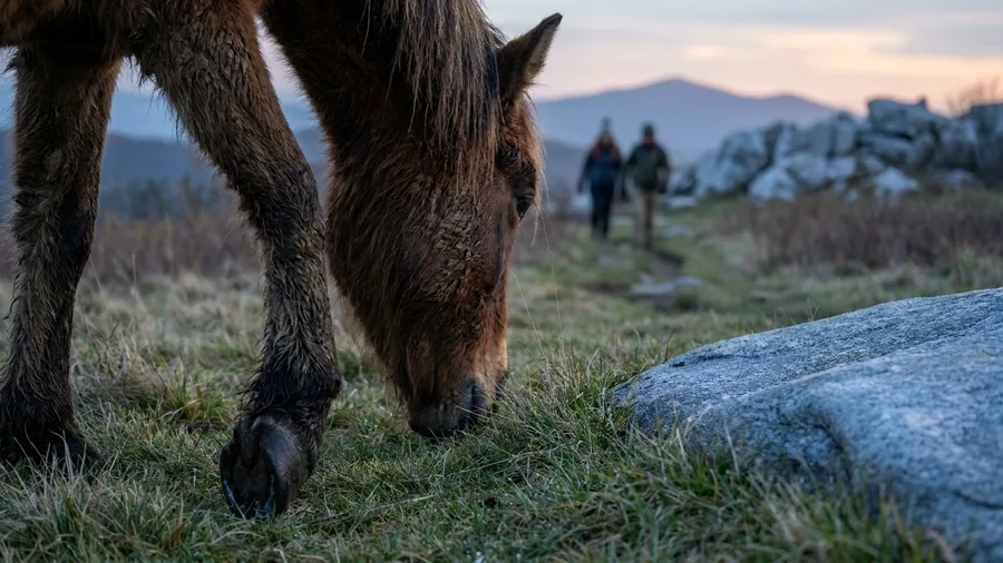
Wilburn Ridge is the high-mountain ridge walk you take when you have a little more trail time than the easiest bald loop demands. From Massie Gap, a marked AT spur puts you on open highland in minutes, and the 3.5-mile round trip with 600 ft of gain runs 2 to 2.5 hours on foot. The catch comes up front: those 600 ft and the rocky stretches make this a real hill walk, not a lawn stroll, and it is where someone new to hiking starts to feel the afternoon.
What you get for the effort is an open spine of rock outcrops and Mount Rogers views with wild ponies grazing the grass. They are wild animals on open grazing land, not a petting zoo, so keep your distance and never feed them. Two to 2.5 hours leaves a middle slice of the 3.5-hour window, enough for the ridge and the return, provided you start on time and watch the sky on the exposed sections.
Before You Drive to the Trailhead
-
Check closures and trail status with the ATC or managing park Roads and gates change seasonally
-
Confirm parking rules and lot capacity Some lots require a pass or have a time limit
-
Read the afternoon forecast Exposed balds and ridges catch fast storms
-
Download an offline map of the segment Cell service is spotty on most of these trails
-
Pack 1 liter of water and a rain shell No reliable refill points on these segments
-
Set a turnaround time before you start walking Turn around at the time, not at the summit
4. Humpback Rocks via Appalachian Trail
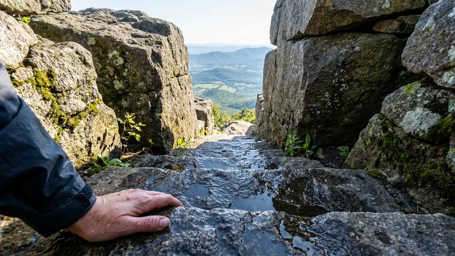
Go on a dry day, because the summit is bare rock with nothing to duck behind when a storm rolls in, and the steps on the way up get slick when they’re wet. The climb to Humpback Rocks packs 700 feet of gain into 2.0 miles, so the short distance is deceiving: this is a hard hour, not a stroll. Hikers whose knees protest on steep steps can find gentler options in trail towns built for older hikers. Rocky steps carry you up in a series of short, knee-deep pushes, and the trail time runs 1 to 1.5 hours for the round trip.
Where the open ridge walking at Grayson Highlands spreads its effort across wide ground, Humpback Rocks concentrates all of it in a single steep pull, and the reward is a different kind of Virginia: a rock outcrop jutting out over the Shenandoah Valley, with the valley floor spread out below and the Blue Ridge folding away to the horizon.
Parking at Humpback Gap puts the trailhead right off the road, which is what makes the climb work on a 1 p.m. start. Late afternoon is the hour to aim for if you can flex the drive, since the outcrop faces west and the light softens across the valley as the day drops, but the 1 to 1.5 hours on trail still fits comfortably inside the afternoon with time to spare for the view.
💡 Tip: The best light on the valley is mid-afternoon. A 1 p.m. start lands you at the summit right on schedule.
5. Annapolis Rock Short Out-and-Back
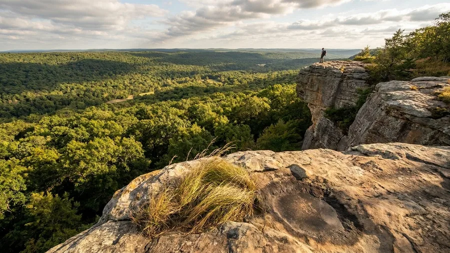
The rocks are warm under your hand as you pull up the last step, and then the trees fall away and the whole of Greenbrier State Park sits below you, green and still, with the cliff dropping off at your boots.
That drop is the payoff and the hazard at once, so keep well back from the edge, especially with kids or a windy day. The view is the reason to come, and it comes after a steady woodland climb rather than a scramble: 4.0 miles round trip with about 600 feet of gain, 2 to 2.5 hours on trail, most of it under a canopy of oak and hickory before the trees open at the cliff.
If a stepped summit climb in about an hour gets you an overlook, this route stretches the same cliff-view idea into a longer, gentler approach and a bigger block of the afternoon. It is more time on foot than the quick climbs, and what you trade for it is a quieter walk through the woods and a longer sit at the top.
The trailhead is a small lot on US-40 that fills by midday on weekends, so a 1 p.m. start has almost no parking margin. Arrive before 2 p.m. and you are more likely to find a space; later and you may be circling or parking down the road.
6. Weverton Cliffs Quick Climb
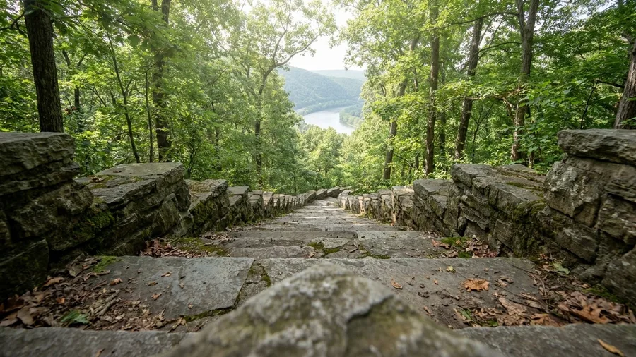
About an hour of climbing gets you a river view, and 2.5 miles round trip with 500 feet of gain is the whole of the work. Switchbacks and stone steps lift you off the Potomac floodplain to an overlook above the water, and that short round trip leaves more than half of the 3.5-hour afternoon in reserve for a late 1 p.m. start or a slow hunt for a parking spot.
The location near Harpers Ferry is the draw: you get the river bend and the town’s gap from above in a fraction of the time a bigger summit demands. It is the shorter of the two river overlooks nearby, and the one to pick when the afternoon has less margin.
Park at the Weverton Road lot, which is small, and check the weather before climbing, because the overlook is exposed to the wind and to storms that build and move fast along the Potomac. Once you are up there, stay a while: the ledge is a good place to sit with your back to a rock and watch the river do nothing at all.
7. Bear Mountain Loop via AT
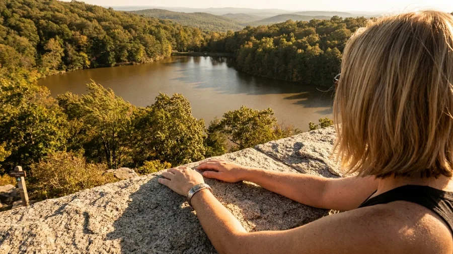
The tower’s stone holds the afternoon heat and gives it back as warmth through your palm; below, Hessian Lake sits flat and brown-green in the low sun. From the Bear Mountain Inn lot, a 3.9-mile loop with about 900 ft of gain packs Perkins Memorial Tower, the lake shore and Hudson Highlands ridge views into 2.5 to 3 hours on trail.
That combination is why it earns a spot: you get a tower, a lake and a ridge in one walk instead of a single overlook. The catch is the clock. At 2.5 to 3 hours on trail, this loop uses the top of the 3.5-hour window, so a 1 p.m. start leaves no slack. Park at the inn, keep the summit stop short, and know that weekend crowds arrive with you rather than after you.
💡 Tip: Skip the summit snack and eat in the car. Losing 20 minutes at the top erases your margin.
Two ways to spend the afternoon
The bald walk
- 1.5–2 hrs on trail
- Open views from the start
- Exposed — check weather
- Best for photos and a picnic
The scramble
- 2–3 hrs on trail
- Hands-on rock, slower pace
- Dry rock required
- Best for confident hikers
8. Harriman Lemon Squeezer Scramble
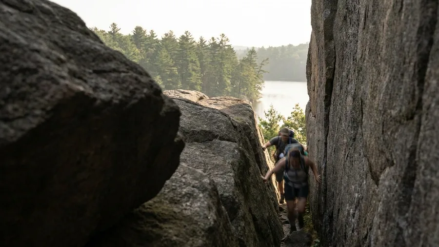
From the Elk Pen lot in Harriman State Park, yes: a 3.5-mile round trip with about 500 ft of gain reaches the Lemon Squeezer, a rock gap you climb through with your hands, and opens to a view over Island Pond. Budget 2 to 2.5 hours on trail.
The money here is parking rather than a ticket. Harriman day-use parking is typically a modest fee in the range of $6 to $10 per car, and until the lot fills it is the cheapest hands-on rock work you will find near the city. Check current rates and lot rules before you drive.
Short mileage is the trap. The crevices are narrow enough that a large pack does not fit through, so leave it in the car or strip it down, and wet rock turns the moves slick. Read the route as playful rather than exposed, but it still asks for care and an honest 2 to 2.5 hour moving time.
Compared with the bald loops and overlooks nearby, this scramble eats more of the window for less distance. Dry rock and daylight are the conditions that make it work, and a late 1 p.m. start does not leave room for both the squeeze and a slow return.
Lemon Squeezer at a glance
📍 Turnaround cutoff
Start by 2:30 to finish by 5
⏱️ Latest start
Cuts the squeeze at 2:45
⛰️ Elevation gain
500 ft
🅿️ Lot fills
Weekends by noon; arrive before 2
🪨 Break-even
Dry rock only — wet turns it slick
☀️ Before you drive
Check ATC closures and park rules
One thing not to carry
Cell service is spotty — download an offline map before Elk Pen, because the crevices get narrow and the route markers are sparse.
9. Mount Greylock Summit via AT
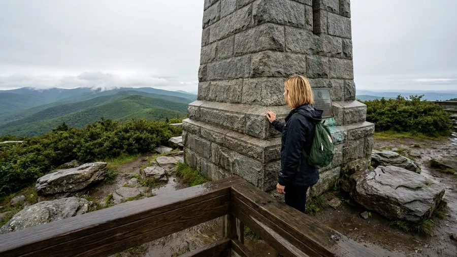
Skip the rock gymnastics and take the summit: Mount Greylock is the afternoon entry that trades hands-on scrambling for a walk to Massachusetts’ highest point, and it pays off with a lodge, a war memorial tower and a summit panorama. From the Notch Road gate, the AT segment runs 3.0 miles round trip, climbing roughly 700 ft over 1.5 to 2 hours on trail.
That leaves more than an hour of the 3.5-hour window untouched, so a 1 p.m. start here is comfortable rather than tight. What sets Greylock apart from a bare overlook is what sits at the top: Bascom Lodge for a porch rest and the granite war memorial tower you can climb for the widest view in the state. The approach is short but it still gains real elevation, so the climb earns the summit rather than handing it to you.
The catch is road status. The Notch Road gate and summit access decide whether this approach works at all, so check conditions before you leave the car and confirm the gate is open for the season – typically May through October. Get that right and the walk delivers a high point, a tower and a lodge inside the afternoon with margin to spare.
💡 Tip: Bascom Lodge is seasonal. Check its hours if you want a hot meal at the top.
10. Lonesome Lake Hut Out-and-Back
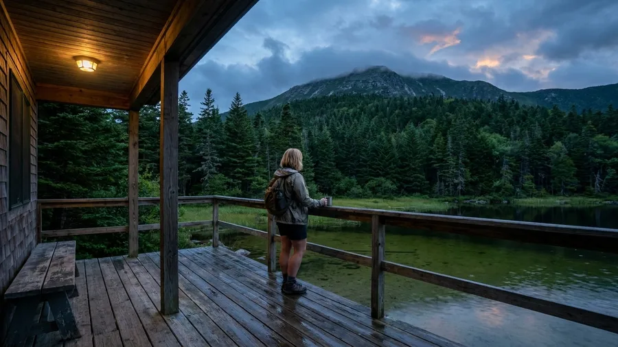
The spruce and fir hold the cold on the climb up, and the air turns damp and shaded before it opens. This is the same short-climb format as a state high point, aimed instead at a wooden hut and a lake under Franconia Ridge. Round trip runs 3.0 miles with 1,000 feet of gain, call it 2 to 2.5 hours on trail.
The hut porch is the destination: sit, look out over Lonesome Lake, and the ridge rises behind it. The 1,000 feet is the real work here, more climbing than the bald walks, but it fits the afternoon and leaves time to sit before you turn around. Park at Lafayette Place; the lot is the constraint, so an arrival before noon is the difference between a 1 p.m. start and a drive to a backup. The hut is a turnaround with shelter, not a shortcut, so budget the hours and the climb together.
Four AT afternoon myths, corrected
11. Mount Minsi via Appalachian Trail
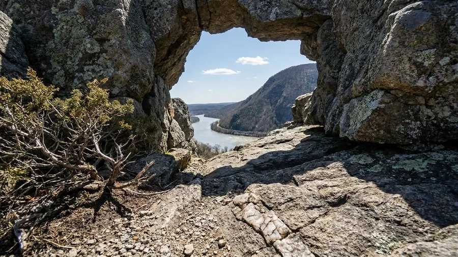
The climb here is 800 feet, where a hut-and-lake route asks for 1,000, and the reward is a different river. A steady ridge walk of 3.0 miles round trip, 2 to 2.5 hours on trail, ends at a rock overlook above the Delaware.
What you get at the top is the water gap itself: the Delaware bending through, and Mount Tammany across the river, its long slope rising straight out of the far bank. It is a famous view and a busy one on a clear weekend, so the crowd at the ledges is the real price. Worth it once for the pairing of river and mountain, less so if you wanted solitude. The overlook is a cluster of rock, not a broad platform, and people rotate through in minutes.
Park at the Lake Lenape trailhead and watch the weather. Wet rock slows the ridge and stretches the 2 to 2.5 hour estimate into a longer afternoon; at 3.0 miles and 800 feet the climb sits inside the 3.5-hour window, but slick stone is the condition that breaks the plan.
💡 Tip: The overlook is exposed. Wind on the river gap is stronger than it feels at the trailhead.
12. Stony Man via Appalachian Trail
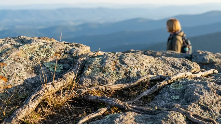
Forty-five minutes to 1 hour on trail, 1.6 miles round trip, 340 feet of gain. That is the shortest summit walk on the AT in Shenandoah, and it leaves the rest of a 3.5-hour afternoon as buffer. Readers who want big views without the climb can find more trails like it in national park hikes with zero fitness.
The payoff is the cliff view over Skyland and down the Shenandoah Valley, a summit view for the least time on foot of anything on this list. Park at the Stony Man trailhead and check NPS entry requirements before driving, since the park’s rules apply the moment you pass the gate.
Come after a 1 p.m. start and you still walk out with daylight to spare. If the afternoon has shrunk, or the drive ran long, this is the one to take.
13. Roan Mountain Grassy Ridge
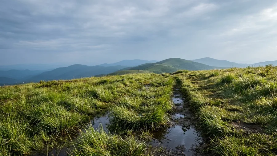
You climb out of the gap at Carvers Gap and the trees simply stop, and the wind arrives at the same moment the view does. Grassy Ridge is the AT’s bald-hopper walk on the NC/TN line: 4.0 miles round trip from the Carvers Gap trailhead with about 700 ft of gain and 2.5 to 3 hours on trail, grassy summits strung together so the sky stays open almost the whole way.
It is the free win here — no fee, no gate, a roadside lot at the gap — and it buys the most open sky of any single afternoon on this list. The effort is spread thin across the ridge instead of stacked into one climb, which is exactly why it eats 2.5 to 3 hours of a 3.5-hour window. Pack a rain shell even on a clear 1 p.m. start: high and exposed, you feel a weather change before the forecast does.
14. Mahoosuc Notch Short Scramble
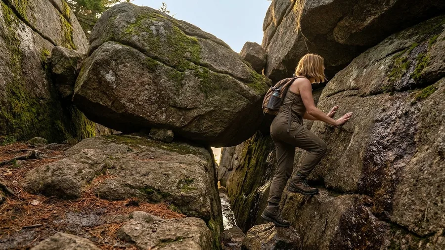
Mahoosuc Notch is the AT’s rock puzzle, and locals treat it as a gym rather than a hike. The distance is what fools people: 2.5 miles round trip and only 400 ft of gain, but the book time runs 2 to 3 hours because the middle mile is a jumble of car-sized boulders you climb over, under and between, sometimes handing a pack up ahead of you.
The trailhead sits at the end of a remote gravel road, so check road and weather conditions before you drive, and go only on dry rock with daylight to spare. A prompt 1 p.m. start and a hard turnaround are what let the notch fit inside 3.5 hours; it is the strong hiker’s option, not the default, and anyone watching only the clock should pick something else.
💡 Tip: Rocks stay wet in the notch shade. If it rained yesterday, give it another day.
Frequently Asked Questions
Can you really hike part of the Appalachian Trail in an afternoon?
Yes. The AT runs through 14 states, and many segments sit within a short drive of a trailhead. A 2- to 4-mile round trip with 300 to 1,000 feet of gain fits the 3.5-hour window from 1 p.m. to 5 p.m. if you set a turnaround time.
What is the easiest big-view AT hike for a tight afternoon?
Max Patch in North Carolina. The 2.4-mile loop gains 360 feet and takes 1 to 1.5 hours on trail, with open bald views almost from the car. It leaves most of the afternoon as margin.
How much water should I carry for a short AT hike?
One liter covers 2 to 3 hours of moderate climbing. Refill points are not guaranteed on these segments, so carry everything you need from the trailhead.
Which AT afternoon hike is best for a late start?
Stony Man in Shenandoah. At 1.6 miles round trip and 340 feet of gain, it takes 45 minutes to 1 hour on trail, leaving the rest of the window as buffer for a 1:30 p.m. start.
Do I need to worry about parking at these trailheads?
Yes. Most lots are small to medium and fill by midday on weekends. Arrive before 2 p.m. when you can, and check the managing park’s page for parking rules before you drive.
When is the best season for an afternoon AT hike?
May through October, when afternoon daylight and trailhead access fit this plan. Winter closures, seasonal roads and early sunsets can all break the 3.5-hour window.
Pick the segment your afternoon can actually hold
Starting late, take the shortest walk: Stony Man, 1.6 miles round trip with 340 feet of gain and 45 minutes to an hour on trail. Want open views without a long climb? A bald or ridge gets you there, with Max Patch for the tight afternoon and Roan Mountain for the most sky. A rock scramble belongs only in dry weather with enough daylight to move slowly, which means Harriman’s Lemon Squeezer or Mahoosuc Notch and nothing less.
Before you drive, check current closures, parking rules and the forecast with the Appalachian Trail Conservancy or the managing park, because cell service can be spotty. Carry 1 liter of water, a map or offline app and a rain shell.
The 1 p.m. start and the 3.5 hours of daylight are the whole test. Pick the segment whose round-trip time, climb and trailhead margin leave the payoff reachable and the car reached before the light goes.
One segment. One afternoon.
Pick your trailhead from the table at the top, set a turnaround time, and check the ATC page for closures before you leave. That's the whole plan.