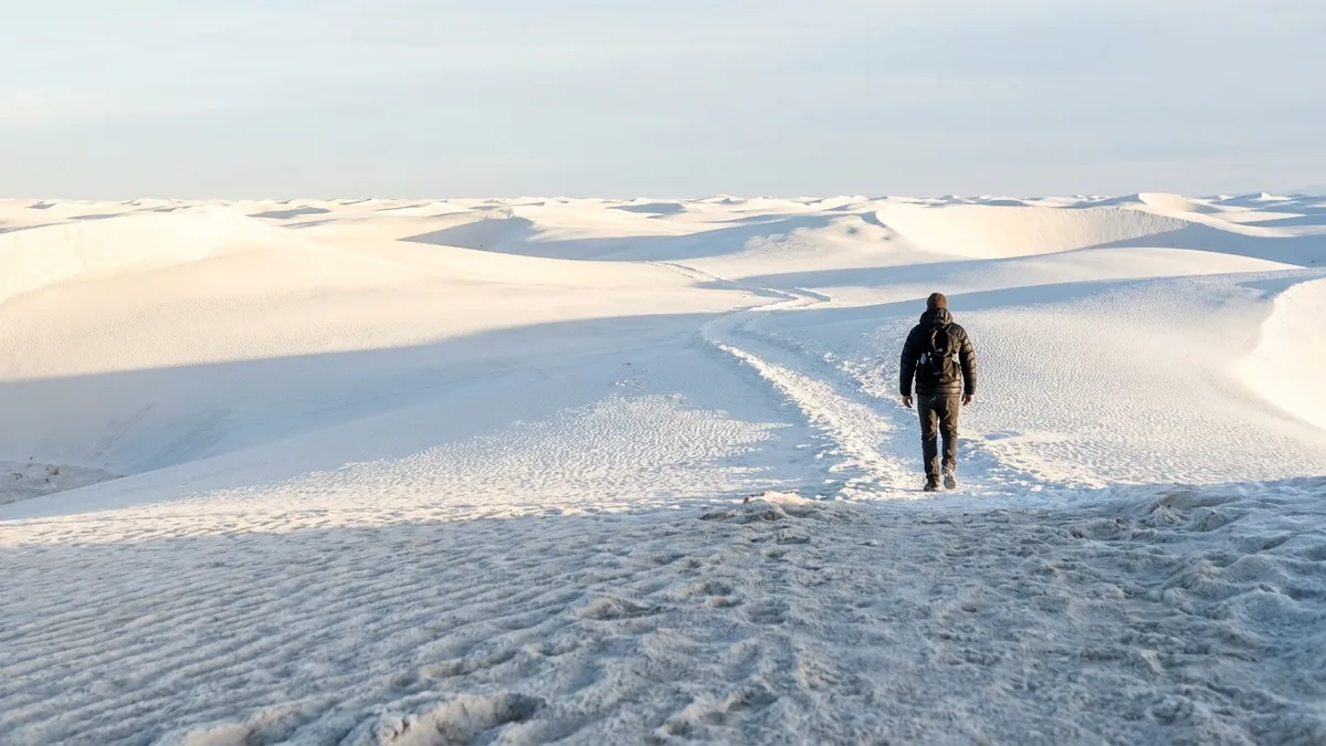
Rent the snowshoes after you pick the trail, not before. Most winter hikers do it the other way around, and that is how you end up on a forest road breaking trail through powder, looking at the same conifers you could have seen from a highway pullout in July. The gear decides the hike, when the hike should decide the gear.
These ten routes look like another planet, and not one of them needs flotation. The surfaces tell you why: packed sand, sandstone, gravel, boardwalk, lava, packed snow, slickrock, dirt. Boots handle all of it, with microspikes the most you will want at Craters of the Moon, Bryce and Arches. So the real decision is not what to buy. It is what is underfoot and how cold the air is.
Work through the ten and you can shortlist by warm-weather or cold-scenery taste, match distance and gain to your fitness, and check each park’s winter access page before you drive. Other-planet scenery, no snowshoes required.
Quick Tips Before You Start
Pack microspikes, not snowshoes
A pair of strap-on spikes fits in a daypack and handles the packed-snow sections at Bryce, Arches and Craters of the Moon.
Carry more water than summer
Desert winter air is dry, and the White Sands and Death Valley routes have no water source anywhere on trail.
Check the actual forecast, not the state
Bryce sits above 8,000 feet and can be 20°F colder than the town below; Death Valley can hit 70°F the same week.
Download offline maps
Bisti has no marked trail and patchy cell service; the same goes for the outer dunes at White Sands.
Verify winter access roads
Some park roads close seasonally or after storms; check the park's winter access page the morning you drive.
1. White Sands Alkali Flat Dune Walk
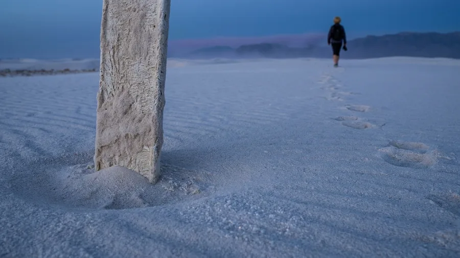
You hear the gypsum before you see it move, a faint hiss as the wind combs the dune crests, and the whole basin glares back white enough to hurt through sunglasses. That is the sound of a place that has nothing to do with snow.
The Alkali Flat Trail runs 5 miles out and back from the trailhead, gaining about 200 feet as it climbs and drops across open dunes into a flat, hard-packed pan. Underfoot it is sand and more sand, firm where the wind has packed it, soft in the troughs. Boots get you the whole way; gaiters keep the grit out of your socks and cost nothing but ten minutes of adjustment.
Stand on the crest that sits roughly a mile and a half in, late in the afternoon, and the dune field runs white to the horizon with a faint lilac line where the far mountains sit. Winter air holds around 40 to 60 degrees, so you can walk it in a base layer and a wind shell and still be comfortable. Because the surface asks nothing of your gear, the real question is distance and exposure: five miles of open sand is a long time in the sun, and there is no shade, no water, and no cover once you leave the trailhead. Solo walkers who want big sky and silence will love it. Anyone who needs a bail-out point will not.
💡 Tip: Sunglasses are not optional. Gypsum reflects light hard enough to cause snow blindness on a bright day.
| Hike | State | Round trip | Elevation gain | Winter surface | Alien feature |
|---|---|---|---|---|---|
| Alkali Flat | NM | 5 mi | 200 ft | Packed sand | White gypsum dunes |
| Fire Wave | NV | 1.5 mi | 200 ft | Sandstone and sand | Striped red rock |
| Golden Canyon | CA | 3 mi | 500 ft | Dry gravel | Badlands canyon walls |
| Hidden Valley | CA | 1 mi | 100 ft | Packed sand and rock | Piled granite boulders |
| North Crater Flow | ID | 1.5 mi | 150 ft | Lava and packed snow | Black lava field |
| Kilauea Iki | HI | 4 mi | 400 ft | Rock and packed dirt | Solidified lava lake |
| Mammoth Terraces | WY | 2 mi | 300 ft | Boardwalk and packed trail | Steaming travertine |
| Queens Garden/Navajo Loop | UT | 3 mi | 600 ft | Packed snow and ice | Snow-dusted hoodoos |
| Delicate Arch | UT | 3 mi | 480 ft | Slickrock and packed snow | Lone red arch |
| Bisti/De-Na-Zin | NM | 3 mi | 200 ft | Dirt and rock | Trailless hoodoos |
2. Valley of Fire Fire Wave Sandstone Trail
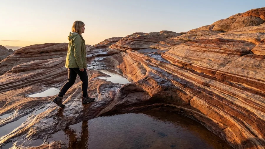
A dune walk covers five miles to make its point; the Fire Wave does it in 1.5, and that is the whole argument for driving out here on a winter afternoon. Striped sandstone, firm underfoot, no flotation, no gaiters, no route-finding.
The trail is a round trip of about 1.5 miles with roughly 200 feet of gain, crossing open sand to a low fin of rock banded in cream, rust and deep red. You are on your feet the entire time, but the footing is solid where it counts. Boots handle it; there is no snow to sink into and no scree to slide on.
most visitors drive in from Las Vegas in the middle of the day, crowd the parking area and shoot the wave in flat overhead light. Locals and rangers go at first light or in the last hour, when the low sun rakes the stripes and the rock reads as layered sediment in a way it never does at noon. Arrive early and you may have the formation to yourself for ten minutes.
The park sits about an hour northeast of Las Vegas, and winter temperatures typically run 45 to 65 degrees, which means a light jacket and maybe gloves. Entry is a per-vehicle fee, check the current amount. This is the quick-win stop on the desert stretch of any winter list: short, bright, and reachable on a half-day.
It suits travelers with limited time who want one dramatic photograph and a short, low-effort trail. It does not suit anyone hunting solitude or a long day out. Come for the color, take the shot, and drive on.
💡 Tip: Combine it with the White Domes loop a mile up the road for a second, slot-canyon-style payoff in the same afternoon.
⚠️ COMMON MISTAKE
Do not assume the desert is warm
Desert winter nights drop below freezing, and the White Sands and Death Valley routes can start at 30°F and finish at 65°F. Dress in layers you can peel, and carry a shell for wind.
3. Death Valley Golden Canyon Badlands Route
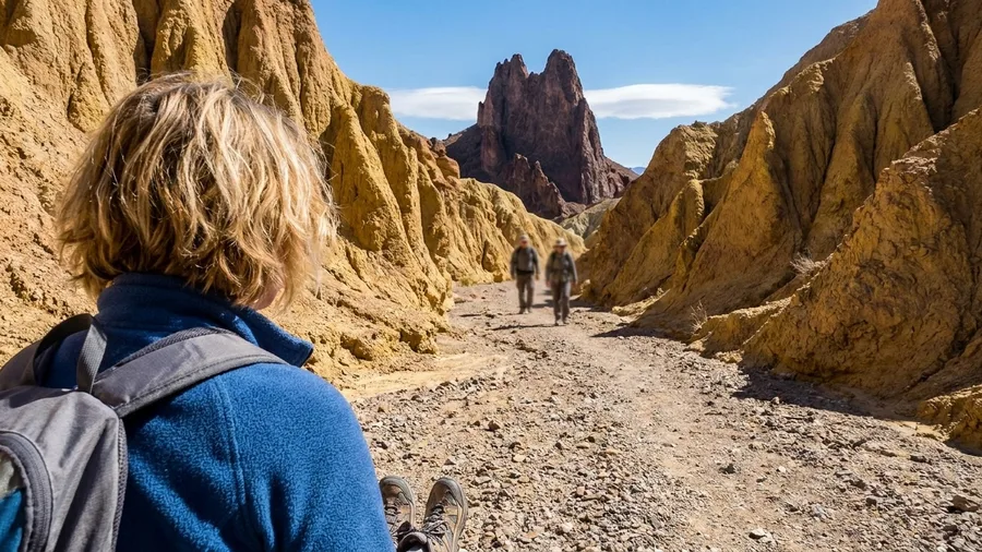
The gravel is loose, so wear shoes with a real tread and start early, because there is no shade and the canyon holds heat once the sun clears the rim. If you have knee trouble or a fear of exposure, the narrow sections above the canyon floor will bother you more than the mileage does.
Golden Canyon to Red Cathedral runs about 3 miles round trip with 500 feet of gain, winding up between ochre badland walls to a fin of red rock. The trail is dry gravel and rock the whole way, boots only, and the gain is bigger than the open desert walks, so your legs matter more than your equipment. Winter temperatures around 50 to 70 degrees make it a genuine warm-weather hike with clear skies and zero snow travel. Families with older kids will manage it; families with small children and hikers hoping for an easy stroll will find it more than they bargained for.
💡 Tip: Start before 9 a.m. The canyon faces east and holds shade until mid-morning, which is the coolest window.
4. Joshua Tree Hidden Valley Rock Maze
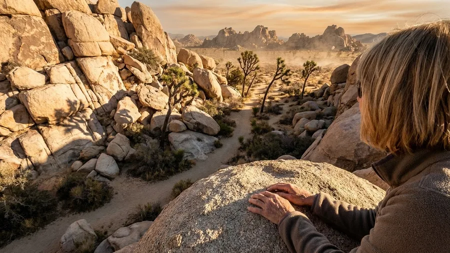
Put Hidden Valley on your list even if the budget is zero, because the park entry fee is the only cost and the walk itself is one easy mile. The loop gains barely 100 feet, and it threads between granite boulders stacked like crates someone abandoned mid-move. Packed sand and rock run the whole way underfoot, so boots are the entire kit list and snowshoes have nothing to do here.
Walls of stone pinch the path to shoulder width in places, then open onto a sandy flat ringed with Joshua trees and scrub. The rock is the strange part: rounded, pale, piled in ways that look arranged rather than eroded, and winter light at 40 to 65°F keeps you comfortable in a thin layer while you gawk.
It is a one-mile loop with 100 feet of gain, so the alien-rock question here is footing, not endurance — which makes it the pick for families, for a late-afternoon leg-stretch, or for anyone whose knees are done with climbing for the day. Arrive early; the Hidden Valley parking lot is small and fills fast. Check the park’s winter page for closures before you drive.
Joshua Tree Hidden Valley — At a Glance
🎟️ Park entry
Around $30 per vehicle, valid 7 days
🅿️ Parking
Small lot, full by mid-morning
🌅 Best hour
Last 2 hours before sunset
🥾 Footwear
Trail runners or boots; microspikes rarely needed
🚶 Skip if
You want solitude — the loop stays busy
Why it fits
The one stop on this list where the permit, the lot and the surface all line up for a boot-only walk.
5. Craters of the Moon Lava Flow Walk
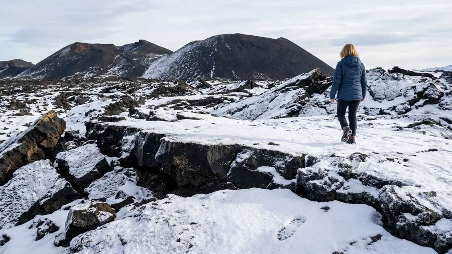
It doesn’t. The North Crater Flow is 1.5 miles round trip with about 150 feet of gain, black rock and cinder cones under a skin of packed snow, and microspikes are as much traction as the route ever asks for.
You walk it in 15 to 35°F air, and the scenery sits close to the trailhead, so the cold exposure stays short. What you are doing, plainly, is crossing a frozen lunar field on foot: boots gripping the packed snow, black lava breaking through in ridges, cinder cones rising against a white sky. Keep the loop short, watch the ice on the steeper rock, and confirm winter access on the monument’s site before the drive.
💡 Tip: The loop is exposed and windy; a face covering makes the difference between a pleasant hour and a miserable one.
The Tourist Way vs the Boot-Only Way
6. Hawaii Volcanoes Kilauea Iki Crater
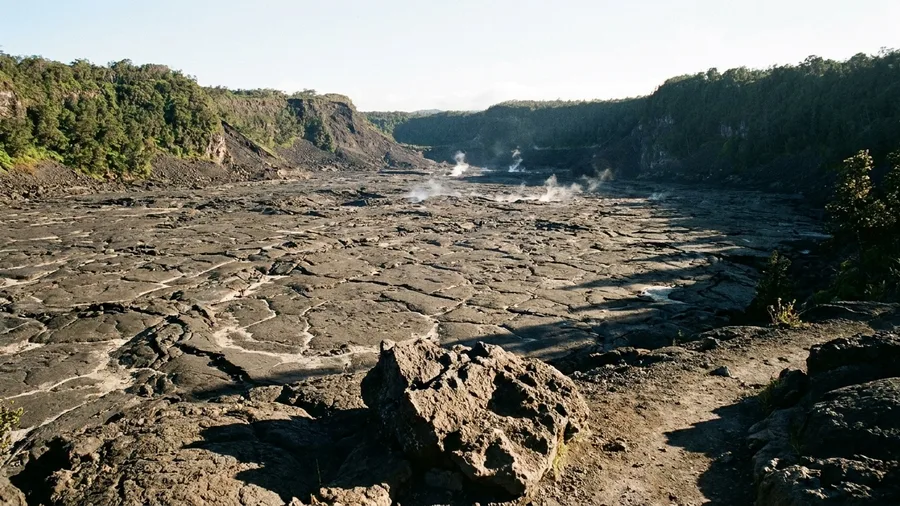
Kilauea Iki is a four-mile loop that drops about 400 feet off the rim and onto the floor of a solidified lava lake.
You descend through fern and ohia forest, then the trees stop and the crater opens: cracked black rock, steam curling from vents, the crust still faintly warm underfoot. The odds of seeing active steam are good — vents here vent most days, depending on the volcano’s mood — while molten rock is not something you can count on. Rock and packed dirt line the crater floor, boots are all you need, and 55 to 75°F means no winter gear at all. Check the park’s site first, since air quality and closures change with the volcano.
💡 Tip: The crater floor can be slick after rain; trekking poles help more than any specialty footwear.
7. Mammoth Terraces Steam and Travertine
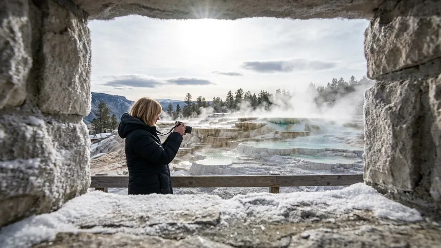
Steam hits your face before you see where it comes from. At ten degrees, every vent along the Mammoth Terraces throws a column of warm vapour that condenses on your jacket and freezes there, and you climb toward it like a hallway radiator. This is volcanic country the way a crater floor is volcanic country, except the heat is coming out of the ground in front of you, and the walking is on boardwalk rather than rock.
The loop is about 2 miles with 300 feet of gain, on a built path and packed trail, which means boots and nothing else. Winter runs roughly 10-30°F here, so the cold air, not snow depth, decides how you dress. Allow an hour and a half, and time it for the middle of the day when the steam catches the light.
💡 Tip: The Lower Terraces are the easiest access; the Upper Terraces are quieter but involve a longer walk in.
🥾 How to Plan a Boot-Only Winter Hike
Check the park's winter access page
Confirm roads, trails and permits are open the morning you drive.
Pick the surface, then the route
Decide whether you want sand, lava, slickrock, boardwalk or packed snow, and choose accordingly.
Match your layers to the temperature range
Desert routes swing 30°F between morning and afternoon; Bryce and Mammoth stay cold all day.
Pack microspikes if there is packed snow
They handle Bryce, Arches and Craters of the Moon; leave the snowshoes at home.
Carry water and a map for every route
Bisti has no marked trail and the dunes have no water source.
8. Bryce Canyon Hoodoo Winter Rim
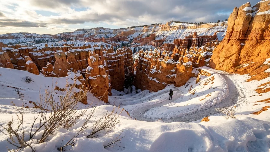
Three miles, 600 feet down and back up, and here is the catch: that is the shortest good hoodoo loop in the park, and it is almost entirely downhill on the way in, which means it is almost entirely uphill on the way out. The Queens Garden and Navajo Loop combination drops you into the amphitheatre and hands you a climb back with the switchbacks under packed snow.
What you get for the effort is a frozen city. Snow sits on every hoodoo ledge and stays on the north faces, so the orange spires come out striped white and rust, and in low winter sun the whole bowl glows. Boots and microspikes handle it, and the packed snow stays walkable because the park keeps the main trails tracked. Snowshoes are dead weight on a route this packed.
The honest reservation is the ice, not the distance. The descent can turn slick after a thaw-freeze night, and the upper switchbacks hold shade all day. Check the park’s winter trail report before you drive out, start early enough to climb out in daylight, and carry traction even if the trailhead looks dry.
💡 Tip: Check the Bryce Canyon winter shuttle and road status; the main road can close after storms.
Warm-Desert vs Cold-Scenery Routes
Warm desert
- White Sands: 40–60°F
- Death Valley: 50–70°F
- Joshua Tree: 40–65°F
- Hawaii Volcanoes: 55–75°F
- Boots or gaiters; no traction needed
Cold scenery
- Bryce: 15–35°F
- Yellowstone: 10–30°F
- Craters of the Moon: 15–35°F
- Arches: 20–45°F
- Microspikes for packed snow and ice
9. Arches Delicate Arch Red Rock
Pay the park entrance fee, roughly $30 per vehicle, and get to the trailhead before the lot fills, because Delicate Arch is the best value on this list and everybody else knows it too. The fee covers seven days across Arches, so treat it as the price of the rest of the park as well.
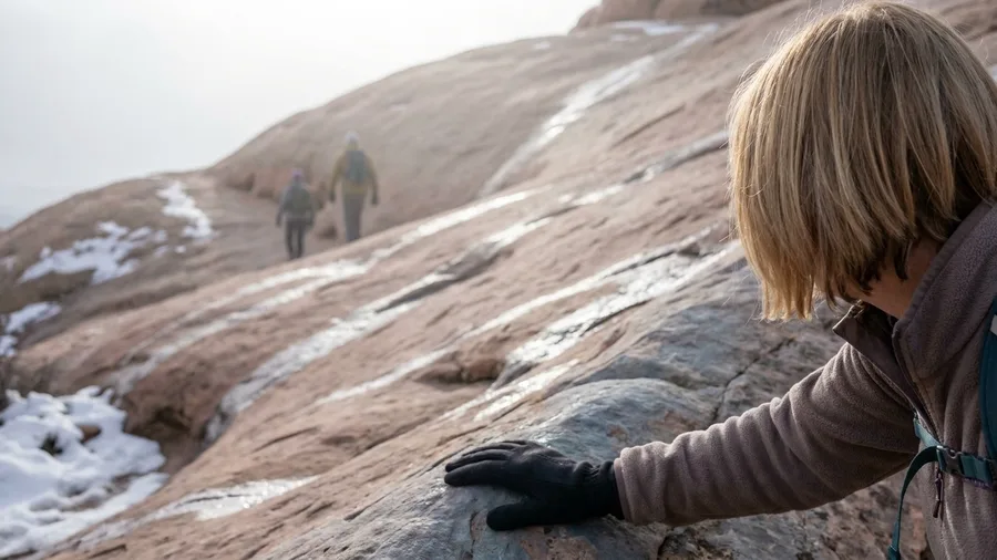
The hike itself is 3 miles round trip with 480 feet of gain, and most of that gain is the climb across open slickrock to a natural bowl. In winter the rock holds packed snow in the shady patches and stays bare and grippy in the sun, so the surface changes as you go. At the top the trail turns a corner and the arch appears alone on its ledge, red against whatever sky the day gives you.
Slickrock is the deciding surface here. It is steep enough that snowshoes would be a joke, and not deep enough that they would help. Microspikes are the smart addition if there has been recent snow, and nothing more.
Go in the afternoon if you want the arch lit from the front rather than backlit. Winter temperatures run about 20-45°F, and the bowl at the top catches wind, so bring a layer you can pull on while you sit. Most people spend twenty minutes at the arch and an hour climbing; budget three hours for the round trip.
💡 Tip: The last pitch is exposed; skip it if there is ice and you do not have microspikes.
Boot-Only Winter Hiking — Four Numbers
10. Bisti Badlands Hoodoo Wander
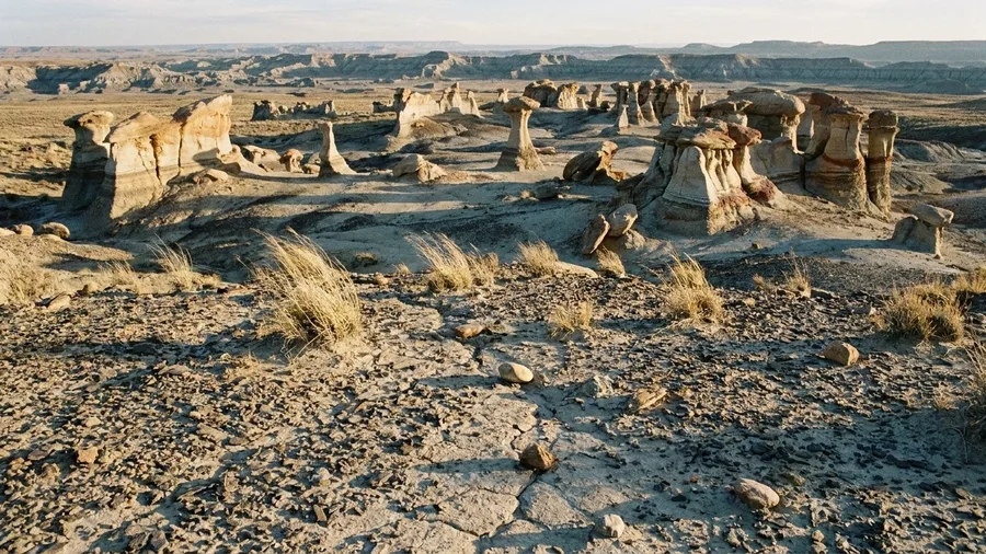
Bisti/De-Na-Zin Wilderness in northwestern New Mexico is the answer, and it is the one place on this list where the route is entirely yours to draw. There is no path, no cairn, no sign after the trailhead – just about 3 miles of open badlands and 200 feet of rolling gain through hoodoos that look grown rather than eroded.
The formations are the reason to come. Wind and water have carved the sandstone into wings, capsules, and mushroom stalks, some of them clustered so tightly they read as a ruined city rather than geology. In winter, with temperatures running roughly 25-50°F, you get the strange shapes without the summer heat that makes the exposed wash punishing by mid-morning.
Underfoot it is dirt and rock, firm and dry, which means boots and nothing else – no snowshoes, no traction, no gear decision at all. The constraint is navigation: the terrain looks similar in every direction, cell signal is unreliable, and footprints vanish. Load an offline map, note your entry point, and give yourself a hard turnaround time. Solitude here is real, and so is the ease of getting turned around.
💡 Tip: The main parking area is off NM-371; check road conditions after rain or snow, as the dirt access can turn to mud.
Frequently Asked Questions
Do I really not need snowshoes for any of these?
Correct. Every route on this list is a boot walk or a microspike walk on sand, lava, slickrock, boardwalk or packed snow. None of them requires flotation. Microspikes help on the packed-snow sections at Bryce, Arches and Craters of the Moon.
Which hike is the warmest in winter?
Hawaii Volcanoes’ Kilauea Iki sits around 55–75°F in winter, the warmest on the list. White Sands, Death Valley and Joshua Tree are also mild, roughly 40–70°F depending on the day.
Which is the hardest route?
Bryce Canyon’s Queens Garden/Navajo Loop has the biggest gain at 600 feet, and the packed snow makes it the most demanding on traction. Death Valley’s Golden Canyon is next at 500 feet.
Do I need permits or reservations?
Arches has used timed-entry reservations in recent years, and some parks charge entrance fees. Check the managing park’s site for current rules before you drive, since policies change seasonally.
What should I pack for a boot-only winter hike?
Layers you can peel, a warm hat, gloves, sunglasses, more water than you think you need, a map or offline GPS, and microspikes if there is packed snow. Leave the snowshoes at home.
Choose by Temperature and Footing, Not by Gear
If you want warmth, point the car at White Sands, Death Valley, Joshua Tree or Hawaii Volcanoes. If you want cold scenery, Bryce, Yellowstone and Craters of the Moon deliver it, with microspikes in the pack for the packed sections.
Snowshoes were never the entry ticket. The surface under your feet is.
Before any of it, open the managing park’s winter access page and check roads, closures and permits. That habit is the difference between a good winter hike and a wasted drive, and it is the one step that turns a white dune field from a photograph into a morning you can actually walk.
Pick Your Route by Surface
Scan the table at the top, match a route to your cold tolerance, then check the park's winter access page before you drive.