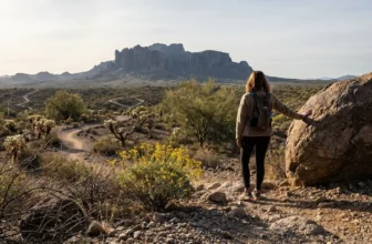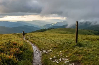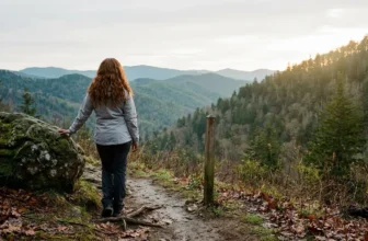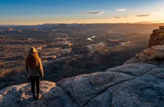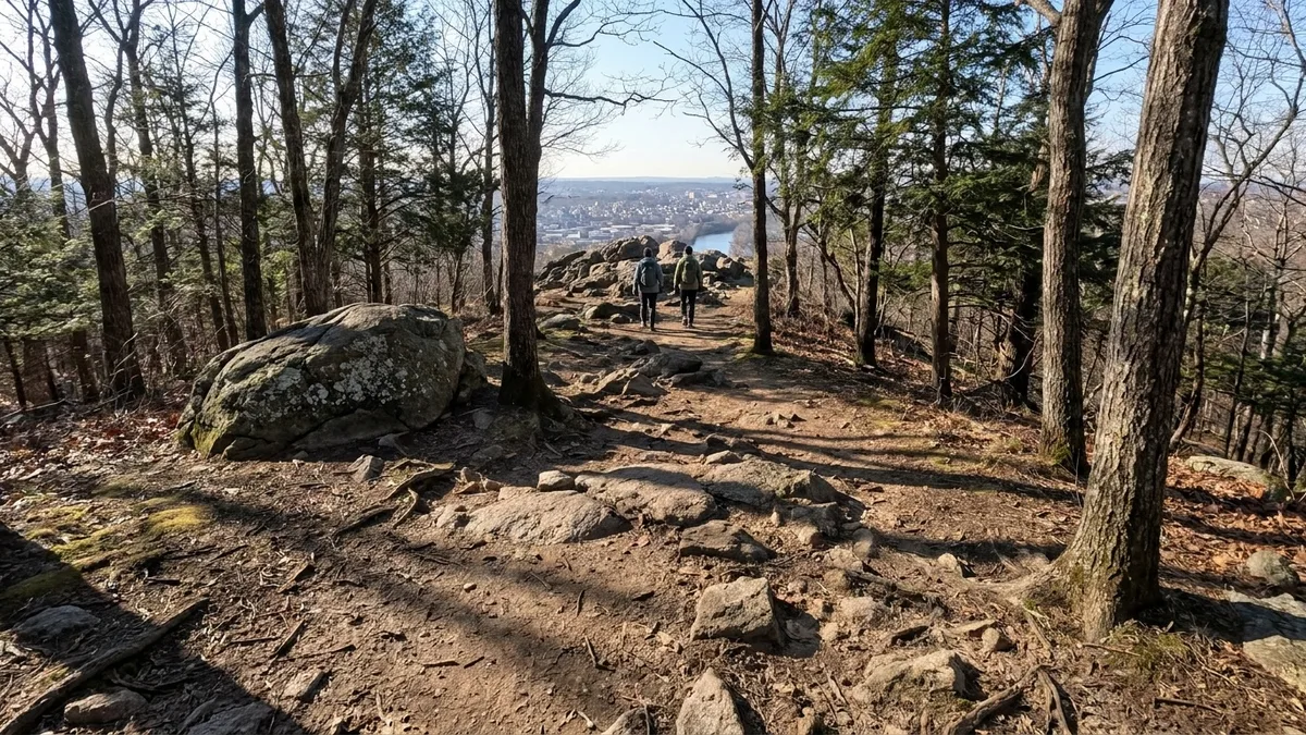
The mistake is treating the drive as the plan. Pick the trail first and the day fills itself with the wrong thing: you end up at a famous trailhead at 9:30 on a Saturday with a full lot behind you, or on a flat path when you wanted rock. Sort the Saturday by what you actually want – hands on stone, shade, rain cover, a view – and the trail follows.
Most city readers assume a wild trail near downtown means either a paved park loop or a six-hour interstate round trip that eats the whole day. The numbers say otherwise: seven trails sit 20 to 60 minutes from a downtown, run 3.7 to 6.5 miles round trip, climb anywhere from 150 to 1,500 feet, and cost from nothing to $20 per vehicle at Great Falls.
Each one below carries the same five facts – drive time, distance, climb, cost, and the single catch that will make or break it. That is what lets a free morning pick the trail instead of the trail eating the morning.
Work out first whether you want rock, shade, rain cover or a view, then check the lot: Great Falls, Breakneck Ridge and Mount Tam fill before 8 a.m. on weekends, so a weekday start before 8 is the clean move. Pick by the day you have, not the longest drive, and the wild half day stays inside the half day.
Quick Tips Before You Start
Arrive Early
The lots at Great Falls, Breakneck Ridge, and Mount Tam fill before 8 a.m. on weekends — be there by 7:30.
Wear Real Shoes
Three of these trails have hand-over-hand rock; flip-flops and smooth sneakers are a bad idea.
Carry Water
Echo Mountain has zero shade; bring at least a liter per person even on cool days.
Download a Map
Cougar Mountain's trail network crisscrosses; screenshot the route before you lose signal.
Bring Cash or Card
Great Falls charges $20 per vehicle; Mount Tam is $8. The rest are free.
1. Billy Goat Trail, 25 Minutes From DC
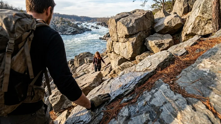
Wear real shoes and skip the stroller, because the first mile of Section A asks you to use your hands on the rock, and a hiking partner in flip-flops will slow the whole morning to a crawl.
Billy Goat Trail A sits in Great Falls Park, Virginia, about 25 minutes from downtown DC, a 4.7-mile loop that climbs roughly 800 feet and puts you hand over hand above the Potomac on slabs and ledges. The park charges around $20 per vehicle to get in, and the queue at the entrance gate is the tell: arrive on a weekday before 9 and you walk up to the rock instead of shuffling onto it. Keep an eye on the river, too, since the broad shallows below the falls are where herons work the current and you have a fair chance of spotting one if you stop moving and watch for a minute.
What the short drive buys you is a backcountry feel 25 minutes from the Capitol, and the thing that governs the day is not mileage but the rock and the hour you hit it. If the scramble feels like too much once you reach it, drop down to the river-level towpath and walk the flat, which gets you out the same way without the exposure.
💡 Tip: Park at the Great Falls Tavern Visitor Center lot; the Billy Goat trailhead is a short walk from there. The lot fills by 8:30 a.m. on Saturdays.
What People Get Wrong About City Trails
Based on typical weekend conditions; check current park alerts before you go.
2. Echo Mountain From Downtown LA
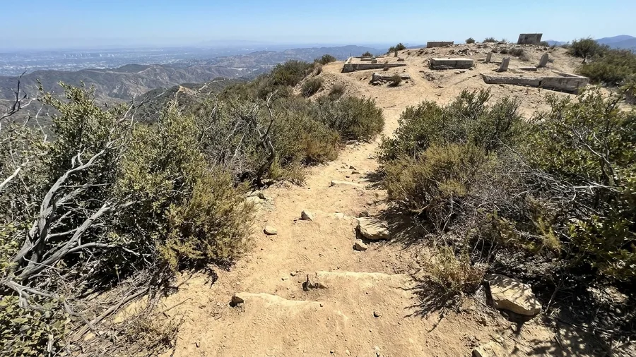
It is a sustained, sun-exposed climb to the ruins of an 1890s railway resort.
From the Altadena trailhead, the Sam Merrill Trail climbs to Echo Mountain on a 5.4-mile round trip with about 1,400 feet of gain through chaparral that gives you no shade at all. This is the opposite trade from a river-edge scramble with a flat way down: here the whole half-day rests on fitness and timing, not on traffic. The ruin at the top is the payoff, old foundations and concrete footings scattered along a ridge with the whole basin laid out below you in a way that only makes sense once you have climbed to it.
The parking at the trailhead is small and free, and on a weekend it fills early with people who know exactly why they came at dawn.
That is the honest handle on the crowd here. Go at first light and the climb is nearly empty and cool enough to enjoy; go at midday and you share a shadeless uphill with everyone else. This is a fit half day, not a first hike, and if you cannot start early, pick another morning.
What the short drive buys is 1,400 feet of real climbing 20 minutes from downtown Los Angeles, with the sun and your own legs setting the pace. Come fit, come early, and it delivers.
💡 Tip: The ruins have a small museum open on weekends; check hours before you count on it.
| Trail | Nearest downtown | Drive time | Round trip | Elevation gain | Cost |
|---|---|---|---|---|---|
| Billy Goat Trail A | Washington, DC | 25 min | 4.7 mi | 800 ft | $20/vehicle |
| Sam Merrill Trail | Los Angeles | 20 min | 5.4 mi | 1,400 ft | Free |
| Breakneck Ridge | New York City | 60 min (train) | 3.7 mi | 1,250 ft | Metro-North fare |
| Steep Ravine-Dipsea | San Francisco | 35 min | 6.5 mi | 1,500 ft | $8 day-use |
| Swallow Cliff-Yellow Trail | Chicago | 35 min | 4.2 mi | 150 ft | Free |
| Cougar Mountain loop | Seattle | 25 min | 5.0 mi | 900 ft | Free |
| Skyline Trail | Boston | 20 min | 4.3 mi | 900 ft | Free |
3. Breakneck Ridge, One Train From Manhattan
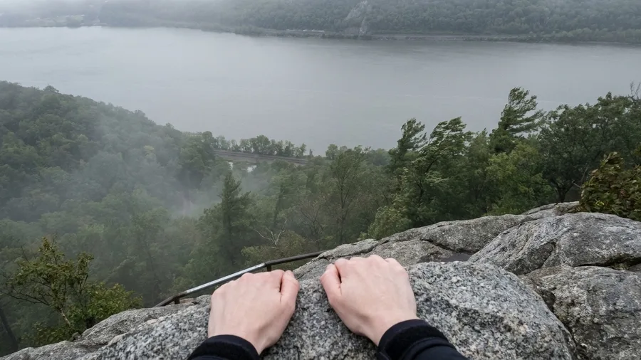
The rock comes up fast here, a wall of cold gray granite in front of you within a few minutes of leaving the platform, the river flat and quiet below, and the wooded slope gray with fog on a lot of mornings.
You can trade the car for a train entirely: Metro-North from Midtown drops you at the Breakneck Ridge flag stop in roughly 60 minutes, and the 3.7-mile loop climbs about 1,250 feet with the scramble in the first mile. Then sit on the ledges at the top and do nothing for an hour. The flag stop runs on a limited weekend schedule, so your return train time is the real plan for the day.
If the exposure bothers you, walk back down through the village instead of over the ridge.
💡 PRO TIP
The Early Start Rule
Three of these trails — Great Falls, Breakneck Ridge, and Mount Tam — have lots that fill before 8 a.m. on weekends. If you're driving, be at the trailhead by 7:30. If you're taking the train to Breakneck, book the first weekend train out of Grand Central.
4. Steep Ravine and Dipsea, Mount Tamalpais
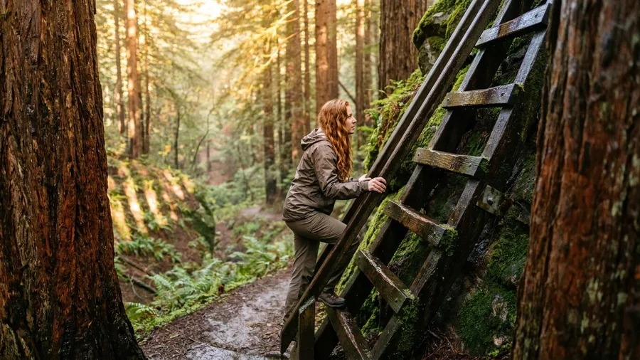
Eight dollars per vehicle buys you 6.5 miles, 1,500 feet of climb, and two of the strangest pieces of infrastructure on any Bay Area trail. The Steep Ravine-Dipsea loop is 35 minutes from San Francisco across the Golden Gate, and the fee is the least interesting number in the sentence.
The ladder is the first thing you will describe to someone afterward: a wooden stair bolted up a rock face in the ravine, wet most mornings, with redwoods closing in on both sides. The Dipsea stairs on the coast half are the second. Between them the walk changes character entirely: the ravine stays still and damp while the coastal ridge above it takes the fog and wind that roll in off the Pacific most mornings, so you get two trails for one climb. Go midweek if you can, or be at the trailhead before 8 a.m. on a weekend, because parking is the one thing here that will wreck the day before you start walking.
💡 Tip: Park at the Pantoll Ranger Station lot; it's the most reliable starting point for this loop.
5. Palos Preserves Yellow Trail, Chicago
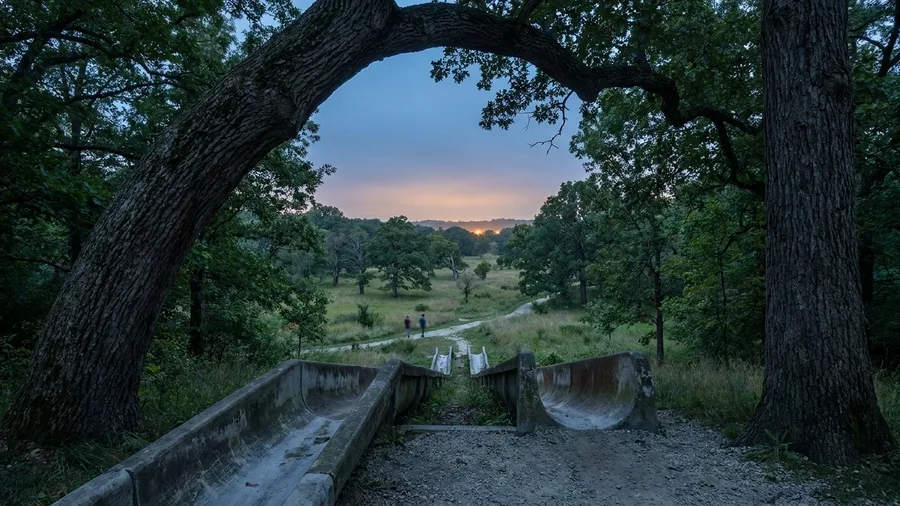
You hear the crushed limestone under your shoes before you see anything, and the oak canopy closes over the path within a few minutes of leaving the car. Swallow Cliff, 35 minutes from the Loop, is free to park and free to walk, which sets the tone for the whole loop.
The story here lives in the concrete chutes at the trailhead: toboggan slides built in the 1930s, the kind of thing whole neighborhoods once rode down on winter weekends. They stand abandoned now, a hundred-odd feet of poured stone dropping into the trees, and the trail bends past them on its way into oak savanna. That savanna is the other thing you notice, wide-spaced trees with grass running underneath, closer to a Midwestern meadow with a roof than to a forest.
This loop gives you 4.2 miles and 150 feet of gain, so do not come expecting a summit, a view, or a scramble, because there are none of the three. It is a multiuse path and you will share it with runners and cyclists. Bring the right expectation and the flatness stops mattering: the wildness comes from the oaks and the quiet, not from the elevation.
Rock Scramble vs. Flat Forest Loop
Rock Scramble (Billy Goat, Breakneck)
- Hands-on rock, real exposure
- Requires grippy shoes and nerve
- Shorter mileage, bigger effort
- Best for fit hikers who want adrenaline
Flat Forest Loop (Palos, Cougar)
- Gentle grades, wide paths
- Works in rain and fog
- Longer mileage, easier effort
- Best for runners, families, rainy days
6. Cougar Mountain, 25 Minutes From Seattle
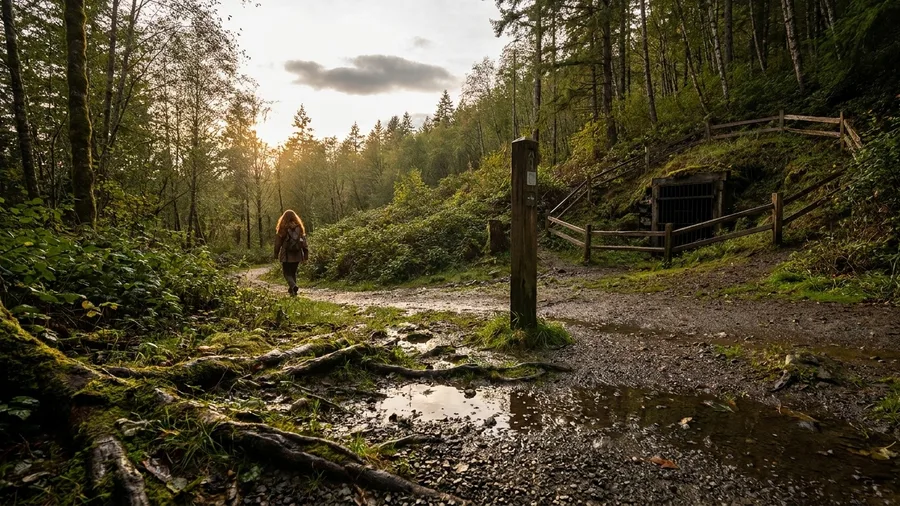
Where a flat limestone path asks you to accept no climb at all, Cougar Mountain hands back 900 feet of gain and 5 miles of second-growth forest, free, no permit, 25 minutes from downtown Seattle. Locals pick it on a wet forecast for exactly that reason: the ridge hikes lose their views in drizzle, and this one never had a view to lose.
The markers along the way are the payoff: fenced-off coal mine entrances sunk into the hillside, iron grates over black holes where the seams ran, forest grown back over ground that was cleared and worked a century ago. The loop runs 5 miles from the Red Town trailhead, but the network crisscrosses itself constantly, so carry a map and read it at junctions, because the map here matters more than the blazes. If the forecast is drizzle and you are dressed for it, that is the day this trail is at its best.
🗓️ Plan Your Half-Day Hike
Pick your constraint
Match the trail to the day: sun, rain, parking, schedule, or navigation.
Check the lot
For Great Falls, Breakneck, or Mount Tam, look up lot fill times and arrive early.
Pack the essentials
Water, grippy shoes, map, and cash for entry fees.
Start early
Aim to be on trail by 7:30 a.m. to beat crowds and heat.
Have a bail-out
Know the easier route back in case rocks or weather turn you around.
7. Skyline Trail, Blue Hills, Boston
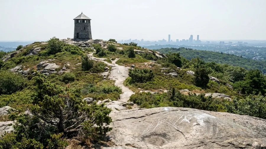
The Skyline Trail in Blue Hills Reservation: 20 minutes from downtown, 4.3 miles out and back, 900 feet of gain, no fee and no reservation. It is rockier than the short drive suggests, and the blazes are easy to lose where paths cross, so the route itself, not the distance, is what governs your morning. That is the last variation on the same idea: a short drive buys one specific thing, and here it is rock underfoot and a view from the top.
From the summit of Great Blue Hill you get a 125-mile view on a clear day, the stone tower standing at the top, and a rock-strewn path up that asks for attention at every junction. It suits an early-morning or after-work hike rather than a full day, which is the point of a trail this close to the city. Bring daylight to spare and read the blazes rather than trusting the worn path, because the crossings fool people. Free parking and no reservation mean the only thing you spend is the morning.
💡 Tip: Start from the Trailside Museum lot; it's the most direct route to the summit.
Frequently Asked Questions
Do I need a reservation for any of these trails?
Only Great Falls Park charges an entry fee ($20 per vehicle); no reservations are needed. Breakneck Ridge requires a Metro-North ticket, and Mount Tam has an $8 day-use fee. The other four are free with no permit.
Which trail is best for a beginner?
The Palos Preserves Yellow Trail near Chicago is the most beginner-friendly: flat, wide, crushed limestone, and free. Cougar Mountain near Seattle is also gentle but has a crisscrossing network, so bring a map.
Can I do any of these without a car?
Breakneck Ridge is the only one reachable by public transit: Metro-North from Grand Central to the Breakneck Ridge flag stop. The others require a car or a rideshare.
What time should I arrive to avoid crowds?
For Great Falls, Breakneck Ridge, and Mount Tam, arrive before 8 a.m. on weekends — ideally by 7:30. The other four trailheads have free or cheap parking and rarely fill.
Are these trails dog-friendly?
Most are, but check park rules: Great Falls requires leashes, Breakneck Ridge allows dogs on leash, and Mount Tam has restrictions in some areas. The Palos Preserves and Cougar Mountain are generally dog-friendly on leash.
Match the Trail to the Morning You Have
Match the trail to the morning, not the other way around. Hands on rock means Billy Goat or Breakneck Ridge. A rainy day or a run means the Palos Yellow Trail or Cougar Mountain, both flat or forested with free parking. A half day with a view means Echo Mountain, Steep Ravine-Dipsea or Skyline. Do one thing first: check the lot and go before 8 a.m. on a weekday. Great Falls, Breakneck Ridge and Mount Tam fill before 8 on weekends; the other four have free or cheap parking and no reservation, much like national park trails without reservations.
No six-hour interstate day is needed. Twenty to sixty minutes from downtown buys all seven, but the short drive only pays off when the one catch is planned around. Pick by the condition of your free morning – rock, forest, rain cover or view – and the wildness stays inside the half day.
Plan Your Short-Drive Hike
Pick your trail from the table above, check the lot, and set your alarm. A wild morning is closer than you think.