Every national park trail guide promises the ridge at dawn, twelve miles behind a young hiker. The trails below promise the same scenery from 0.5 to 2.2 miles out, and that gap is the whole point.
The fear is that park scenery comes two ways: a parking-lot view or a trail that wrecks knees, lungs and patience. The twelve walks here run 0.5 to 2.2 miles round trip, gain 20 to 150 feet, and take 15 to 75 minutes at a gentle pace.
Surfaces rotate between paved path, boardwalk, packed gravel and short slickrock, with restrooms at or near every trailhead and benches or shade every 0.2 to 0.5 mile. Elevation runs from about 3,000 feet in Zion to 9,500 at Bear Lake, so arrival day gets a shorter distance. High parks suit May through October, desert parks October through April, and a start before 9 a.m. dodges heat and tour buses.
So the question is not whether to hike. It is which surface, shade, altitude, season and access fit today’s knees and lungs.
The best views do not demand a punishing climb. Walk the flattest, the most shaded, or the biggest view for the least distance, and check current park and shuttle conditions before you leave.
Quick Tips Before You Start
Start Before 9 A.M.
Heat and tour buses both arrive mid-morning; the first hour is yours.
Carry Twice the Water
Trailhead fountains are not guaranteed, and cell service drops to nothing.
Wear Grippy Soles
Packed gravel and slickrock punish smooth-soled shoes more than distance does.
Take Two Poles
Downhill is what hurts knees, and poles cut that load on every descent.
Check the Elevation First
Above 8,000 feet, plan half your usual distance on arrival day.
Tape Hot Spots Early
Stop and tape the moment you feel friction; blisters end trips faster than hills.
1. Bear Lake Loop, Rocky Mountain
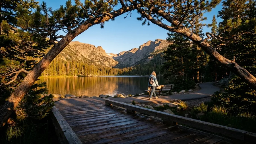
Thirty feet of climbing gets you a glacier-fed lake ringed by peaks in Rocky Mountain National Park, Colorado. The loop is 0.5 mile around Bear Lake, paved and boardwalk the whole way, with benches spaced along it and restrooms at the trailhead.
The catch is the altitude, not the grade: the trailhead sits near 9,500 feet, so arriving and walking it the same afternoon is where lungs get tested. Save Bear Lake Loop for day two, start slowly, and take the benches. Best May through October, and arrive before 8 a.m. if you want a parking space. When trailhead lots fill before you arrive, quiet hiking towns with no crowds offer a calmer starting point. Knees and patience pay almost nothing here; the thin air asks the question.
💡 Tip: The trailhead sits near 9,500 feet. Save the loop for your second day and walk slower than feels necessary.
| Trail and park | Round-trip distance | Elevation gain | Surface | Best season | Restroom |
|---|---|---|---|---|---|
| Bear Lake Loop, Rocky Mountain | 0.5 mi | ~30 ft | Paved and boardwalk | May–Oct | At Bear Lake trailhead |
| Lower Yosemite Fall Trail, Yosemite | 1.2 mi | ~50 ft | Paved | May–Oct | Near shuttle stop |
| Trail of the Cedars, Glacier | 0.7 mi | ~60 ft | Boardwalk and packed gravel | Jun–Sep | At Avalanche Creek |
| Riverside Walk, Zion | 2.2 mi | ~70 ft | Paved | Mar–Nov | At Temple of Sinawava |
| Landscape Arch Trail, Arches | 1.6 mi | ~100 ft | Packed gravel and sand | Oct–Apr | At Devils Garden |
| Mesa Arch Trail, Canyonlands | 0.5 mi | ~80 ft | Packed gravel and slickrock | Oct–Apr | At trailhead |
| Sunset Point Trail, Bryce Canyon | 0.5 mi | ~40 ft | Paved rim path | May–Oct | Near Sunset Point |
| Mammoth Hot Springs Boardwalk, Yellowstone | 1.5 mi | ~150 ft | Boardwalk and stairs | May–Sep | At Mammoth Hot Springs |
| Limberlost Trail, Shenandoah | 1.3 mi | ~50 ft | Packed gravel | May–Oct | At Skyland |
| Big Trees Trail, Sequoia | 1.2 mi | ~30 ft | Paved | Jun–Sep | At Giant Forest Museum |
| Door Trail, Badlands | 0.75 mi | ~20 ft | Boardwalk and packed gravel | Apr–Oct | At trailhead |
| Ocean Path to Thunder Hole, Acadia | 2.0 mi | ~90 ft | Gravel and pavement | May–Oct | At Sand Beach |
2. Lower Yosemite Fall Trail
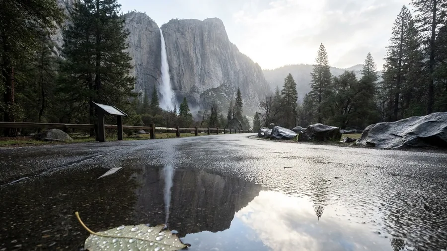
You hear Lower Yosemite Fall before the paved path bends to show it, a low roar that grows as you approach the base. The loop is 1.2 miles with about 50 feet of gain, level pavement underfoot, restrooms near the shuttle stop, and a path flat enough for a walking cane.
Yosemite’s seasonal shuttle is the easy way to the trailhead, and it is also where locals do their thinking: check current park guidance on shuttle routes before you plan the day around it, because service changes and the lot fills. This is the pick when altitude has already told you to keep the day simple and a waterfall up close is worth more than a viewpoint from a distance.
Knees and lungs pay very little on this one. Patience pays for the midmorning crowds and the shuttle wait. Go early if you want the base of the fall with room to stand still and listen, and know that the return is as flat as the way in.
Pick Your Trail by What Your Body Wants
3. Trail of the Cedars
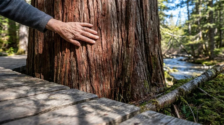
A 0.7-mile loop under cedars and hemlock in Glacier National Park, Montana, that stays cool and dim even at midday in July, when the parking lot at Avalanche Creek is already full and the sun is working the lower valley hard.
The surface is mostly boardwalk with packed gravel where the path dips to the creek, gain is about 60 feet, and benches and interpretive signs punctuate the walk so you can go half a mile, read a plaque, and sit before your knees have to be asked twice. Restrooms sit at Avalanche Creek, June through September is the window, and arriving before 9 a.m. is not about crowds so much as about finding a space in a lot that fills fast. The trees carried the day: shade that removes exposure and heat from the equation entirely, boardwalk that hands you big-cedar scenery for a climb you never make. If the plan is a shorter day, pack a sandwich and eat it at one of the benches along the creek, because the cool air under the canopy is the best lunch stop on the route.
💡 PRO TIP
The 15-Minute Altitude Rule
Above 8,000 feet, walk the first 15 minutes at a pace where you could hold a conversation without pausing. If you cannot, turn around and come back tomorrow. Bear Lake sits near 9,500 feet; Riverside Walk sits near 3,000.
4. Riverside Walk, Zion
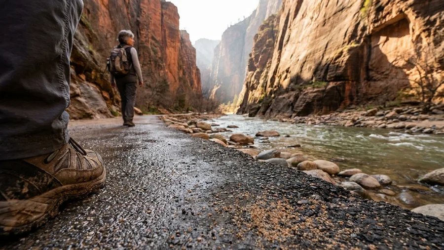
The catch is the shuttle, not the grade. Riverside Walk is flat, paved and shaded nearly the whole way, but you cannot drive to the Temple of Sinawava trailhead during shuttle season, so your day is run by a bus schedule rather than your own knees.
The walk itself asks little: 2.2 miles round trip, about 70 feet of gain, following the Virgin River upstream into Zion Canyon in Zion National Park, Utah. The trailhead sits near 3,000 feet, the lowest on this list, so lungs get no argument from altitude. The paved path runs level between canyon walls that keep the sun off for most of the morning, and restrooms sit at the trailhead. Of everything here, this is the longest distance, and it still never turns into a climb.
Where a shaded forest loop with benches answers heat and tired legs, this one trades the trees for a slot of sandstone and the benches for a shuttle stop. Same easy grade, longer walk, and one more thing to plan around.
Because there is no summit or viewpoint you have to reach, you can turn around whenever you like. Walk twenty minutes and head back, or go the full length to where the canyon narrows and the river takes over the trail. That flexibility is the reason to pick it on a day when energy is uncertain.
So the real cost is patience: waiting for the shuttle, riding with a crowd, and accepting that the trailhead is as far as the bus goes. Check current park guidance before you leave, because shuttle routes and seasons change. Go early, ride in ahead of the tour groups, and let the canyon do the work.
Four Mistakes That End a Good Day
5. Landscape Arch Trail
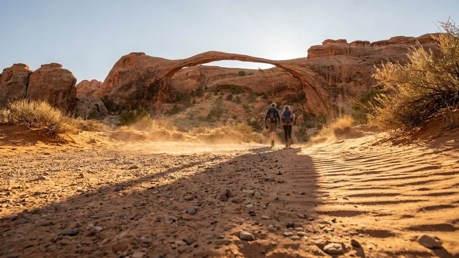
Yes, with a catch that decides the day: no shade, and the last stretch is sand.
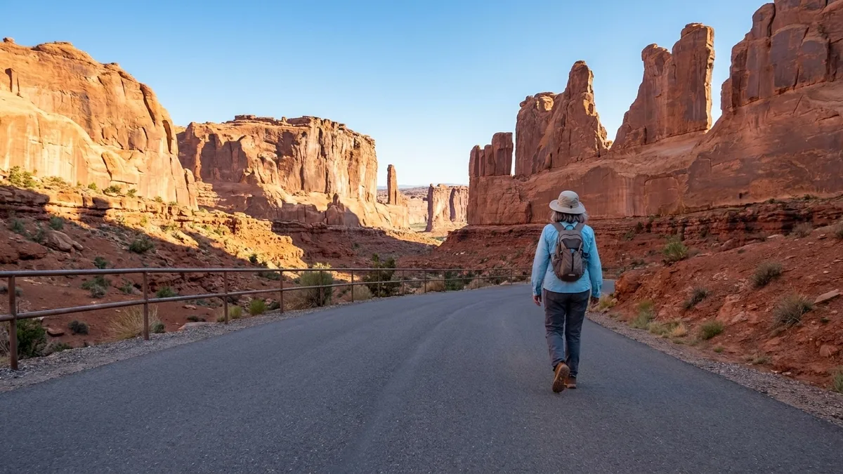
Landscape Arch Trail runs 1.6 miles round trip with about 100 feet of gain in Arches National Park, Utah. The surface is packed gravel at the start and soft sand toward the arch, where footing gets loose and slow. There is no shade anywhere on the route, and restrooms sit at the Devils Garden trailhead.
Time it right or not at all. In the desert season of October through April, be walking before 8 a.m., when the air is still cool and the parking lot has room; carry more water than you think you need. After midmorning the open sun raises the demand on lungs far more than the 100 feet of gain ever will. Distance and gain stay moderate; heat and footing are what make it feel longer.
6. Mesa Arch Trail
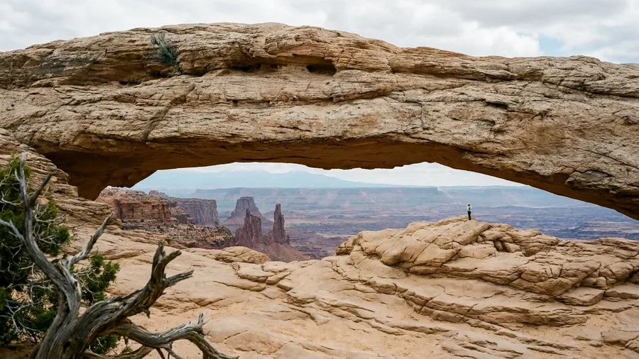
You feel the cold first, then see the line of headlamps bobbing ahead of you on the rock. Mesa Arch is a pre-dawn walk, and in the dark the trail tells you what it wants: attention.
The reason people get up at four is the glow. As the sun clears the horizon, the underside of the arch catches the light and turns a deep orange, and the canyon and buttes below sit in blue shadow through the opening. It lasts a few minutes. The arch is a 0.5-mile loop with about 80 feet of gain in Canyonlands National Park, Utah, on packed gravel and a short slickrock slope.
This is the shortest walk here and among the shortest anywhere, yet distance is beside the point. Slickrock is smooth, sloping and sometimes sandy, and in the half-light it asks for a steady foot and a headlamp rather than strong legs. Restrooms are at the trailhead; after sunrise there is no shade at all.
Come in the October-to-April desert season, arrive early enough to park, and watch the rock underfoot on the way in. Keep an eye out for the little creatures that live among the junipers, and let the quiet dark be part of the trip.
Trail Words That Decide Your Day
7. Sunset Point Trail, Bryce Canyon
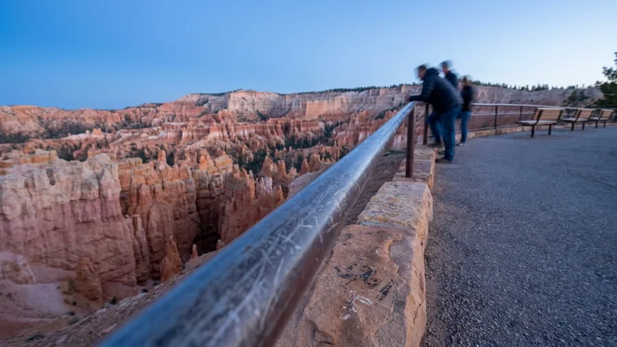
A slickrock loop earns its view by making you watch every step. Bryce Canyon’s Sunset Point Trail hands you a bigger panorama and asks almost nothing of your feet: a 0.5-mile round trip on a paved rim path, about 40 feet of gain, in the Utah park’s amphitheater country. Restrooms and benches sit near the point itself, and the hoodoos line up below the rail without a single stair between you and them.
This is the accessible version of Bryce, and it genuinely suits walkers using a cane, a rollator, or a knee that has already done its work for the day. It does not suit anyone who came to feel the switchbacks underfoot. The Navajo Loop drops steeply off the same rim, and the discipline of this stop is letting it go while the person beside you takes the picture.
Time it for May through October, and aim for morning light or the last hour before sunset, when the hoodoo walls turn orange and the shadows stack up in the gullies. Midday washes the color flat and fills the rail with tour groups.
8. Mammoth Hot Springs Boardwalk
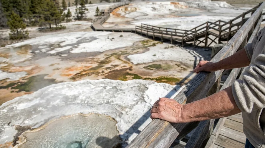
Mammoth Hot Springs is the one to do if you want the most for free. The 1.5-mile boardwalk loop over the travertine terraces in Yellowstone National Park costs nothing beyond the park entrance, and the terraces are the strangest thing you will stand on all trip: white, stepped, steaming, alive underfoot.
Here is the honest catch, and it is about knees. The loop gains about 150 feet, the most of any walk on this list, and much of it comes as stairs. Benches are spaced along the route, restrooms sit at Mammoth Hot Springs, and this is front-country boardwalk, not wilderness. If the stairs complain, take the lower terraces only; the steaming pools and the colored runnels still deliver everything the upper route shows.
Best May through September. Go before 9 a.m. for cooler air and thinner crowds on the narrow sections.
9. Limberlost Trail
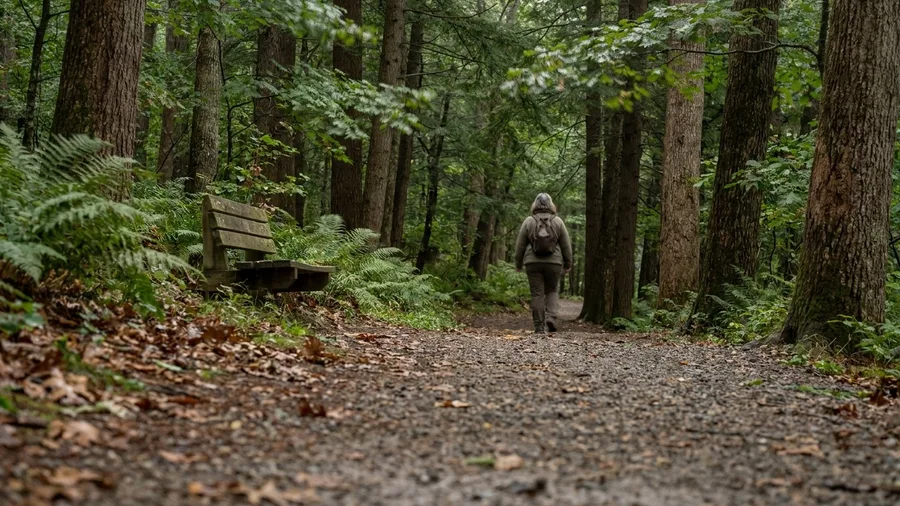
Stairs have a way of deciding a day, and Shenandoah built Limberlost Trail for the people they turn back. It is 1.3 miles, a 50-foot gain, packed gravel with gentle grades, benches spaced along the loop, restrooms at Skyland, and deep shade overhead the whole way, designed as an accessible forest walk rather than adapted into one. It also draws a crowd, especially in October, and the parking is tighter than the trail deserves. Go early and the queue at the trailhead never forms.
Best May through October, and the shade makes it the right call on a hot afternoon when the open ridges are baking. One caution: roots push through the gravel after rain, so watch your footing on the wet sections.
10. Big Trees Trail
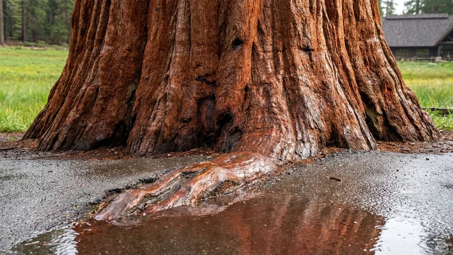
Yes, and it costs about 30 feet of elevation over 1.2 miles. Big Trees Trail loops through Sequoia National Park on pavement, circles a meadow with sequoias standing at its edge, and keeps you in shade the whole way. The Giant Forest Museum sits at the trailhead, with benches and restrooms right there, which makes this the gentlest tree walk in the park.
The path is wide and paved, and it suits a cane or a rollator better than almost anything else on this list. The one technical note is roots pushing through the asphalt in places, so watch your toes rather than the canopy. June through September is the window, and going early buys quiet before the museum lot fills. Thirty feet of gain and a flat loop return a grove of the largest trees on earth, and the only thing asking for your attention is the ground under your feet.
Rim Path or Canyon Descent?
Stay on the rim
- 0.5 miles and about 40 feet of gain
- Paved surface with benches
- Big hoodoo view in under 30 minutes
- Knees finish the day as they started
Drop into the Navajo Loop
- Steep switchbacks straight down
- Loose footing on the way back up
- Adds an hour or more to the day
- Hard on knees and lungs together
11. Door Trail
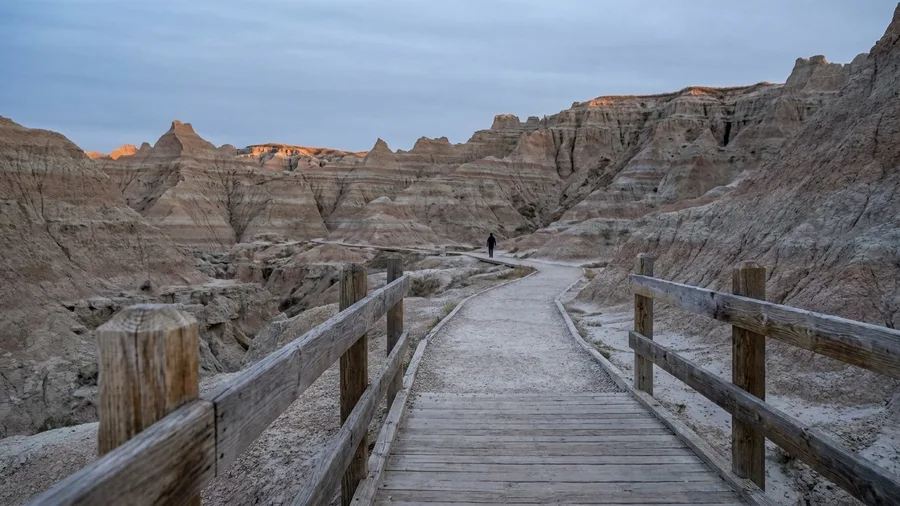
Before you walk it, know that the Door Trail has no shade at all. Boardwalk carries you off the parking lot, then packed gravel takes over and the boardwalk markers stop, and from there the route runs into open formations under a sky with nothing to break it. Restrooms sit at the trailhead. Go early or late for cooler air, and April through October is the season.
It is 0.75 miles round trip with about 20 feet of gain. That is under a mile and barely a rise, and it still puts you inside the Badlands’ striped walls in South Dakota.
The honest likelihood of wildlife here is low in the middle of the day; the reward is the rock, not the animals. If the gravel feels loose underfoot, turn back at the first marker, because a rolled ankle is the one thing that ruins a short walk. Twenty feet of gain and three-quarters of a mile still deliver the drama, and the attention the sun and footing ask for is the price.
12. Ocean Path to Thunder Hole
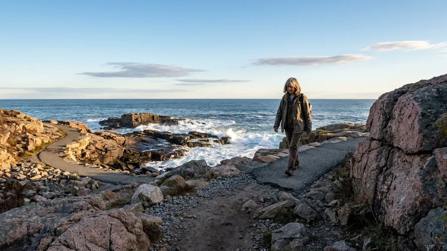
Two miles round trip, about 90 feet of gain, and you are standing at Thunder Hole in Acadia National Park, Maine. The route follows Ocean Path from Sand Beach, where the restrooms are, over gravel and paved sections. It is gentle enough to be an afternoon’s sit, not a hike: find a ledge above the water, watch the swell come in, and let an hour go by.
What decides the day here is not the climb but the footing. Uneven gravel runs the length of the path, so walkers who need a firm, smooth surface should know that going in, and icy days are a skip. The reward comes with tide and storm conditions worth checking before you set out, and rumbling water at Thunder Hole only shows up when the swell is right. May through October is the season. Ninety feet of gain stays kind to knees, but the surface and the coastal weather do the real testing.
Ocean Path — At a Glance
🚻 Restrooms
At Sand Beach trailhead
🪑 Benches
Every 0.2-0.5 mi
☀️ Shade
Sparse — open coast most of the way
⏰ Start by
9 a.m. to dodge tour buses
📵 Cell service
Unreliable at the trailhead
Entry cost
Acadia charges $30-$35 per vehicle for a 7-day pass — no shuttle needed here; you park at Sand Beach.
Where to Base Yourself Near These Trails
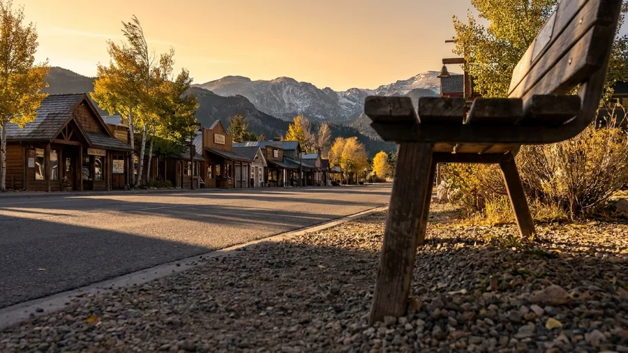
Most of these walks sit inside parks where rooms book out months ahead, so the order matters: base first, trails second. Pick the wrong town and you spend the trip driving, not walking.
For Bear Lake, stay in Estes Park on the park’s east side. It is about ten minutes from the trailhead, with groceries and restaurants in reach. The trade-off is summer traffic on the park road, so leave earlier than you think you need to.
Yosemite Valley is the exception where staying inside the valley removes the drive entirely. Book early and expect noise.
Zion is easiest from Springdale at the park entrance, walkable to the shuttle, which spares you the parking fight altogether. Cheaper rooms sit about 40 minutes away in Hurricane, and the trade-off is a morning drive each way. Bryce works from the Ruby’s Inn area just outside the park gate.
For Acadia, Bar Harbor puts you minutes from Ocean Path with food and fuel close by. Sequoia rewards staying near Giant Forest rather than down in Three Rivers, which adds a long mountain road every morning before you have even started walking.
Frequently Asked Questions
Can a 65-year-old with bad knees still hike in national parks?
Yes, if you pick by surface and gain rather than distance. Bear Lake Loop, Big Trees Trail and Sunset Point Trail all stay at 40 feet of gain or under on pavement or boardwalk, and each finishes within half a mile.
How hard is the altitude at Bear Lake?
The trailhead sits near 9,500 feet, which is the real demand on the 0.5-mile loop. Plan it for your second day, walk slower than feels natural, and turn back if you cannot hold a conversation.
Do I need a shuttle for Riverside Walk or Lower Yosemite Fall?
In peak season, yes. Both trailheads are served by seasonal shuttles, and parking fills early. Check current park guidance for shuttle hours and the last return time before you set out.
What is the best season for these trails?
May through October for the high-elevation parks like Rocky Mountain, Glacier, Bryce and Sequoia. October through April for the desert parks like Arches and Canyonlands, when the heat backs off.
What does park entrance cost?
$20 to $35 per private vehicle for a 7-day pass, depending on the park. A national parks annual pass pays for itself on a trip that hits three or more parks.
Are there restrooms on these trails?
Every trailhead on this list has one. On the walks themselves, expect facilities only at the start, so plan the last stop before you set out.
Choose Your Three From This List
The fear that over-60 park scenery means staying by the car resolves at the same places it started. A boardwalk at 9,500 feet on Bear Lake Loop and a paved rim at Sunset Point, with restrooms and benches close by, do the job.
Flattest and paved: Bear Lake Loop at a half-mile loop and 30 feet, Big Trees Trail at 1.2 miles and 30, Sunset Point at a half-mile round trip and 40, Lower Yosemite Fall at 1.2 miles and 50. Most shade: Trail of the Cedars, Riverside Walk, Limberlost Trail, Big Trees Trail. Biggest view for the least distance: Mesa Arch at a half-mile loop and 80 feet, Sunset Point, Bear Lake Loop, Door Trail at three-quarters of a mile and 20.
Before you leave, check current park trail conditions and shuttle or service updates. Entrance is $20 to $35 per private vehicle for a 7-day pass, seasonal shuttles in Zion, Yosemite and Bryce can change how you reach a trailhead, and cell service is unreliable in most trailhead areas. Decide tonight which three fit your knees, then make the five-minute call at the visitor center. The postcard ridge can wait.
Pick Your Three, Then Check Conditions
Scan the table at the top, choose the trails that match your knees, lungs and season, and confirm current conditions and shuttle hours on the park's site before you drive in.