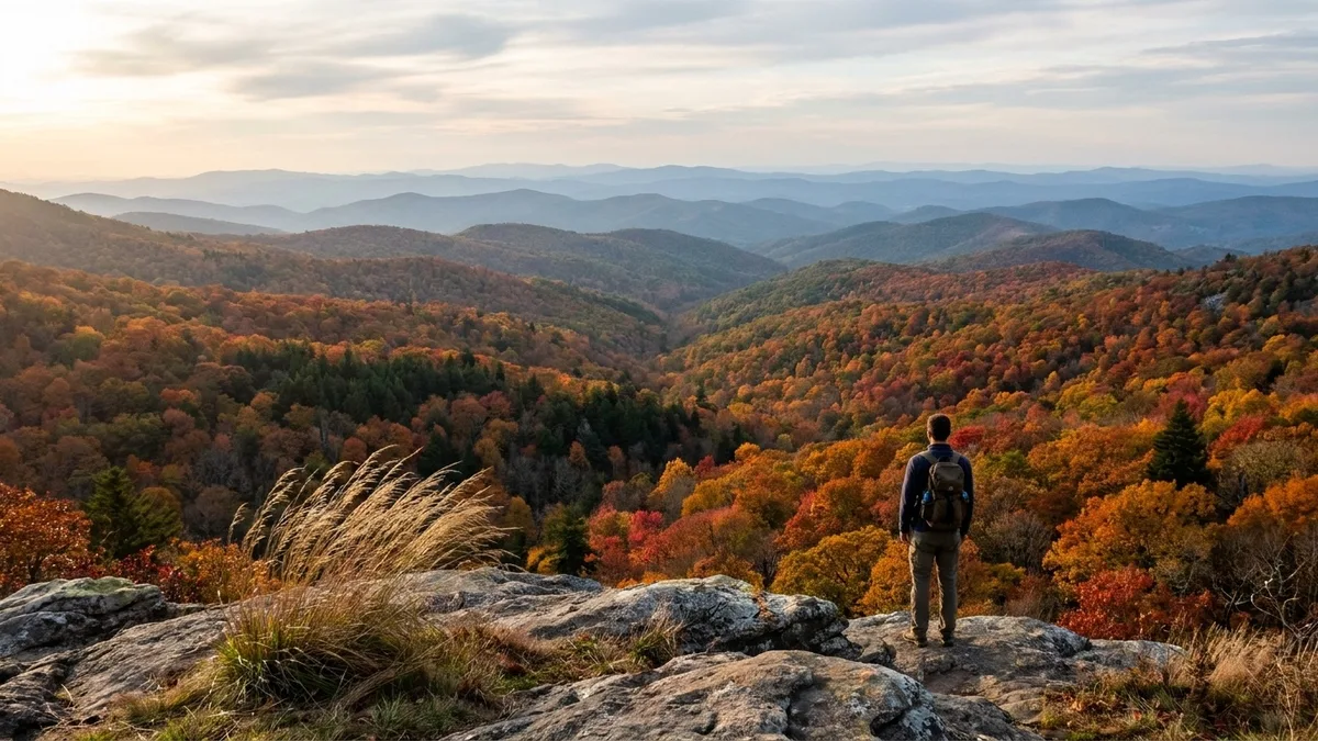
The mistake to avoid is choosing a Southern fall trail by photograph instead of by date. That overlook you saved in September may already be bare while an unassuming Panhandle ravine is two weeks from orange. Northern foliage is gone by late October, and you are left deciding whether any Southern weekend still delivers.
Southern color is not one date. The wave steps down from Blue Ridge and Smokies elevations in mid-to-late October to Georgia, Alabama and the Ozarks in late October and early November, then Texas, Mississippi and Florida into early December. Those windows are illustrative for this stretch, not a live report.
So the useful test is not South versus North. Match the peak window first, then weigh drive time, mileage, gain and fee against your own legs, because the right trail could be a 1.5-mile overlook or a 6.0-mile gorge walk.
By the end you can pick a short drive, a family walk or a full mountain day from 14 trails, on surfaces from paved boardwalk to rocky, rooty paths with creek crossings. Pack layers and a headlamp for short daylight.
Quick Tips Before You Start
Call the window first
Choose by peak date before you pick a trail, because a 10-day swing between Blue Ridge and Florida changes the whole plan.
Pack layers, not one jacket
Ridges and ledges run cold and windy while gorge floors and creek crossings stay warm and damp.
Bring a headlamp
November daylight quits around 5:30, and a 4-hour hike started at noon finishes in the dark.
Check the park page for fees
Day-use and parking charges change, so confirm on the official site before you drive out rather than at the gate.
Treat short as rocky
A 2.4-mile Ozark trail still has roots and creek crossings, so wear shoes with tread, not sneakers.
Arrive early or late
Trailheads at the famous stops fill by ten in late October, and empty again in the last two hours of light.
1. Graveyard Fields Loop, North Carolina
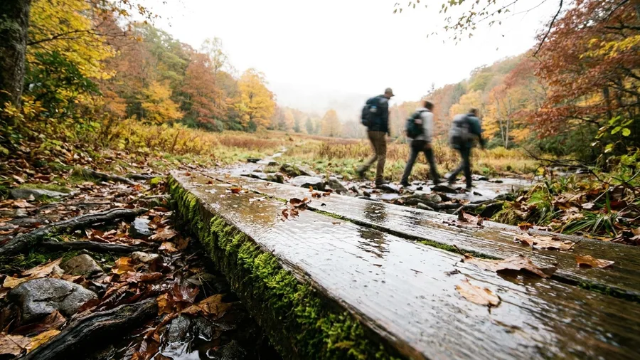
Forty-five minutes from Asheville, the Graveyard Fields Loop covers 2.3 miles and gains nothing extreme, sitting between 3,200 and 4,000 feet. That short approach is the point: no long climb before the color starts.
Peak here lands mid-to-late October, and the open meadows and creek crossings put the leaves at eye level instead of scattered below a summit you have to earn. The path is rocky and rooty, with two creek crossings that need a careful step rather than a leap, so it suits a family walk or a driver breaking up a Blue Ridge day but is a poor fit for a stroller or anyone who wants pavement underfoot. Bring layers and a headlamp; late-October daylight is gone before you expect it, and the window arrives earlier than the Georgia, Alabama and Texas options that follow.
💡 Tip: Go on a weekday morning. The Parkway trailhead fills fast on October weekends.
| Trail | State | Peak window | Distance / gain | Fee | Best for |
|---|---|---|---|---|---|
| Graveyard Fields Loop | North Carolina | Mid-to-late October | 2.3 mi loop, 3,200-4,000 ft | Free | Quick Blue Ridge fix |
| Alum Cave to Inspiration Point | Tennessee | Late October | 4.0 mi RT, 1,200 ft gain | Parking pass | Half-day Smokies climb |
| Chimney Tops | Tennessee | Late Oct-early Nov | 4.0 mi RT, 1,400 ft gain | Parking pass | Short serious hike |
| Blood Mountain | Georgia | Mid-to-late October | 4.3 mi RT to 4,458 ft | Free | Full mountain day |
| Tallulah Gorge Floor Trail | Georgia | Late Oct-early Nov | 2.0 mi RT, 1,100 ft descent | Permit for floor | Gorge drama |
| Pulpit Rock, Cheaha | Alabama | Late Oct-early Nov | 1.5 mi RT | $5 per adult | Easiest big view |
| Walls of Jericho | Alabama-Tennessee | Late Oct-early Nov | 6.0 mi RT, 1,000 ft gain | Free | Backcountry solitude |
| Whitaker Point | Arkansas | Late Oct-early Nov | 3.0 mi RT | Free | The famous ledge |
| Lost Valley | Arkansas | Late Oct-early Nov | 2.4 mi RT | Free | Kids and slow walkers |
| Horsethief Springs | Oklahoma-Arkansas | Late Oct-early Nov | 4.0 mi RT | Free | Quiet ridge and spring |
| Lost Maples East-West Loop | Texas | Early-to-mid November | 4.6 mi loop | $6-$10 day pass | Latest Appalachian-style color |
| Tuxachanie Trail | Mississippi | Late Oct-early Nov | 6.0 mi one way | Free | Flat Gulf Coast walk |
| Big Tree Trail, Torreya | Florida | Late Nov-early Dec | 1.0 mi loop | $3 per vehicle | Last-chance color |
| Laurel-Snow Pocket Wilderness | Tennessee | Late Oct-early Nov | 6.0 mi RT, 1,000 ft gain | Free | Waterfalls plus color |
2. Alum Cave Trail to Inspiration Point, Tennessee
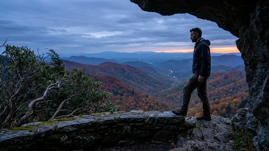
Skip the summit, take the ledge. The Alum Cave Trail to Inspiration Point gives you the Smokies payoff in 4.0 miles round trip and about 1,200 feet of gain, which is a moderate half-day, not a full push. The same late-October window that puts color on the shorter Blue Ridge walks holds here, so if you have the legs for a longer climb, it rewards you.
The cliff ledge and the arch viewpoints throw long views across the ridges, and the climbing is steady rather than brutal, though rocky stairs and a couple of cable-assisted sections keep you honest. Stop at the arch and ledge rather than pressing on, then treat yourself in Gatlinburg afterward: a plate of mountain trout, pan-fried, runs around $20 to $28 at the older town restaurants. Wind on the open ledge is real, and short daylight means layers and a headlamp are not optional.
💡 Tip: Start before nine to beat the Alum Cave trailhead crowd and get soft morning light on the valley.
How hard each Southern trail actually is
Ranked by effort on a low-to-high scale
- Big Tree Trail, Florida: 1.0-mile loop, but ravine stairs
- Pulpit Rock, Alabama: 1.5 miles, gentle grade
- Walls of Jericho: 6.0 miles, creek crossings
- Tallulah Gorge Floor: 1,100 feet back up the stairs
- Chimney Tops: 1,400 feet and scrambling near the top
3. Chimney Tops Trail, Tennessee
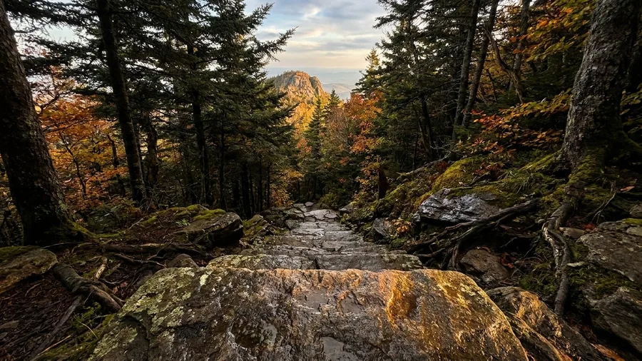
Can a 4.0-mile hike be genuinely hard? On Chimney Tops, yes. It packs roughly 1,400 feet of gain into the same round-trip distance as the gentler Smokies climbs, so if a 1,200-foot day felt right, this is the step up in grade.
The route climbs on steep stone steps and turns to rocky scrambling near the top, where hands come off the poles and onto the rock. It is a real three-hour outing, but the reward is a pinnacle view and color that holds below the rocky summit.
That timing matters. Peak runs late October into early November here, which pushes past the late-October window on the lower Smokies trails and buys you another week or two of leaves when other routes have gone brown.
This is the serious short hike on the list, and it suits fit hikers who accept the steeper effort. The catch is the scrambling and exposure near the top: this is not a family stroll, and anyone uneasy on rock or in wind should choose a lower, wider trail instead.
Layers still matter, and so does a headlamp, because a three-hour climb started in the afternoon finishes in the dark of November. Go early, and treat the pinnacle as the turn-around, not a place to linger once the wind picks up.
💡 Tip: Turn around at the marked viewpoint if the rock is wet. The scramble gets slick and the view is nearly as good.
4. Blood Mountain via the Appalachian Trail, Georgia
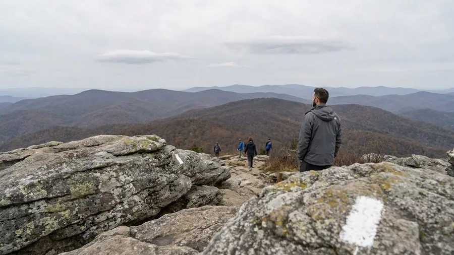
The wind on Blood Mountain does not ask permission, and the summit is bare rock with nothing to break it. Go up on a day when the forecast is dry and the wind is under about fifteen miles an hour, and bring a shell even if the parking lot at Neels Gap is warm.
From Atlanta it is 1 hour 45 minutes to the Byron Reece trailhead, and from there the Appalachian Trail takes you 4.3 miles round trip to 4,458 feet, the high point of the state and the spot where Georgia thru-hikers cut their teeth. Peak color lands mid-to-late October, earlier than the gorge floor and the Alabama ridges further down this list, so set the calendar before you set the drive. The reward is ridge-line color on both flanks as you climb and a rocky crown where the view opens in every direction at once.
Residents treat this less as a leaf peeping detour than as their honest training hike, and the AT traffic tells you why: white blazes, a steady grade, no boardwalk babying, like the forgotten Appalachian trails nearby. Give it a full day with the drive, wear boots with grip, and pack a layer for the top. If you want the view without the exposure, keep reading into the gorge country.
💡 Tip: Bring a wind shell even on a mild day. The summit rock offers nowhere to hide from the wind.
5. Tallulah Gorge Floor Trail, Georgia
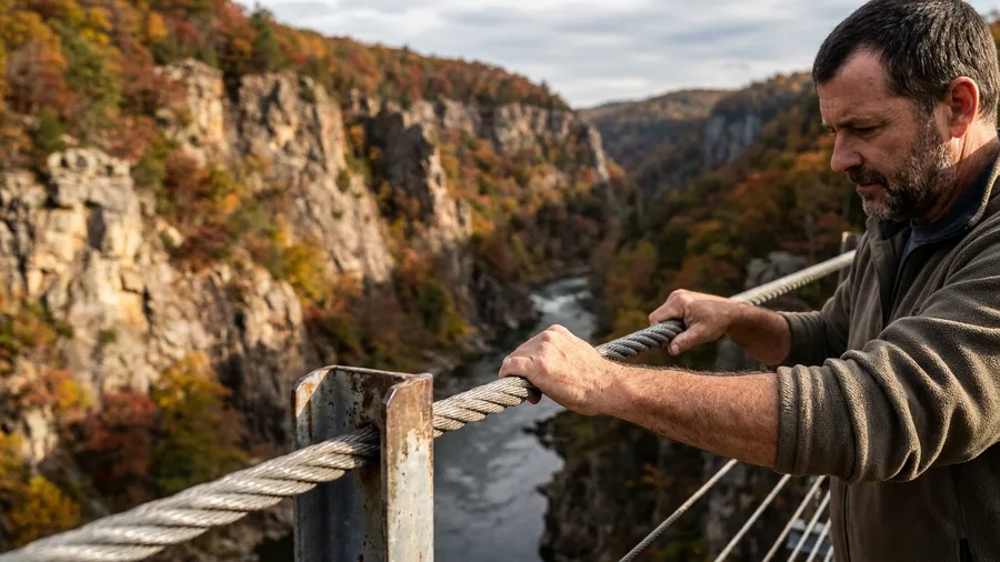
A gorge floor asks for less climbing but no less nerve than the rocky, wind-scoured summit you came from, and it pays you back in a way a peak cannot: the color is above and around you instead of at your feet. Tallulah Gorge Floor Trail covers 2.0 miles round trip with roughly 1,100 feet of descent and climb, run by stairs and a suspension bridge that sways over the river. You descend into the gorge rather than up onto a pinnacle, and the walls close in on all sides.
Peak color here lands late October into early November — later than the high Blue Ridge summits, because the gorge floor and the protected walls hold warmth and leaf later than an exposed peak. The river runs through the bottom, and the color stands on both walls at once. Go early, at first light or just after, before the day hikers fill the stairs and the suspension bridge turns into a slow shuffle. By mid-morning the descent is a queue, and the light on the walls is flat.
The descent is the easy part. The return climb is the real effort — all 1,100 feet of it, on stairs, with legs that have already hiked down. Budget the time for the way back up, not just the way down, and keep daylight to spare; the gorge bottom darkens well before the rim. The going is stepped and sometimes wet, so footing matters more than distance suggests, and a headlamp belongs in the pack on a short late-season day. For a reader who wants gorge drama over a summit, this is the short walk that delivers it — full of stair and river and wall, minus the wind on an exposed ridge.
💡 PRO TIP
Peak date beats photograph every time
A trail two weeks from peak still looks decent in a photo and a fortnight off in person. Match the calendar to the trail before you match your legs to it.
6. Pulpit Rock Trail, Cheaha State Park, Alabama
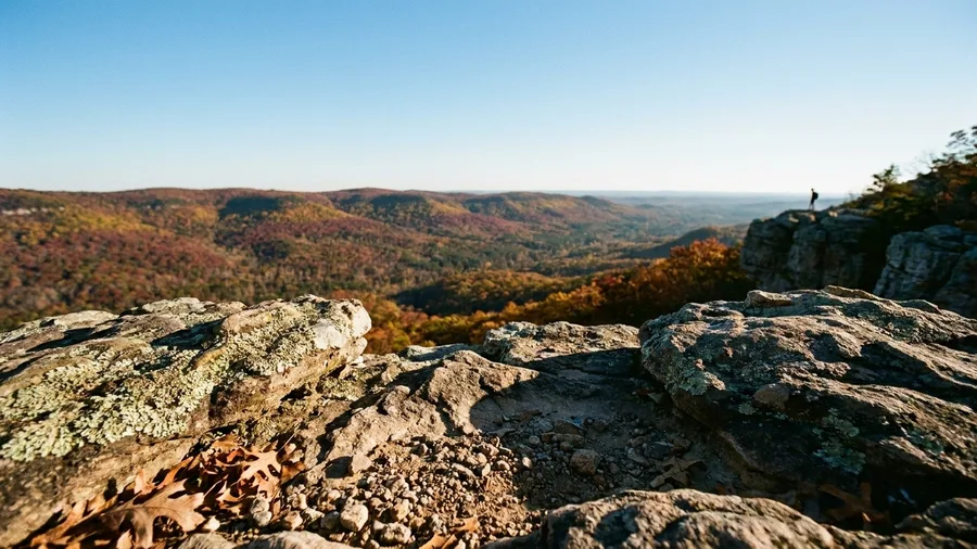
Pulpit Rock is 1.5 miles round trip over the Talladega Mountains, an hour from Birmingham, and it is the easiest big view in the state. Cheaha day-use runs $5 per adult; confirm the fee and hours on the official park page before you drive out.
You are climbing to a rock outcrop above a valley that turns in late October into early November, a color stop rather than a hike. The low mileage makes it work for a family walk or a quick detour. If you want the view without the distance, this is your stop.
7. Walls of Jericho Trail, Alabama-Tennessee
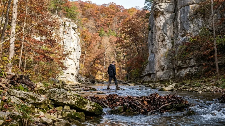
The canyon has its own weather. Cool air pools against the limestone below the rim, carrying the smell of wet rock and fallen leaves that have stopped crunching underfoot, and the only sound is water moving through the creek crossings.
Walls of Jericho is a 6.0-mile round trip with about 1,000 feet of gain, and you should allow 3 to 4 hours for it. That is roughly four times the walk and far more climbing than the low-mileage overlooks above Cheaha, so treat it as the other end of the Alabama scale, closer to the epic multi-day trails than a stop. The trail runs along the Alabama-Tennessee line, drops toward limestone walls, crosses the creek more than once, and opens into a natural amphitheater where hardwood color stacks up the walls around you.
The wildlife likelihood is honest, not promotional. Whitetail deer and wild turkey are common in this hardwood mix, and pileated woodpeckers work the trunks loudly enough that you hear them before you find them. Bigger sightings are a bonus, not a plan; the reliable payoff here is birdsong and quiet.
That quiet is the reason to choose it. The same late-October-into-early-November window brings crowds to the more famous overlooks, while this canyon stays thinly visited because the miles and creek crossings filter people out. If you want a summit crowd and a railing, this is the wrong morning.
Wear boots that can get wet, since the crossings are not bridged everywhere, and start early enough that you are out before the short afternoon light goes. A reader who will trade 6.0 miles and 3 to 4 hours for backcountry color and fewer people gets the better half of the bargain here; the window also lands later than the Blue Ridge high country, which is why it still works when the highest ground has gone brown.
Blue Ridge high country vs. the late southern window
Mid-to-late October
- High-elevation Blue Ridge and Smokies trails at peak
- Best ridge and summit views
- Cold mornings and real wind on exposed rock
- Shorter daylight, headlamp essential
Early November to early December
- Texas, Mississippi and Florida color still climbing
- More flat or ravine walking than climbing
- Milder weather, longer comfortable hours
- Fewer crowds, smaller fees, thinner variety
8. Whitaker Point Trail, Arkansas
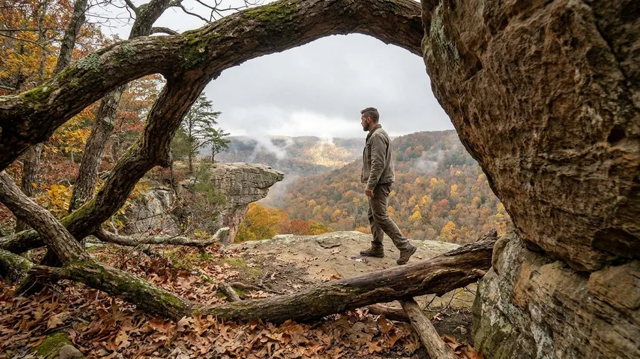
You step to the lip and the ground simply stops, the bluff falling away below your boots and the valley floor laid out in yellow and rust a hundred feet down. The ledge is exposed, which is the whole point and the whole risk.
Whitaker Point is a 3.0-mile round trip, about 2 hours from Fayetteville, and the short mileage is why it earns the drive after a longer canyon day elsewhere. Peak color comes late October into early November, when the bluff-top hardwood turns above the outcrop the trail is named for.
The name carries a story worth knowing before you go. The point was long tied to local lore of a fugitive who leapt from the ledge on horseback to escape pursuers, and the outsized tell has kept the spot famous well beyond Arkansas. Treat it as legend, which is what it is, and let it explain why a modest ledge in the Ozarks draws photographers from three states.
Keep back from the edge. People have died posing on that lip, and no photograph is worth the step; stand a body length back and the frame still works. The walk in is short, the payoff is big, and the late-October-to-early-November timing puts it in step with the other Ozark options on this list.
💡 Tip: Stay well back from the lip. The ledge is unfenced and the drop is immediate.
9. Lost Valley Trail, Arkansas
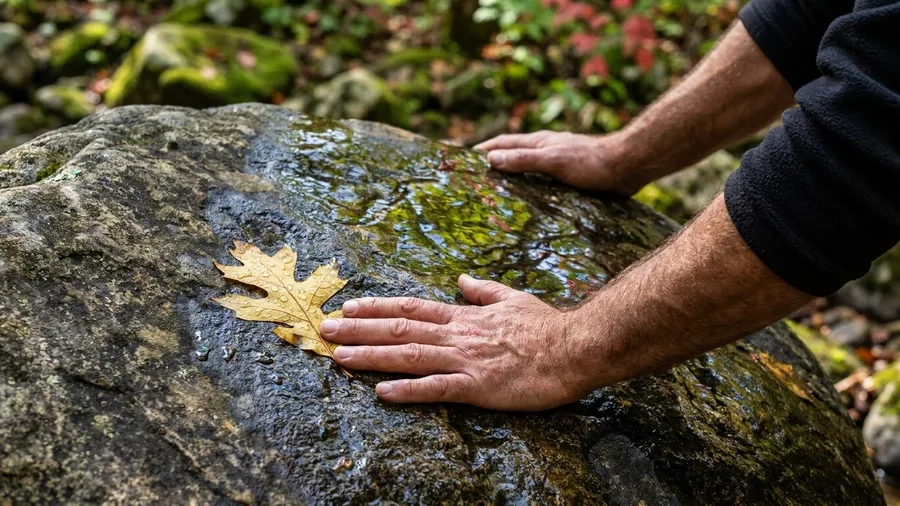
Yes, and it takes about 1.5 hours. Lost Valley Trail is 2.4 miles round trip, with creek crossings, a cave entrance, a waterfall and hardwood color, peaking late October into early November, the same window as the rest of the region.
The path is rocky, not pavement. The short distance is not easy footing, so kids and slow walkers need to watch where they plant their feet. It has less exposure than the bluff ledges and is shorter than Horsethief Springs, which makes it the family choice when you want Ozark color in a short morning.
10. Horsethief Springs Trail, Oklahoma-Arkansas
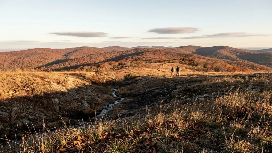
You come up out of the pines onto the open ridge and the wind is the first thing you notice, cool and steady, pushing the oaks around below you in waves of dull red and rust. Low ridges fold away in every direction, and the Ouachita range is empty in a way the Blue Ridge never is – you can stand at this gap for an hour without another hiker stepping into your frame.
Horsethief Springs is a 4.0-mile round trip, and the draw is exactly this: ridge views and a spring far from any famous ledge or summit crowd. Color peaks late October into early November, the same window the Ozarks are running, so a reader who wants the photo without the audience gets both here. Stand at the ridge opening just past the climb, facing the long fold of hills; the light is best mid-afternoon, when the low sun catches the far slope.
The spring itself sits in a shaded pocket where the trail dips, a spot to fill a bottle and sit for ten minutes before the walk back. Fewer hikers than the Blue Ridge is the whole pitch, and it holds. Go on a weekday if you can, carry a layer for the wind on the exposed sections, and leave enough daylight for the 4.0 miles, because the ridge is the last place you want to be guessing at dusk.
11. Lost Maples East-West Loop, Texas
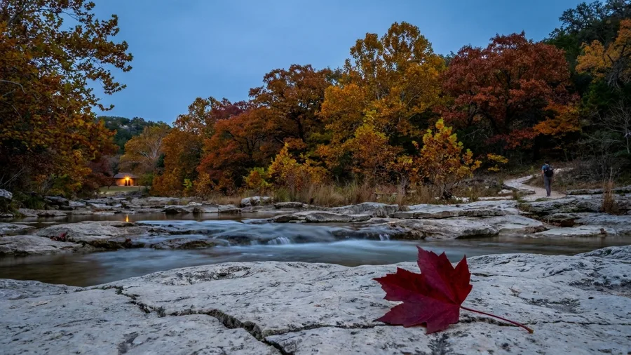
Wait for November rather than fight the October crowds. Texas holds a later peak than the Ouachita ridge walk, and the East-West Loop in Lost Maples is a 4.6-mile circuit two hours and fifteen minutes from San Antonio, so the same color search that ran through late October just slides forward a couple of weeks.
The bigtooth maple here turns later than anything in the Appalachians, mixed in with sugar maple, red maple, hickory, oak, sweetgum and blackgum. The day pass runs about $6 to $10, cheap enough that the drive is the real cost; confirm pass details on the official park page before you go, since this park fills on peak weekends and may require a reservation.
Drive time vs. peak window
How far the extra week costs you
12. Tuxachanie Trail, Mississippi
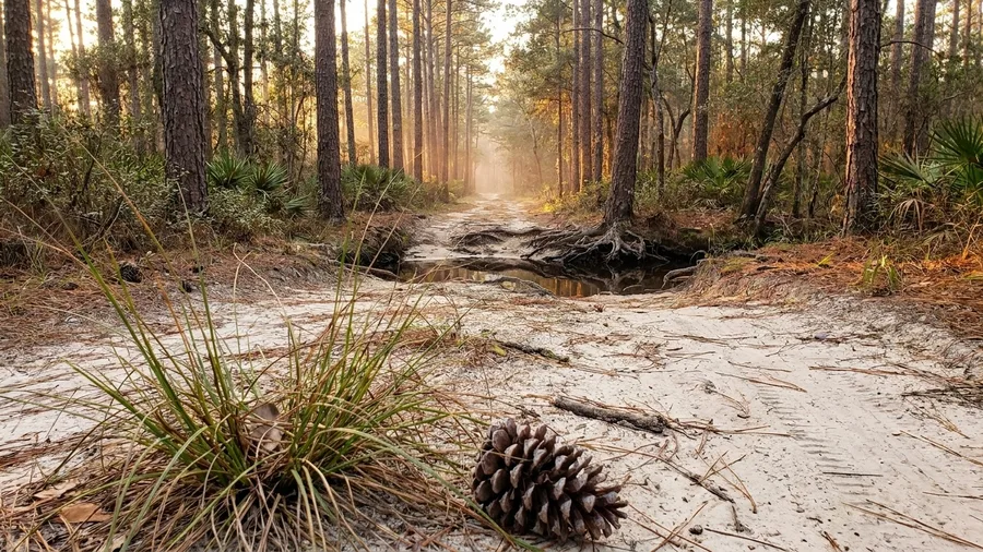
Tuxachanie Trail is a flat, sandy pine-and-hardwood walk that runs 6.0 miles one way along the Gulf Coast, with creek crossings and late color well into the season.
If the Hill Country maple trip is the exception that needs a November drive, this is the opposite bargain: no elevation, no climb, just an easy grade that a Gulf Coast reader can reach without leaving the coast. The color is quieter than a mountain slope – pines and hardwoods rather than a wall of maple – but the creek bends and the longleaf give it its own look in the late light.
The catch is distance, not difficulty. Six miles one way means twelve round trip if you go the whole way, so turn around with daylight to spare rather than pushing to the end marker. Most people do not need to; the best creek views and the sit-down stretches come up well before the far terminus.
This is a place to do almost nothing, on purpose. Bring something to sit on, pick a creek bend, and let an hour go by with the water running. Peak color runs late October into early November, later than the Appalachian trails and earlier than the Panhandle’s latest window, and the flat grade makes it a realistic slow day for anyone who wants fall color without a climb.
Check the surface after rain, since the sandy low sections can hold water and the creek crossings run higher than they look. Otherwise it is the gentlest color walk on the Gulf, and the one that asks the least of you.
13. Big Tree Trail, Torreya State Park, Florida
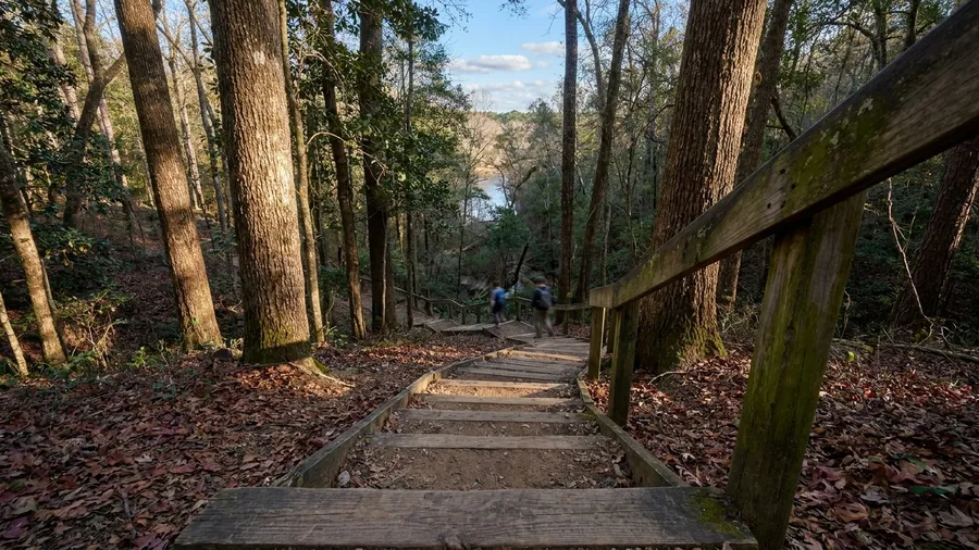
The Big Tree Trail is the one fall walk on this list you can still take after Thanksgiving, and yes, Florida can carry a real one. It is a 1.0-mile loop at Torreya State Park in the Panhandle, and its color peaks late November into early December, the latest window anywhere in this guide. If you have written off the season by the time the last northern leaf is on the ground, this is the last-chance option: drive it or skip fall color entirely.
The loop is short but not flat. It drops into steep ravines on cut-in stairs, follows the Apalachicola bluff to a river overlook, and climbs back out, so you get bluff-top color and a water view in under an hour of walking. Day-use at Torreya runs $3 per vehicle, which makes it the cheapest ticket here as well as the latest. Check the park page before you go, since hours shift with the season, and give yourself the afternoon if you are coming from any distance across the Panhandle.
Laurel-Snow Pocket Wilderness — At a Glance
📏 Distance
6.0 mi round trip
⬆️ Gain
~1,000 ft
⏱️ Time
~4 hours
🍂 Peak
Late Oct-early Nov
💵 Fee
Free
Why it earns the drive
Waterfalls and a rock overlook on the same rugged loop, with fewer people than the Smokies classics.
14. Laurel-Snow Pocket Wilderness Trail, Tennessee
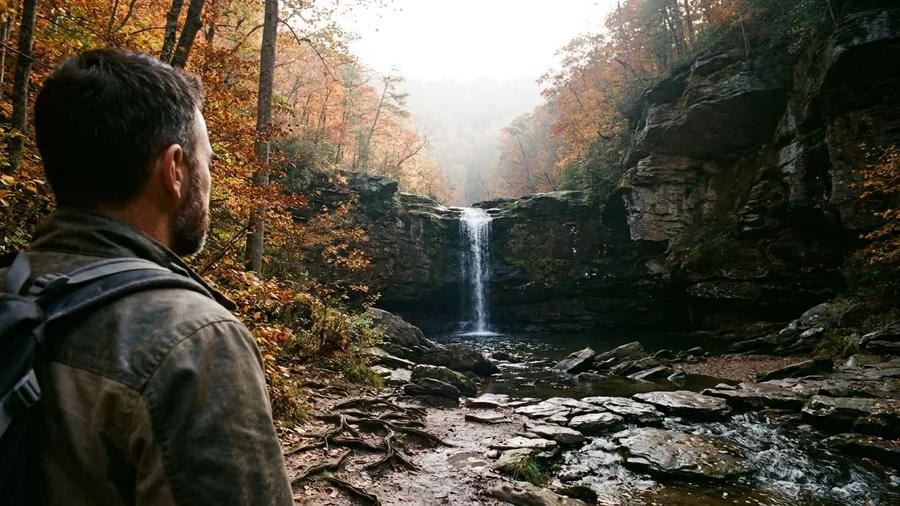
Budget four hours for 6.0 miles and about 1,000 feet of gain, and treat that as the real entry price of this one. That is the trade after a short Florida loop and the latest windows further south: more miles, more climb, and a gorge with waterfalls and a rock overlook at the end, in the late-October-to-early-November window the Smokies and Blue Ridge are already leaving behind.
The trail is rocky and rooty the whole way, with creek crossings to keep your feet honest, so this is a hiking day rather than a stroll. Late October into early November is the color window, and the water and overlook are the payoff rather than a summit. Allow the full four hours, carry layers for short daylight, and plan to be off the trail before dusk catches you in the gorge.
What you buy with that effort is quiet. The Laurel-Snow Pocket Wilderness draws fewer people than the classic Smokies trails, so the waterfalls and the overlook come without a crowd around them. The entry fee is your afternoon and the wear on your legs, and for a reader who wants water plus color in one rugged loop, that is money well spent. Peak falls in the same late-October-to-early-November stretch as the high country, so pick it then, not later.
💡 Tip: Carry a dry layer for the waterfall stop. Spray from the falls soaks through a light jacket fast.
Frequently Asked Questions
Is it worth chasing fall color in the South after the North has gone bare?
Yes, if you pick by peak window rather than by reputation. Blue Ridge and Smokies trails hit mid-to-late October, Georgia and Alabama late October into early November, Texas early-to-mid November, and Florida late November into early December. There is a working window from October through the first week of December.
Can I do any of these in a day?
Most of them. Pulpit Rock is 1.5 miles and an hour from Birmingham. Graveyard Fields is a 2.3-mile loop 45 minutes from Asheville. Big Tree Trail is a 1.0-mile loop. Chimney Tops and Laurel-Snow need most of a morning or a short afternoon.
How much do the trails cost?
Several are free, including Graveyard Fields, Blood Mountain, Walls of Jericho, Whitaker Point, Lost Valley, Horsethief Springs, Tuxachanie and Laurel-Snow. Cheaha day-use is $5 per adult, Lost Maples runs $6 to $10 for a day pass, and Torreya is $3 per vehicle. Smokies trailheads require a parking pass. Confirm on the official park page before you leave.
How hard is the Tallulah Gorge Floor Trail if it is only 2.0 miles?
The drop is easy and the climb back out is not. You lose and regain about 1,100 feet on stairs and a suspension bridge, which puts it above several longer trails on effort. Access to the floor is limited, so check the permit system first.
What should I pack for a late-season Southern hike?
Layers rather than one jacket, shoes with real tread, a headlamp, and water. Daylight ends around 5:30 in November, ridges and ledges run cold and windy, and even the 2.4-mile Ozark trails have roots and creek crossings.
Can kids handle any of these?
Lost Valley is the family pick: 2.4 miles round trip with a cave entrance and a waterfall. Pulpit Rock works for short legs. Big Tree Trail is a 1.0-mile loop but has ravine stairs. Chimney Tops is not a family trail, thanks to scrambling and exposure near the top.
Fit the Peaks Into Two or Four Days
Pick by situation and the choice gets easy. The easiest big view is Pulpit Rock above the Talladega Mountains, 1.5 miles and $5 a head, an hour from Birmingham. The best family walk is Lost Valley at 2.4 miles. The best short serious hike is Chimney Tops, 4.0 miles with 1,400 feet of gain. The latest color sits at Torreya’s Big Tree Trail, peaking late November into early December.
Choose the peak window first, then drive time, then fitness and fee. A trail outside its window is the wrong choice even if it is close. The missed northern season is not the end of fall, because the South’s color is staggered and a late-fall weekend still works when matched to the right elevation and latitude.
Confirm fees and pass details on the official park page before you point the car south, and carry layers and a headlamp for the short daylight. Pick the date, not the photograph.
Check your calendar against the table
Find the peak window closest to your free weekend, measure the drive, then decide. The whole shortlist is in the table near the top of this article.