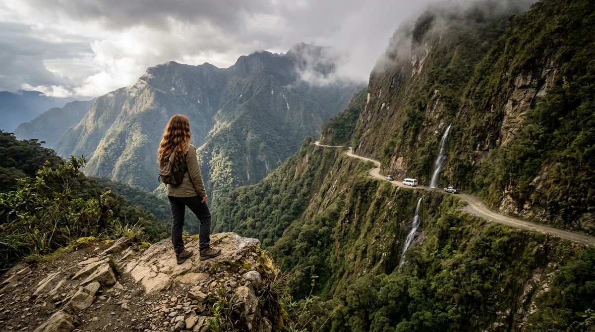
Romanticized travel blogs often glamorize treacherous mountain passes as the ultimate bucket-list challenge, ignoring the stark reality that local residents actively avoid them due to ongoing safety hazards, rockfalls, and lack of maintenance.
Social media algorithms reward high-risk infrastructure failures, but everyday commuters know that choosing a safer bypass route is simply common sense.
The drive involves 12 distinct routes spanning extreme elevations, narrow gravel ledges, and volatile tidal zones.
Traverse unpaved mountain drops, cross submersible coastal causeways, navigate hand-carved cliff tunnels, scale alpine switchbacks, and dodge active rockfalls.
Use this guide to understand which infamous tracks require extreme caution, which ones to approach only at specific hours, and which ones to skip entirely.
Quick Tips Before You Start
Vehicle Check
Inspect brake pads and tire tread depth before entering unpaved terrain.
Timing Matters
Cross high-altitude or tidal routes strictly at dawn before weather shifts.
Offline Maps
Download local offline navigation data since cellular service drops entirely.
⚠️ COMMON MISTAKE
Ignoring Rental Car Contract Terms
Standard rental agreements almost universally void insurance coverage the moment your tires touch unpaved high-risk tracks. Check your policy before departure.
Global High-Risk Route Map
Save this route map before planning any extreme mountain driving trip.
1. North Yungas Road
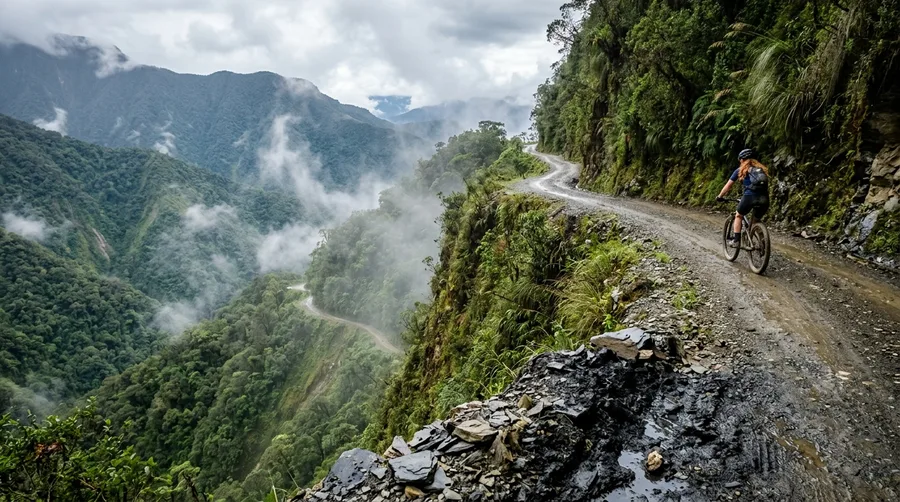
The original gravel route known locally as Death Road is now bypassed by daily commuters who use the paved Cotapata-Santa Barbara highway.
Commercial traffic and residents stopped risking the narrow single-lane drops years ago, leaving the old gravel shelf primarily to downhill mountain bike tours.
Heavy fog and seasonal rains create treacherous mudslides across the 3,000 vertical meters of descent.
💡 Tip: Take the modern paved highway and save the old gravel track for guided bike excursions.
North Yungas Road — At a Glance
🏔️ Max Elevation
4,650 meters
🚧 Surface Type
Unpaved gravel
🛑 Local Status
Bypassed
Primary Hazard
Active rockfalls and sheer vertical drop-offs with zero guardrails.
2. Guoliang Tunnel Road
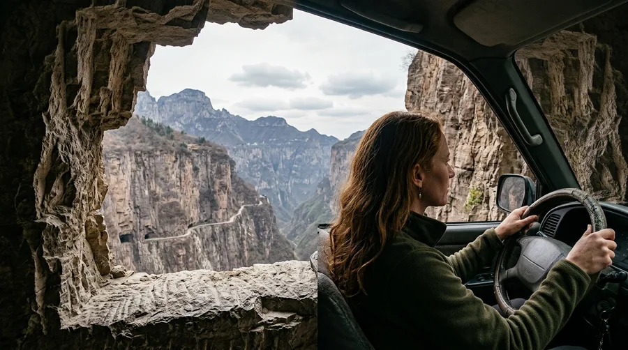
Carving a path through the vertical Taihang Mountains required thirteen local villagers to spend years hand-chiseling a 1.2-kilometer stone tube in the 1970s.
The engineering marvel draws massive crowds today, but modern tour buses have turned the single-lane stone passage into a high-stress logistical gridlock.
Unlit rock-window openings create blinding light contrasts as you drive through.
Meeting an oncoming heavy vehicle requires precise reversing skills along a sheer cliff face with no room for error.
Arrive at sunrise before tour operators open access to avoid getting trapped in the stone corridor.
💡 Tip: Walk through on foot early in the morning rather than driving a large vehicle.
🌱 GROWING TIP
Mastering Cliffside Reversing
Practice backing up on narrow single-track roads before attempting mountain tunnels where passing bays are spaced hundreds of meters apart.
3. Fairy Meadows Road
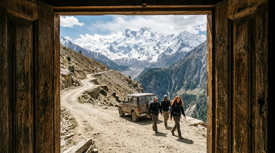
Twelve kilometers of unpaved dirt track climb from Raikot Bridge over the Indus River toward Nanga Parbat base camp.
Wildlife sightings are rare due to heavy vehicle noise, but active rockfalls and melting glacial runoff frequently block the narrow shelf.
💡 Tip: Leave personal vehicles at the bridge and hire a local Jeep driver.
Best For / Skip If
4. Atlantic Ocean Road
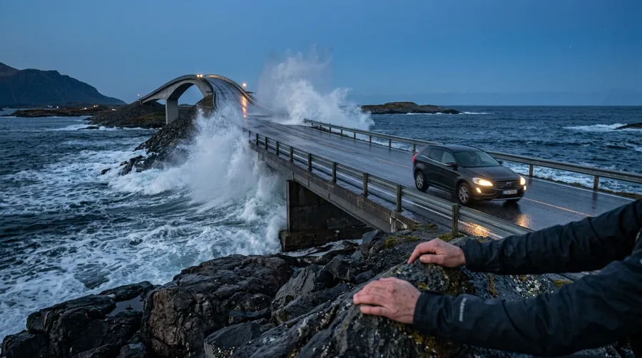
Rogue Atlantic waves routinely sweep directly over the low-lying asphalt bridge deck during autumn storm surges.
The 8.3-kilometer route crosses an exposed Norwegian archipelago where weather shifts instantly.
Stop at the Eldhusøya elevated rest walkway to sit down, grab a coffee, and watch ocean swells crash against the basalt rocks for an hour.
💡 Tip: Check meteorological warnings for gale-force winds before crossing.
5. Zojila Pass
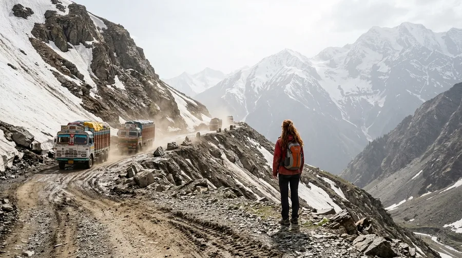
Can you cross the Himalayan gateway before the morning sun destabilizes the fragile snowpack above?
Transit must occur strictly between 5:00 AM and 7:00 AM before rising temperatures trigger wet avalanches and mudslides.
Unpaved single-lane tracks sit at 3,528 meters elevation alongside heavy military transport convoys.
💡 Tip: Wait at the checkpoint overnight rather than attempting afternoon passage.
💡 PRO TIP
The Dawn Window Rule
In high-altitude Himalayan and Andean passes, mechanical and weather stability expires by mid-morning. Always aim to clear summits before noon.
6. Passage du Gois
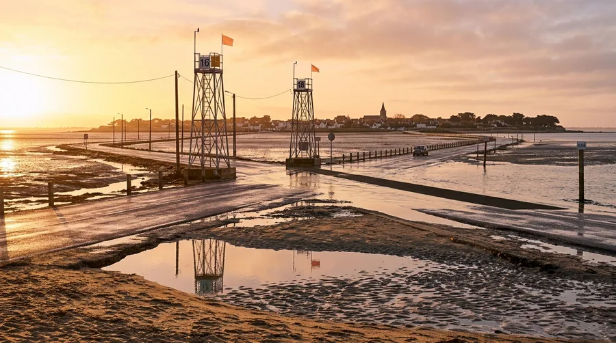
Driving across a submersible ocean causeway means risking your vehicle to incoming tides rather than mountain cliffs.
The 4.1-kilometer route connects mainland France to Noirmoutier twice daily before seawater covers the asphalt.
Stop at a harbor bistro afterward to sample regional oysters and potatoes for roughly 20 Euros.
💡 Tip: Consult official tide tables posted at both entry gates before driving across.
7. Skippers Canyon Road
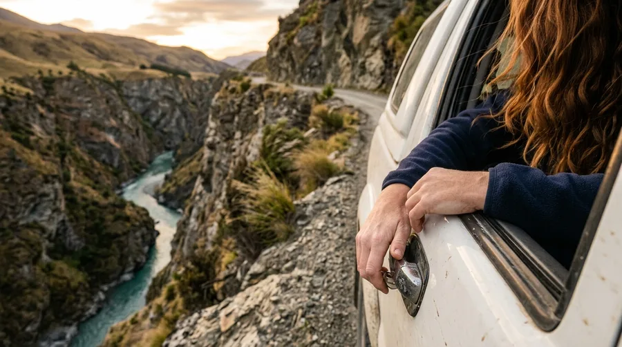
You grip the passenger door handle tightly as your rental agreement explicitly voids coverage the moment your tires hit the gravel.
Park the rental car at the viewpoint and book a guided 4×4 tour or pair the trip with a Shotover River jetboat excursion.
Miners carved these sheer schist rock walls by hand above the roaring river gorge in the late 19th century.
💡 Tip: Leave the driving to local commercial operators who carry specialized insurance.
8. Stelvio Pass
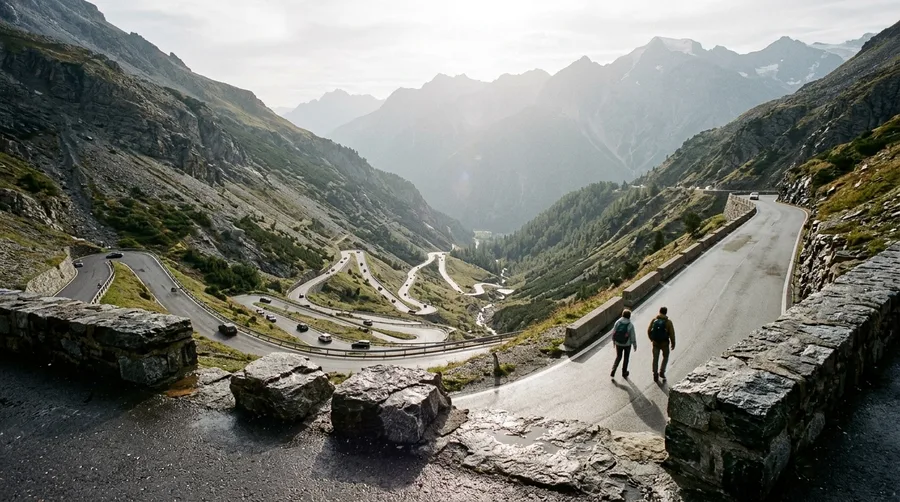
The sharp smell of hot brake pads and the whine of motorcycle engines echo off 48 hairpin turns.
Mid-summer midday gridlock makes this famous Italian Alpine route frustrating, but a 6:00 AM start offers clear asphalt and open air.
💡 Tip: Arrive at dawn to experience the switchbacks without campervan congestion.
9. Dalton Highway
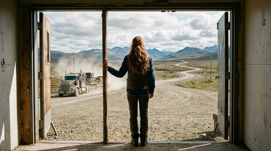
Flying gravel, blinding dust storms, and absolute isolation define 414 miles of Arctic wilderness.
The haul road was rushed to completion in just 154 days during 1974 to service the Trans-Alaska Pipeline.
Carry dual spare tires, C.B. radios to communicate with semi-trucks, and full winter survival gear before departing.
💡 Tip: Yield the right of way to massive industrial haul trucks at all times.
10. Trans-Fagarasan Highway
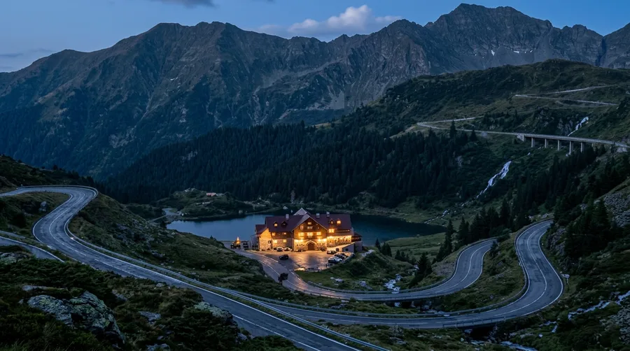
Cool, pine-scented mountain air meets the roar of cascading waterfalls alongside asphalt twists in the Carpathian range.
Ceausescu’s military regime built the vertical hairpin drops across strategic ridge lines.
Book a night at the Balea Lake Chalet accessible via cable car when the road closes to vehicles.
Pair your stay with a traditional multi-course dinner featuring forest mushrooms and local game for roughly 200 Euros total.
Staying overnight bypasses day-tripper traffic jams completely.
💡 Tip: Take the cable car up in the afternoon to avoid parking gridlock at the summit.
11. Karnali Highway
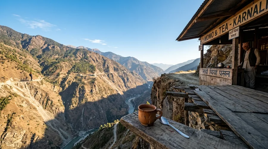
250 kilometers of bone-jarring dirt road carve through the steep hills of western Nepal.
Stop at a remote roadside tea stall run by local elders who serve spiced milk tea and honey flatbread for under 50 Nepalese Rupees.
💡 Tip: Use tea breaks to let your vehicle's suspension and brakes cool down.
12. Trollstigen Route
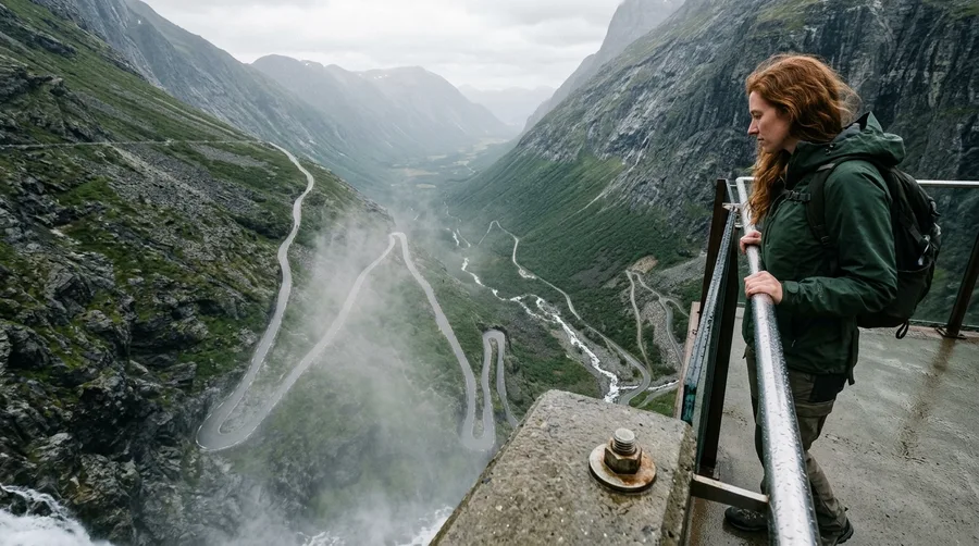
You stand on the cantilevered viewing platform at Stigfossen as mist rises from the waterfall, framing 11 hairpin bends below.
The upper architectural viewing platform at the visitor center juts out over the abyss.
Visit during Nordic twilight around 9:30 PM in summer to capture soft golden light without tour bus crowds blocking the railing.
💡 Tip: Time your ascent for late evening to enjoy empty viewing platforms.
Frequently Asked Questions
Do standard rental car companies cover travel on hazardous gravel roads?
Standard rental agreements almost universally void coverage on unpaved or notoriously dangerous routes. You must verify contract terms or rent specialized 4×4 vehicles with explicit off-road riders.
What physical preparation is required for high-altitude mountain passes?
Acclimatize gradually in nearby towns for at least 48 hours to prevent severe altitude sickness. Ensure your vehicle’s cooling system and brake fluid are fully serviced before climbing steep grades.
Are these extreme roads open year-round for travelers?
Most high-altitude mountain passes and coastal hazard routes experience strict seasonal or weather-dependent closures due to heavy snow accumulation, avalanche risks, or ocean flooding.
How can travelers check real-time road conditions before departure?
Consult official national transport agency portals, local police advisories, and regional meteorological stations rather than relying on outdated travel blog posts.
Beyond the Edge: Navigating the Reality of Wild Routes
Respecting local infrastructure decisions and environmental volatility matters far more than collecting social media badges on dangerous asphalt. True adventure driving means knowing when to park the car, take a local detour, or admire a route from a safe viewing platform.
Prioritize preparation, situational awareness, and local advice over reckless risk-taking on every journey you plan.