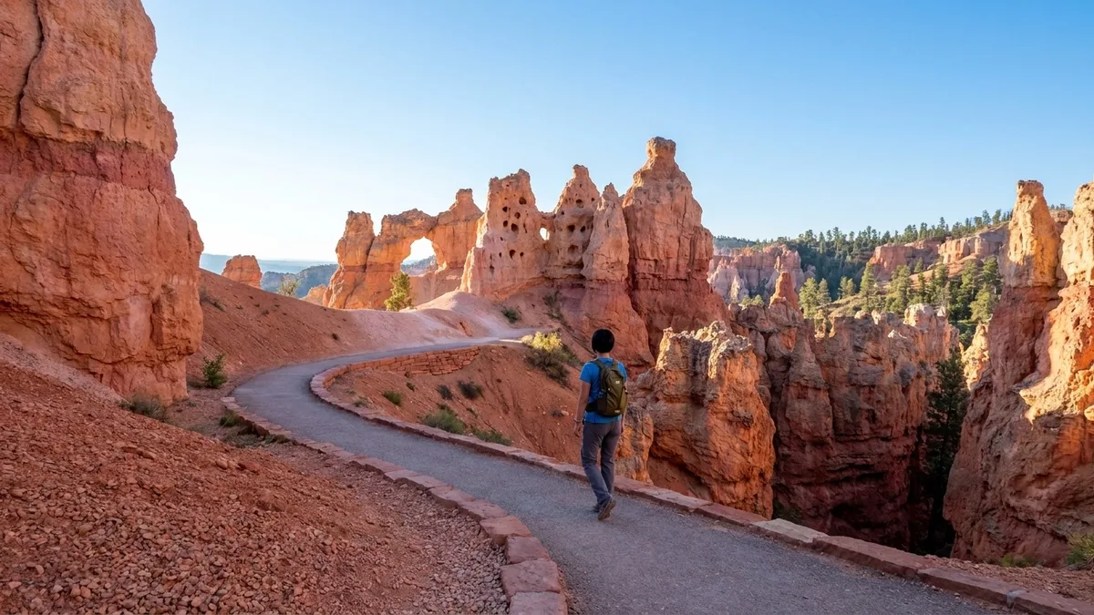
Does Utah hand you the big view without the big climb? Mostly, yes – and the walk that proves it is Sunset Point at Bryce, a 0.5-mile paved loop gaining 30 feet. You walk in believing the postcards sit at the end of a long, steep trail. They do not.
The hard part here is rarely distance. Canyon Overlook in Zion is only a mile round trip and still puts you on unfenced rock over a drop. Dead Horse Point Rim runs 1.5 miles with 40 feet of gain, and its overlooks are fenced the whole way.
So plan by where you sleep, then by how you feel near an edge, and let fitness sit this one out. Twelve short walks cover Bryce, Moab, Zion, Capitol Reef, St. George and Salt Lake City, and this guide names the flattest for the height-shy and the single walk to leave out.
Each one comes with its distance, gain, time, surface and one honest caution, so you can match a walk to the day’s base town and your own tolerance for the rim.
Quick Tips Before You Start
Wear grippy shoes
Even paved trails get sandy or icy; trail runners or hiking shoes beat flip-flops on every walk here.
Carry two liters
Utah is dry and high; you will feel it on the shortest walk, so bring water for everyone.
Start early or late
Most of these trails have no shade; before 9 a.m. or after 4 p.m. is cooler and quieter.
Check the shuttle
Zion and Arches run shuttles in peak season; know the last pickup before you start walking.
Watch the weather
Afternoon storms make slot canyons dangerous and slickrock slippery; have a backup plan.
1. Sunset Point: Bryce Amphitheater in 25 Minutes
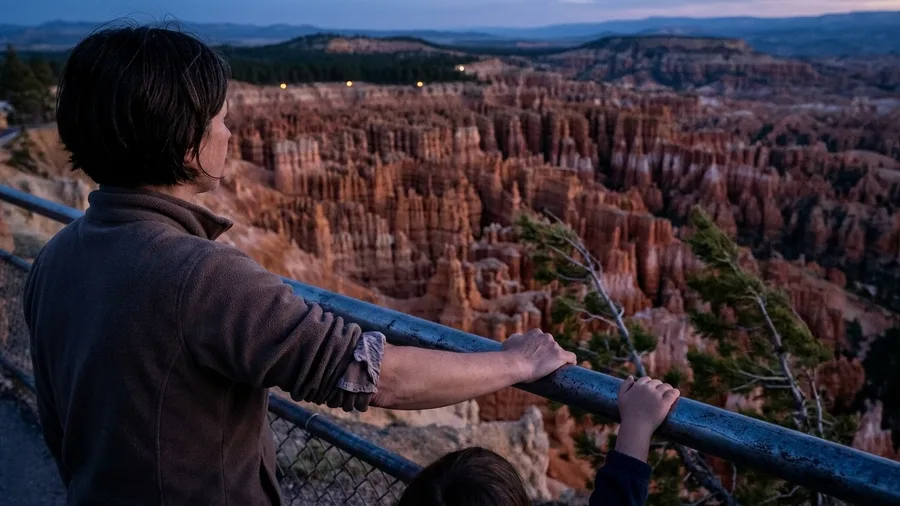
Twenty-five minutes. That is the whole walk from the Sunset Point lot to the amphitheater rail and back onto pavement, 0.5 miles with 30 feet of gain, and the view arrives before your coffee has gone cold.
You start on asphalt, so strollers and grandparents roll or shuffle it without a stumble. The guardrail runs along the rim, which matters, because the drop behind it is real and there is nothing but air and hoodoos below. What you see is the whole Bryce Amphitheater laid out in rows of orange spires, packed so tight the far wall reads as texture. Come at sunrise and the entire bowl catches fire, pink at the top and deep rust at the base; the likelihood of catching that glow is a matter of arriving in the dark, and the lot is closer to you than the trailheads most people are driving to.
💡 Tip: Park at Sunset Point lot before 7 a.m. for sunrise; the lot fills by 8:30 in summer.
| Hike | Distance | Elevation gain | Time | Surface / caution |
|---|---|---|---|---|
| Sunset Point, Bryce Canyon | 0.5 mi loop | 30 ft | 25 min | Paved; drop beyond rail |
| Mesa Arch, Canyonlands | 0.5 mi loop | 80 ft | 30 min | Slickrock; unfenced edge |
| Park Avenue, Arches | 1 mi one-way | 120 ft descent | 40 min | Paved; return uphill or shuttle |
| Dead Horse Point Rim | 1.5 mi out-and-back | 40 ft | 45 min | Flat gravel; fenced |
| Canyon Overlook, Zion | 1 mi RT | 160 ft | 45 min | Stone steps; drop-offs |
| Grotto Trail, Zion | 1 mi one-way | 40 ft | 25 min | Paved; deer |
| Mossy Cave, Bryce area | 0.8 mi RT | 100 ft | 30 min | Dirt/boardwalk; icy in winter |
| Pink Ledges, Red Canyon | 0.8 mi loop | 80 ft | 30 min | Sandy; steps |
| Goosenecks & Sunset Point, Capitol Reef | 0.4 mi RT | 60 ft | 25 min | Paved/gravel; fenced |
| Jenny’s Canyon, Snow Canyon | 0.5 mi RT | 50 ft | 20 min | Deep sand; flash flood risk |
| Buffalo Point, Antelope Island | 0.5 mi RT | 100 ft | 30 min | Dirt/rock; bison nearby |
| Ensign Peak, Salt Lake City | 1 mi RT | 400 ft | 40 min | Dirt; exposed, hot in summer |
2. Mesa Arch: Half a Mile to the Postcard
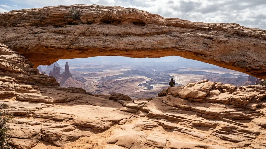
The half-mile bargain holds in Canyonlands, but the guardrail doesn’t: here you trade pavement for slickrock and an unfenced edge, still only 0.5 miles and 80 feet of gain, about 30 minutes.
Mesa Arch sits at the rim in the Island in the Sky district, a rock span that frames the canyon and the White Rim below in the shape of a window. The approach is slickrock with a few shallow steps, and the payoff is that famous calendar shot, but the edge under the arch has no rail at all, so a sure-footed walker gets the view and a height-shy grandparent stands back a few feet. Go at dawn for the glow through the opening.
It is the small, cheap stop that breaks up the drive to the rest of the island.
3. Park Avenue: A Mile Between Sandstone Walls
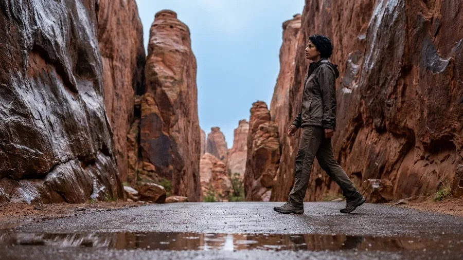
The sandstone closes in on both sides and the sky narrows to a strip of blue overhead, and you have only walked a few minutes from the viewpoint.
Park Avenue runs 1 mile one-way between towering sandstone fins, 120 feet of descent taking about 40 minutes on pavement. Start at the Park Avenue viewpoint to get the full corridor, because the big wall views come on the downhill leg with almost no climbing. Stand where the fins pinch together for the shot everyone wants, and go early to catch the walls lit and the path near-empty.
The catch is the exit: you either turn around and climb the mile back up, or you catch the ship. If you miss the shuttle, that easy downhill becomes a climb.
💡 Tip: If the shuttle is running, walk one-way and ride back; it saves the 120-foot climb.
⚠️ COMMON MISTAKE
Don't save the climb for the end
At Park Avenue, the downhill mile feels easy, but the return is a 120-foot climb. Check the shuttle times before you start, or plan to walk back uphill.
4. Dead Horse Point Rim: Flat Walk, Huge Bend
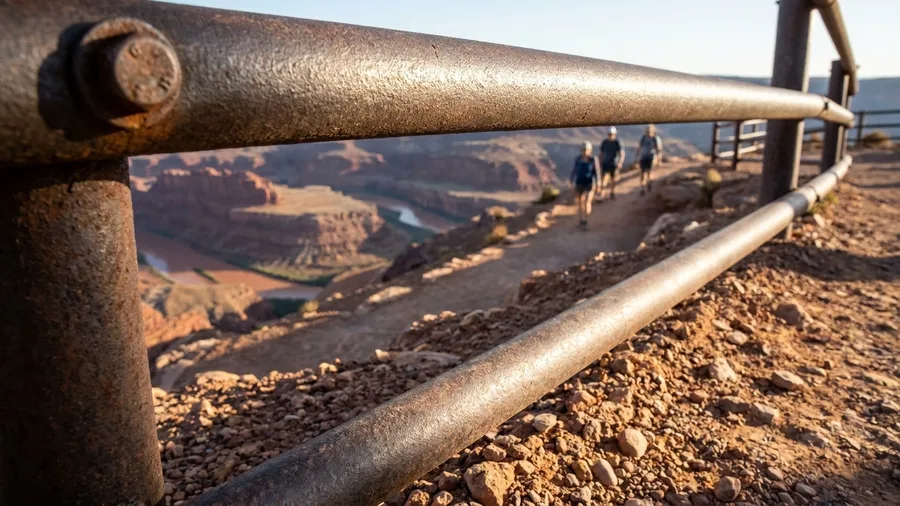
The one thing to know before you drive out is that the fences are real. Every viewpoint on the Dead Horse Point Rim Trail sits behind a rail, and that single fact is what makes this the flattest big-view walk on the whole Moab list.
It is 1.5 miles out and back, 40 feet of gain, about 45 minutes at an unhurried pace. The surface is flat gravel the entire way, wide enough for two people abreast, so you are not watching your feet and you are not planning an exit. Where a descent into a sandstone corridor asks you to think about the climb back, this path just runs level along the rim above the Colorado River’s gooseneck, that tight 180-degree bend where the water doubles back on itself a thousand feet below.
Go late afternoon. In the last hour or so before sunset the low light catches the river and the water goes from dull green to something closer to copper, and the canyon walls across the bend start throwing shadows that make the scale of the thing readable. Midday washes it flat. Bring a layer, because the rim wind picks up as the sun drops and there is nothing between you and it.
This is the walk for the grandparent who wants the view and not the edge, the parent with a toddler who will not stay on a line, the person in the group who has been quietly dreading the drop-offs all trip. The caution is simply that you stay behind the fences, which are there and which work.
There is an entrance fee to the state park, so check the current rate before you go, but the walk itself costs nothing beyond that. Park at the overlook lot at the end of the road and the trail starts from it. Give it an hour and you have the best view in the park with the lowest possible cost in effort and nerves.
5. Canyon Overlook: Zion’s Short but Exposed Classic
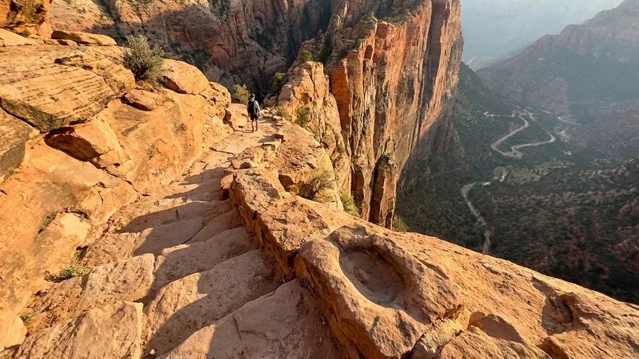
The wind funneling through the rock tunnel is cold and sudden, and when you come out the other side the ground falls away on your right with nothing between you and it.
Canyon Overlook is 1 mile round trip and 160 feet of gain, roughly 45 minutes, but it is stone steps, a narrow ledge, and unfenced drop-offs the whole way to the view of the switchbacks below. Skip it when the rock is icy or wet, and skip it if heights make your stomach turn, because this is the least beginner-friendly walk on this list despite the short mileage. If drop-offs are a problem, this is the one to leave out.
6. Grotto Trail: Zion’s Flat Riverside Connector
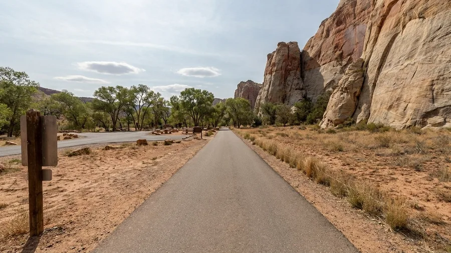
Yes, and the answer is the Grotto Trail, a paved mile between Zion Lodge and the Grotto picnic area that gains about 40 feet and takes roughly 25 minutes one way.
The path runs under the cliffs in shade for most of its length, which matters in a canyon that bakes by mid-morning. Shuttles stop at both ends, so you can walk it one way and ride back rather than doubling the distance. It is flat, wide, and stroller-friendly, and it carries the lowest exposure of any Zion walk here.
The hour to do it is early, before the shuttle fills and before the sun clears the east wall. In the first hour the canyon is cool and the light is soft on the sandstone, and the path belongs to a handful of people instead of a queue.
Watch for deer near the picnic area, especially in the morning when they graze the grass there. Give them room and keep children close; they are habituated enough to stand their ground.
This is the walk for families with young children and for grandparents who want the canyon without the ledge. Budget half an hour each way if you have small legs, and treat the picnic area as the destination rather than an afterthought.
7. Mossy Cave: Waterfall and Grotto in 30 Minutes
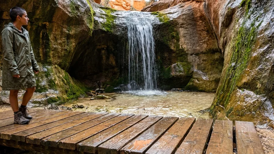
A creek runs down a side canyon off Highway 12, and you walk up beside it to a waterfall and a dripping alcove. The round trip is 0.8 miles with about 100 feet of gain, roughly 30 minutes – the shortest water walk on the Bryce side of the road.
You park in the lot off the highway and follow the trail upstream; half the route is packed dirt, the other half a boardwalk built over the wet ground where the creek spills across the path. In spring the falls actually fall – snowmelt off the plateau pushes real water over the lip – like the USA waterfalls worth the hike, and the grotto behind it stays wet enough all year that the rock drips. Kids tend to stop at the first wet patch and have to be talked onward.
The caution here is surface and season, not drop-offs. The creek path ices into a slick chute in winter and after a cold storm, and traction aids are worth the ten minutes it takes to strap them on. Spring is when the waterfall earns the name; late summer, expect a trickle. That’s the whole trade – 30 minutes and 100 feet, and the weather decides how much of it you get.
Mossy Cave: What the Prose Didn't Say
🅿️ Parking
Highway 12 pullout, fills by mid-morning in summer
☀️ Worst month
August – creek often bone dry
🌊 Best window
April-May snowmelt
🧒 Kid factor
First wet patch becomes the destination
↩️ Skip if
You want the amphitheater rim – this is a side canyon
Caution
Ice forms on the boardwalk sections, not the dirt – watch the wet-plank stretches after a cold night.
8. Pink Ledges: Red Canyon’s Hoodoo Sampler
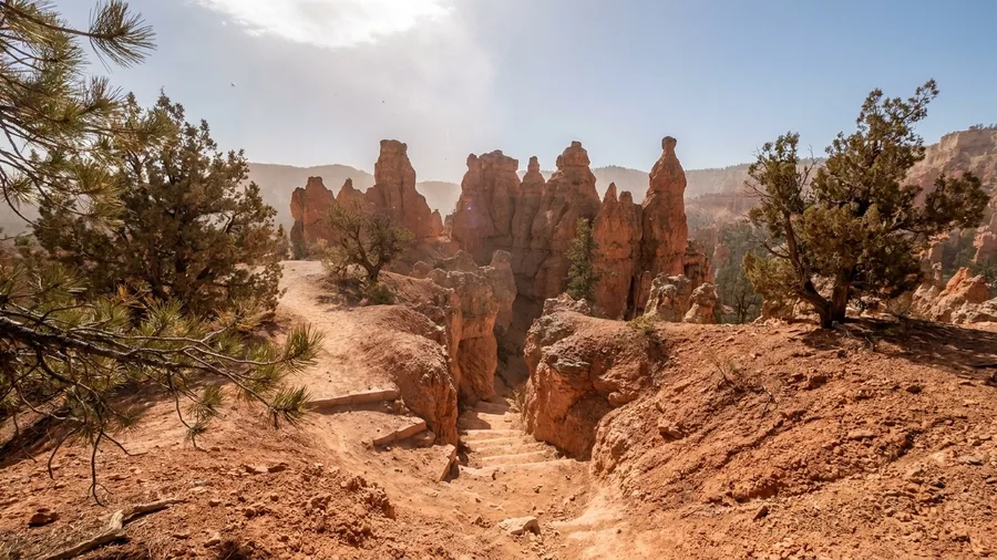
This is the hoodoo stop to take if you want the scenery without the park day – 0.8 miles, about 80 feet of gain, 30 minutes, trailhead right at the Red Canyon Visitor Center on Scenic Byway 12.
You’ll loop up past red spires and through a cut in the rock, sandy underfoot with a handful of steps. It suits families and anyone pressed for time; the loose sand and the steps make footing less certain than the paved paths inside Bryce, so it’s not the one for a stroller or a wobbly ankle.
Paved vs. Sandy: What to Expect
Paved paths
- Sunset Point, Bryce
- Grotto Trail, Zion
- Park Avenue, Arches (outbound)
- Goosenecks, Capitol Reef
Sandy or slickrock
- Pink Ledges, Red Canyon
- Jenny's Canyon, Snow Canyon
- Mesa Arch, Canyonlands
- Buffalo Point, Antelope Island
9. Goosenecks and Sunset Point: Two Easy Overlooks
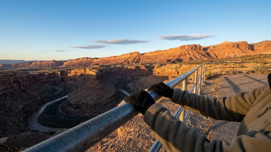
Two fenced overlooks sit at the end of a path from the Capitol Reef overlook lot: a twisting canyon of goosenecks on one side, the Waterpocket Fold on the other. It’s 0.4 miles round trip, about 60 feet of gain, and 25 minutes – the cheapest big view in the park.
The path is part paved, part gravel, and the edges are fenced at both viewpoints, so the cost is mostly time rather than exposure. Go at sunset, when the fold catches warm light and the shadowed canyon twists go darker and darker as the sun drops behind you.
What you’re paying for is the park entrance fee – around $20 per vehicle, good for seven days – and 25 minutes of walking. There’s no drop-off to negotiate as long as you stay behind the rails.
10. Jenny’s Canyon: Snow Canyon’s Mini Slot
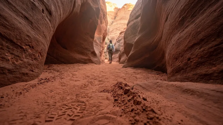
If you want to find out whether a slot canyon scares you without committing to a real one, walk Jenny’s Canyon. It’s a half-mile round trip out of the Snow Canyon lot near St. George, 50 feet of gain, about 20 minutes end to end. The prize is a shallow corridor of carved red walls that pinches in and lets light down the rock, and the walls close in without ever feeling like a coffin. It’s the taste, not the meal.
The surface is the catch: deep sand most of the way, the kind that eats a step and asks for another, so budget more energy than the distance suggests. There is no climbing, and the exposure is essentially zero once you’re inside the walls. The one rule is weather. Anywhere a slot narrows, a storm miles away can send water through it, and flash-flood risk is the caution that decides whether this walk runs today, not drop-offs. Check the forecast the morning of, and if rain is anywhere in the picture, pick another easy USA national park trail and come back.
💡 Tip: Wear shoes that can handle deep sand; you will sink ankle-deep in places.
Your short-walk sequence by base town
11. Buffalo Point: Antelope Island’s Lake View
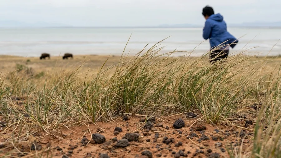
The first thing you notice on Antelope Island is the smell of the lake, an open, briny note that reaches you before you’ve left the causeway. Then the quiet, broken by the hum of insects in the grass. From there, a half-mile round trip and 100 feet of gain puts you up Buffalo Point, a grassy knob above the water with the whole Great Salt Lake and the Wasatch Range behind it. Give it 30 minutes.
The trail is dirt and rock with a few switchbacks, and the effort is moderate: short, but you’re gaining height. Go on a calm morning and the lake reads flat and pale to the horizon. The exposure is open slope, not cliff, so a height-averse walker can manage it fine. What you should plan for is the bison. They graze near this island often enough that you should keep a wide margin and give them the right of way, and that’s the caution that shapes the walk more than the ground does.
Bring something for after: a picnic and a cold drink from a cooler in the car, roughly what you’d pay at any mainland grocery store, eaten at one of the shoreline tables. The salt air does half the work. It’s a short climb, a big lake, and a reason to slow down before you drive back to the city.
12. Ensign Peak: Salt Lake City’s 40-Minute Summit
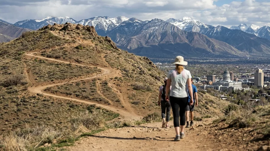
No, and Ensign Peak is the proof. The trailhead sits at Ensign Peak Park just north of downtown, and from there it’s 1 mile round trip with 400 feet of gain, about 40 minutes up and back. That’s the most climbing in this whole set of walks, but the trade is clean: no cliffs, no drop-offs, and the entire valley and the lake laid out below you.
The name is the story. This is the knob where, in 1847, Brigham Young’s advance party is said to have looked over the valley before the main company arrived, and a monument at the top marks it. You climb a dirt trail with a few switchbacks, gain the summit above the State Capitol, and the city you were just driving through turns into a grid with a mountain wall behind it. The history is one paragraph long, and standing on the spot makes it land better than reading it.
The caution is heat and sun. The slope is exposed the whole way, with little shade, so in summer this is an early-morning or evening walk and not a midday one. No fees, no shuttle, no reservation: park on the street by the trailhead and go. Come for the view if you like, but come for the fact that a city this size kept a hill like this open and free.
🗺️ How to plan a day of short walks
Pick your base town
Bryce, Moab, Zion, Torrey, or Salt Lake City.
Check the caution
Drop-offs, sand, or flash floods decide who can do it.
Start early
Most trails have no shade; go before 9 a.m. or after 4 p.m.
Pack water and grippy shoes
Two liters per person and shoes with tread.
Leave a buffer
Plan one walk per half-day and add a drive-by if you have energy.
Frequently Asked Questions
Do I need a reservation for these hikes?
No individual hike requires a reservation, but you need a park entry pass for Bryce, Arches, Canyonlands, Zion, and Capitol Reef. Zion also requires a shuttle ticket in peak season; check recreation.gov before you go.
Are these walks suitable for young children?
Sunset Point, Grotto Trail, and Dead Horse Point Rim are the best for young kids because they are paved or flat and fenced. Canyon Overlook has drop-offs and is not ideal for children who run ahead.
What is the easiest hike with a big view?
Sunset Point at Bryce is the shortest and most accessible: a 0.5-mile paved loop with guardrails and a huge view. Dead Horse Point Rim is flatter but longer.
Can I do these in winter?
Many are open year-round, but ice is a real hazard on Canyon Overlook and Mossy Cave. Bring traction devices and check conditions at the visitor center. Bryce and Cedar Breaks can be snowy into May.
Which hike should I skip if I am afraid of heights?
Skip Canyon Overlook in Zion. Mesa Arch also has an unfenced edge, but you can stay back from it. Stick to fenced overlooks like Dead Horse Point and Sunset Point.
If You Only Bag One Short Utah Summit
Choose in two passes. First by where you’re sleeping: Bryce for Sunset Point, Mossy Cave and Pink Ledges; Moab for Park Avenue, Mesa Arch and Dead Horse Point Rim; Zion for Grotto Trail; Capitol Reef for Goosenecks; St. George for Jenny’s Canyon; Salt Lake City for Buffalo Point and Ensign Peak.
Then filter for edges. The flat, guarded shortlist is Dead Horse Point Rim, Grotto Trail, Sunset Point and Goosenecks, all on pavement, gravel or fenced rock with 60 feet of gain or less. Skip Canyon Overlook if exposure bothers anyone in the car: a mile round trip, 160 feet of gain, stone steps and a narrow ledge with no rail. The postcard is still 0.5 mile and 30 feet from the Sunset Point lot.
Pick your one walk for tomorrow
Open the table above, match the base town you are sleeping in to its row, and check the caution column before you set the alarm.