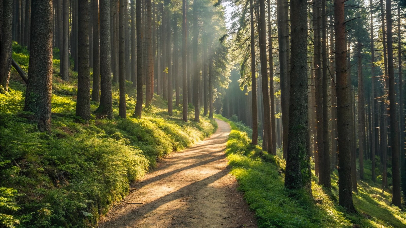
The holy trail of silence where the only footprints for miles are your own — silence is not empty, it is filled with untold stories of the wild. Scenic pullouts get crowded, but beyond those, closer isolation lies, lonely county roads littered and nature unabated.
These aren’t the headliners you’ll find on every Instagram feed — they’re the quiet legends, tucked into corners of our national parks, where awe lives undisturbed. If you’ve ever craved a wilder, more personal kind of beauty, you’ll want to see every one of these trails before the world catches on.
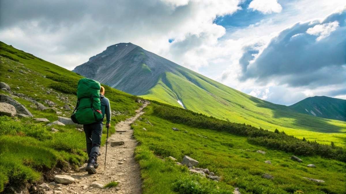
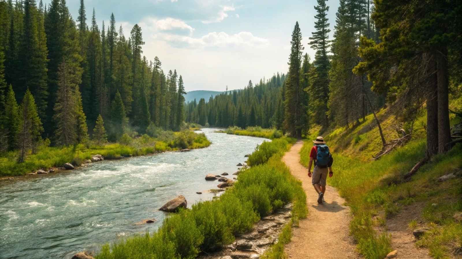
1. Lamar River Trail – Yellowstone National Park (WY)
When most visitors to Yellowstone flock to Old Faithful or the Grand Prismatic Spring, the Lamar Valley stays refreshingly quiet. In this wildlife rich vein, Lamar River Trail starts here and within a mile or so you will be almost guaranteed to be alone — maybe a bison or two and far off through the mountains maybe a few wolves on the one phone trail with the Lamar River that extends for miles in Yellowstone’s northeast wilderness. A long trail in Yellowstone’s far northeast backcountry (dawning on the Lamar River, wide valleys, meadows of wild flowers, and tranquil forests).
What makes this trail exceptional isn’t just its solitude, but the sense of raw wilderness that’s hard to come by in Yellowstone’s more developed areas. You can hike just a few miles in or go for a full backpacking loop — either way, you’re stepping into country that feels nearly untouched. Be prepared, though: this is serious bear country, and that solitude comes with a responsibility to be smart and safe.
The Lamar River Trail is your go-to if you’re looking for a serene, soul-resetting hike in one of America’s busiest parks. There are no permit lines or herds of hikers — just you, the mountains, and that whispering river alongside you.
Quick Info:
- Best Months to Visit: Late June to September
- Length: 8–15+ miles (out-and-back or multi-day options)
- Trailhead Location: Soda Butte/Lamar Valley area
- Highlights: Wildlife viewing, expansive meadows, solitude
- Bear Safety Required: Yes (bring bear spray, practice food storage)
- Permit Needed: For overnight only
2. North Fork Quinault River Trail – Olympic National Park (WA)
This trail doesn’t make many “top 10” lists, which is exactly why it belongs on yours. Tucked into the quiet Quinault Rainforest region of Olympic National Park, the North Fork trail is a lush, emerald corridor filled with mossy giants and the musical sound of rushing water. Unlike the more traveled Hoh Rainforest, the North Fork Quinault is so peaceful that you may go hours without seeing another person.
The trail runs next to the river for nearly 20 miles and has many campsites and sidetrails that make it good if you are heading out-and-back hiking or a longer loop. What is mesmerizing is the ever-changing scenery — soaring cedar and hemlock give way to meadows, but then open alpine ridges with continued pushing. You are hiking 5 ecosystems in a day
For anyone craving solitude under a cathedral of green, this trail is a dream. The canopy almost glows, especially in early morning or after a light rain. And yes, there’s a solid chance you’ll hear elk bugling in the distance during fall.
Quick Info:
- Best Months to Visit: May through October
- Length: 10–20 miles round trip or more
- Trailhead Location: North Fork Ranger Station (Quinault)
- Highlights: Rainforest, river views, solitude, elk sightings
- Permit Needed: For overnight camping (Wilderness permit)
- Bear Safety: Advisable but not as frequent as Yellowstone
3. Lost Mine Trail – Big Bend National Park (TX)
One of the shorter trails on this list, The Lost Mine Trail, is by far one of the best trails. The hike steadily climbs out of Organ Pines and into the Chisos Mountains with equally amazing 360 degree panoramic views that cannot be matched anywhere in the park. If you go early or late in the high season it is typically still pretty quiet.
The hike itself is about five miles round trip, making it one of the best bang-for-your-buck solitude experiences in any national park. Along the way, you’ll pass through cool pinyon-juniper woodlands, colorful desert slopes, and eventually reach a windswept ridge where the world opens up in every direction. There’s something deeply satisfying about sitting on that final overlook, watching shadows drift across Casa Grande Peak and the surrounding desert.
One of the least-visited major parks in the country is Big Bend, and this trail best illustrates that vastness that people bemoan because of its accessibility (we count ourselves lucky) — silence, immensity, and sky. Do not underrate it for its length.
Quick Info:
- Best Months to Visit: October through April
- Length: 4.8 miles round trip
- Trailhead Location: Basin Road (near Chisos Basin Campground)
- Highlights: Mountain views, solitude, sunset spots
- Permits Needed: None for day hiking
- Tips: Start at sunrise for full solitude
4. Bechler River Trail – Yellowstone National Park (ID/WY Border)
The Bechler River Trail feels like stepping into a secret world. Tucked into Yellowstone’s remote southwest corner — accessible only by rough roads from Idaho — this trail is far from the tourist traffic. What you get in exchange is a corridor of waterfalls, thermal features, and hot springs that feels completely removed from the Yellowstone most people know.
Located at what is popularly known as “Cascade Corner” this is where you can find more waterfalls per square mile anywhere in the park. If Not The Trail, then what will we call it? For those who like a variety: the trail has meadows, rivers to cross, geothermal stuff, and an actual underground BACKCOUNTRY HOT SPRING TO SOAK MISTER BUUBLES. You will also find peaceful campsites and pristine views if you are up for a good multi-day crushed high five.
The trail is wet and wild, often requiring stream fords and good navigational sense. But for the adventurer looking for a true wilderness immersion, the Bechler delivers solitude and scenery in abundance.
Quick Info:
- Best Months to Visit: Mid-July to September (after snowmelt)
- Length: 30 miles one-way (shuttle or out-and-back)
- Trailhead Location: Bechler Ranger Station (near Ashton, ID)
- Highlights: Waterfalls, geothermal pools, remote camping
- Permit Needed: Yes, for overnight trips
- Bear Safety: Essential
5. Redwood Creek Trail – Redwood National and State Parks (CA)
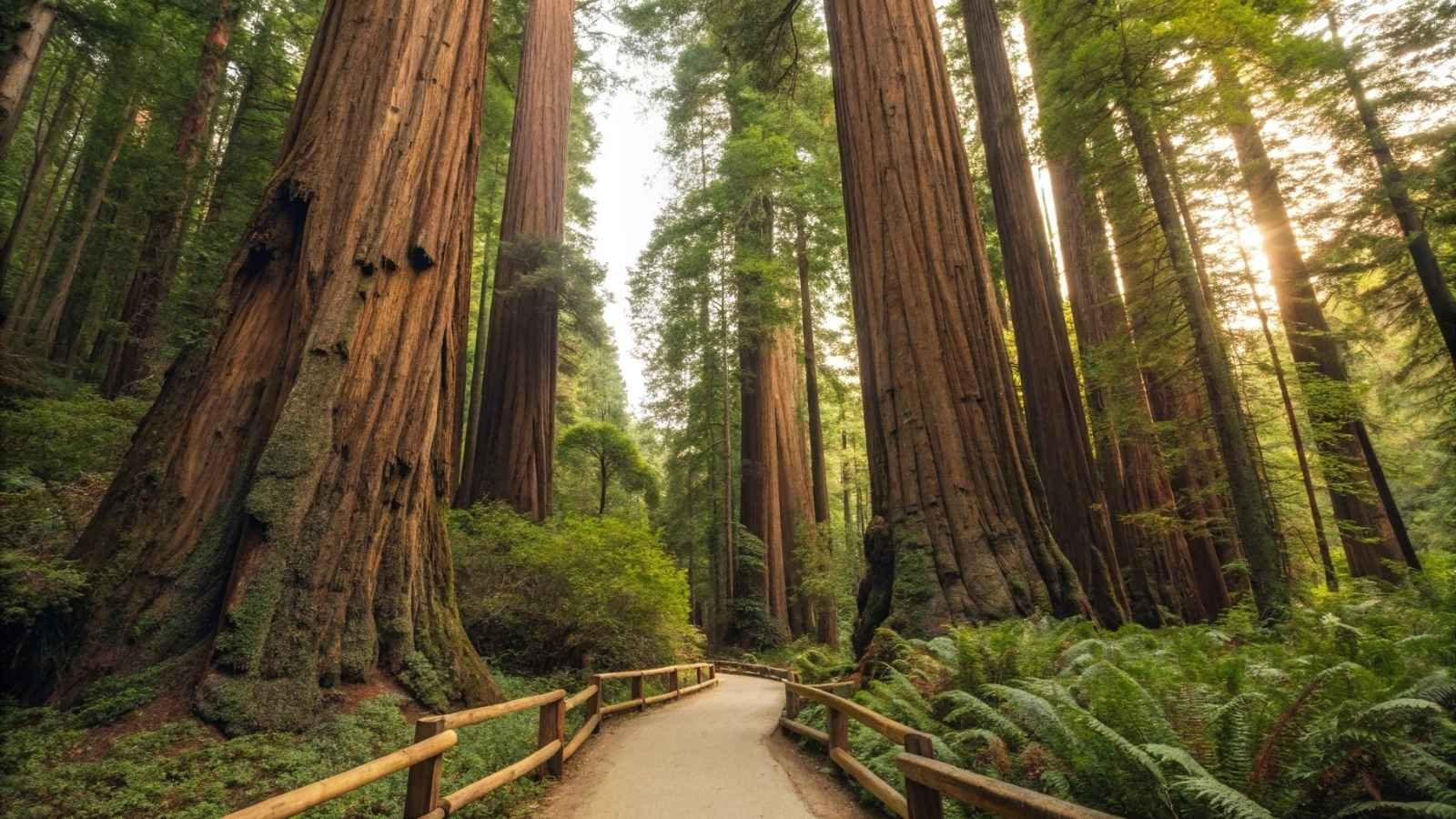
Most people experience the Redwoods by walking a short loop near the visitor centers, but just a few miles south, the Redwood Creek Trail offers something much more secluded. Following the winding Redwood Creek, the trail leads you into a quiet forest where old-growth redwoods tower in stillness and the only sound is the occasional splash of a hidden stream or rustle of ferns.
You can do the trail as an easy day-hike or go full-blown overnight. You can also take a branch trail up to the infamous Tall Trees Grove, just be sure to get a special use permit before you go to that part of the park. Usually, you will just get this Tolkien-esque feeling of “I must be in Middle-earth” minus the numbers.
This is a good trail for people who want the adventure without the mountain climb. Not a lonely, stark solitude here; the quiet is soothing, approachable, even reverent. It is the kind of place that keeps you honest as to why you got into hiking in the first place.
Quick Info:
- Best Months to Visit: May through October
- Length: Up to 16 miles round trip
- Trailhead Location: Redwood Creek Trailhead (Orick, CA)
- Highlights: Old-growth redwoods, creek crossings, peaceful forest
- Permit Needed: For overnight or Tall Trees Grove access
- Bear Safety: Not typically required
6. Nankoweap Trail – Grand Canyon National Park (AZ)
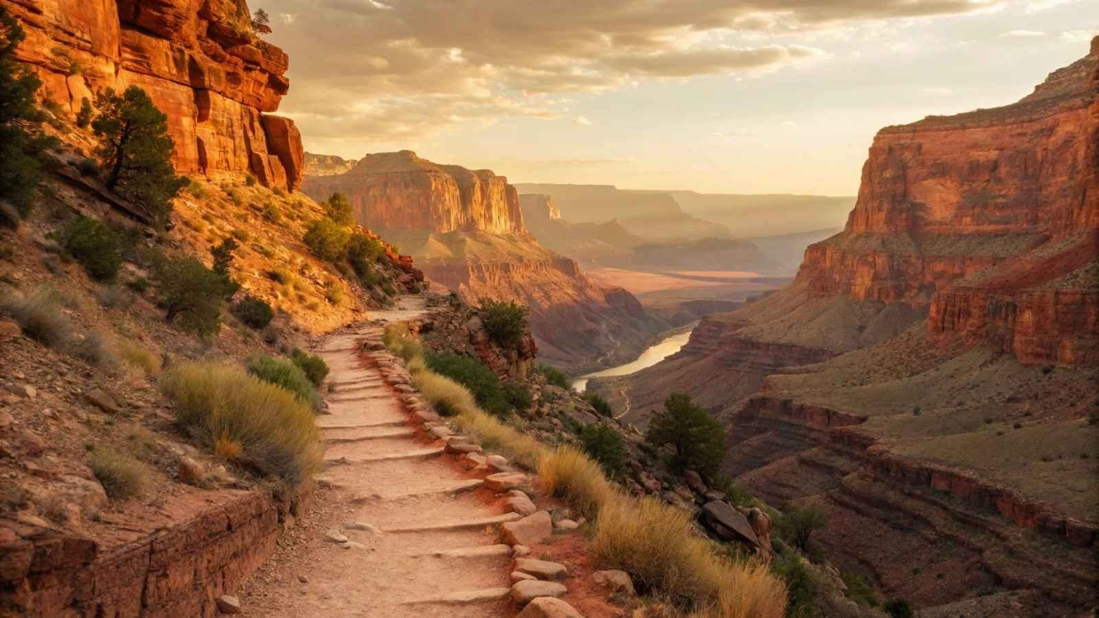
The Nankoweap Trail is the Grand Canyon’s wild side — a brutal, breathtaking descent that carves through exposed cliffs, remote ridgelines, and winds all the way down to the Colorado River. Most visitors never even hear about it, let alone attempt it. And that’s no surprise: it’s considered one of the most difficult and remote trails in the park, requiring serious fitness, planning, and respect for the terrain.
What you get in return, however, transcends any other experience of the canyon — sanctified vistas for just you and you won’t haggle with bus tours, the stillness of those ancient Ancestral Puebloan granaries, a land camaraderie with the Earth few people will understand or remember. The Nankoweap is capital-T Time Travel — it’s less walk and more canyon grunt, and the descent into the darkness of the canyon, though every single step down (and especially up), leaving you to remind yourself that it does not owes nothing.
If you’re up for the challenge, this is a bucket-list experience for serious hikers. It’s strenuous, dry, and unforgiving — but it may just be the most soul-shakingly beautiful trail you’ll ever walk.
Quick Info:
- Best Months to Visit: March to May, September to November
- Length: 28 miles round trip
- Trailhead Location: Saddle Mountain Trailhead (North Rim)
- Highlights: Remote canyon views, solitude, archaeological sites
- Permit Needed: Yes (overnight backcountry)
- Water Availability: Extremely limited — plan carefully
- Not for Beginners: Route-finding and heat exposure are serious risks
7. Hockett Trail – Sequoia National Park (CA)
Hidden in the southern reaches of Sequoia National Park, far from the General Sherman crowds, the Hockett Trail is a lush backcountry corridor that once served as a 19th-century wagon route. Today, it’s a quiet, forested escape winding through wildflower meadows, pine forest, and granite-lined creeks.
Sequoia Park trails are the exception to this rule; they are lower in elevation, so this is a high/early season route than some of Sequoia’s alpine paths. Tallest giant sequoias and all the same towers of giants, but you get to experience not-so-well-known habitats, and forests (such as the Hockett Meadow, which is located out in the boonies and bloom) as well. Good platform for solitude seekers, long-distance hiking lovers, and those who still have sky-high passes to conquer.
It’s one of those places where you can walk for hours with only the sound of your boots and birdsong. For a multi-day trip, combine it with other trails for a big loop. Otherwise, just pick a scenic turnaround point and enjoy a peaceful day in the trees.
Quick Info:
- Best Months to Visit: May through October
- Length: 10–30+ miles (out-and-back or loop options)
- Trailhead Location: South Fork Campground (near Three Rivers, CA)
- Highlights: Meadows, creeks, solitude, historical trail
- Permit Needed: Yes (overnight use)
- Crowd Level: Very low — even on weekends
8. Greenstone Ridge Trail – Isle Royale National Park (MI)
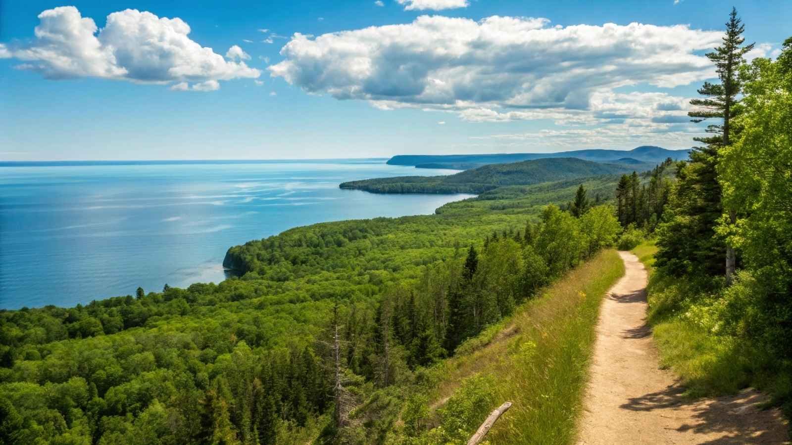
Getting to Isle Royale is an adventure in itself — a long ferry or seaplane ride into Lake Superior’s most remote island wilderness. But once you arrive, the Greenstone Ridge Trail awaits: a 40-mile spine across the island that’s more moose than man, more birdsong than bootsteps.
This trail offers some of the best solitude in the entire National Park system. There are no roads, cars, or even day tourists. You’re out there for days, hiking along a mossy ridge with Lake Superior stretching out endlessly on both sides. The trail passes through boreal forests, windswept rock fields, and fern-covered meadows — often in total silence.
One of the joys of this trail is its meditative rhythm. Each day brings a new lake, a new view, a new quiet. If you’ve ever wanted to disconnect and just hike—hike — this is your trail. Just don’t forget your bug spray in June.
Quick Info:
- Best Months to Visit: July through September
- Length: 40 miles (Windigo to Rock Harbor)
- Trailhead Location: Windigo or Rock Harbor (depending on direction)
- Highlights: Lake views, wildlife (moose!), total solitude
- Permit Needed: Yes, but easy to obtain
- Access: Ferry or seaplane from Michigan or Minnesota
9. Teton Crest Trail via Death Canyon – Grand Teton National Park (WY)
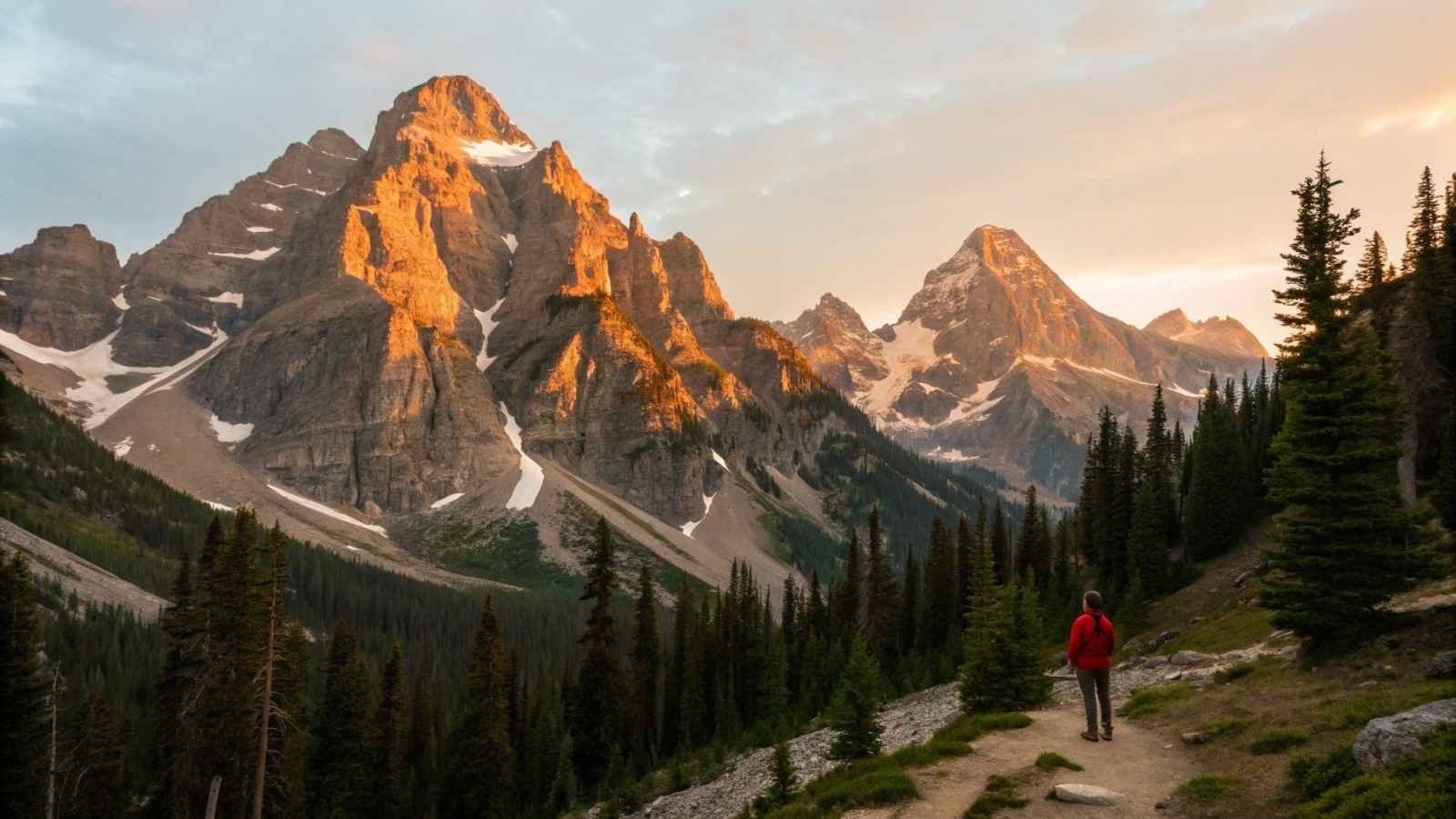
The vast majority view Grand Teton through the smoke of Inspiration Point or Jenny Lake, so that the Teton Crest Trail, in particular, via Death Canyon, is very literally another park. A High-alpine wilderness of glacial lakes, ancient granite ridgelines, and grazing meadows resplendent with wildflowers.
Entering the Teton backcountry from Death Canyon is a more peaceful way to do it. The higher you go, the fewer people you pass, and it gets twice as pretty. The trail is the perimeter of the Teton Range, taking you way more places you’d never see if you just take the front of it — Alaska Basin, Hurricane Pass, and South Fork Cascade Canyon in particular.
It’s a serious trek, often done as a multi-day backpacking trip. But even a day hike up into Death Canyon itself gives you access to one of the park’s most secluded and rewarding landscapes, often with far more marmots than people.
Quick Info:
- Best Months to Visit: July through September
- Length: Varies — 6 miles (day hike) to 35+ miles (Teton Crest route)
- Trailhead Location: Death Canyon Trailhead
- Highlights: Alpine lakes, big views, wildflowers, solitude
- Permit Needed: Yes (for overnight trips)
- Wildlife Caution: Bears are common — bring spray and know protocols
10. Bluebird Lake Trail – Rocky Mountain National Park (CO)
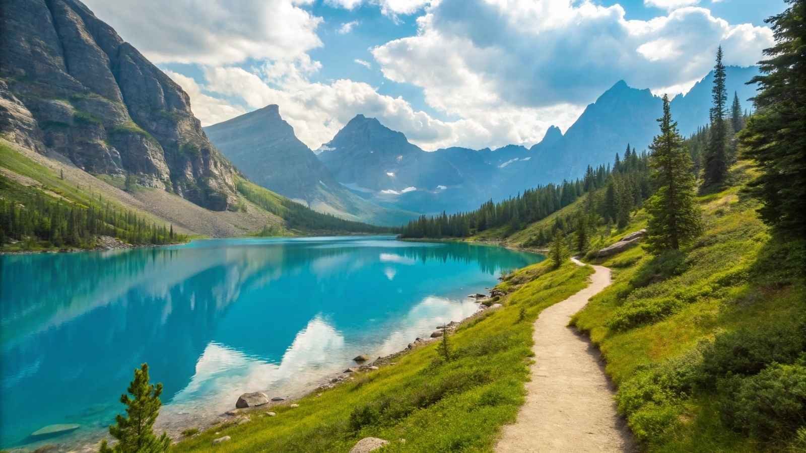
While everyone else rushes to Bear Lake or Sky Pond, Bluebird Lake sits quietly at the end of a long, steady trail in the lesser-traveled Wild Basin section. This is one of Rocky Mountain’s most peaceful full-day hikes, with waterfalls, pine-scented woods, and alpine views that just get better with every mile.
The trail starts gently, passing by Copeland Falls and Calypso Cascades. As you climb higher, the crowds thin — and by the time you reach the windswept tundra near Bluebird Lake, it’s likely just you and the pika. The lake itself is a jewel nestled beneath cliffs, often still rimmed with snow even into early summer. It’s the kind of view that makes the mileage melt away.
What sets this hike apart is its flow — it just keeps delivering. Waterfalls, wildflowers, wildlife, and that ultimate lake view, all without the pressure of the more famous trailheads. It’s a long day, but one of the park’s best-kept secrets.
Quick Info:
- Best Months to Visit: July to mid-September
- Length: 12.6 miles round trip
- Trailhead Location: Wild Basin Trailhead
- Highlights: Waterfalls, alpine lake, tundra views, solitude
- Permit Needed: None for day hiking
- Note: Arrive early — limited parking at Wild Basin
11. Mauna Loa Summit Trail – Hawaiʻi Volcanoes National Park (HI)
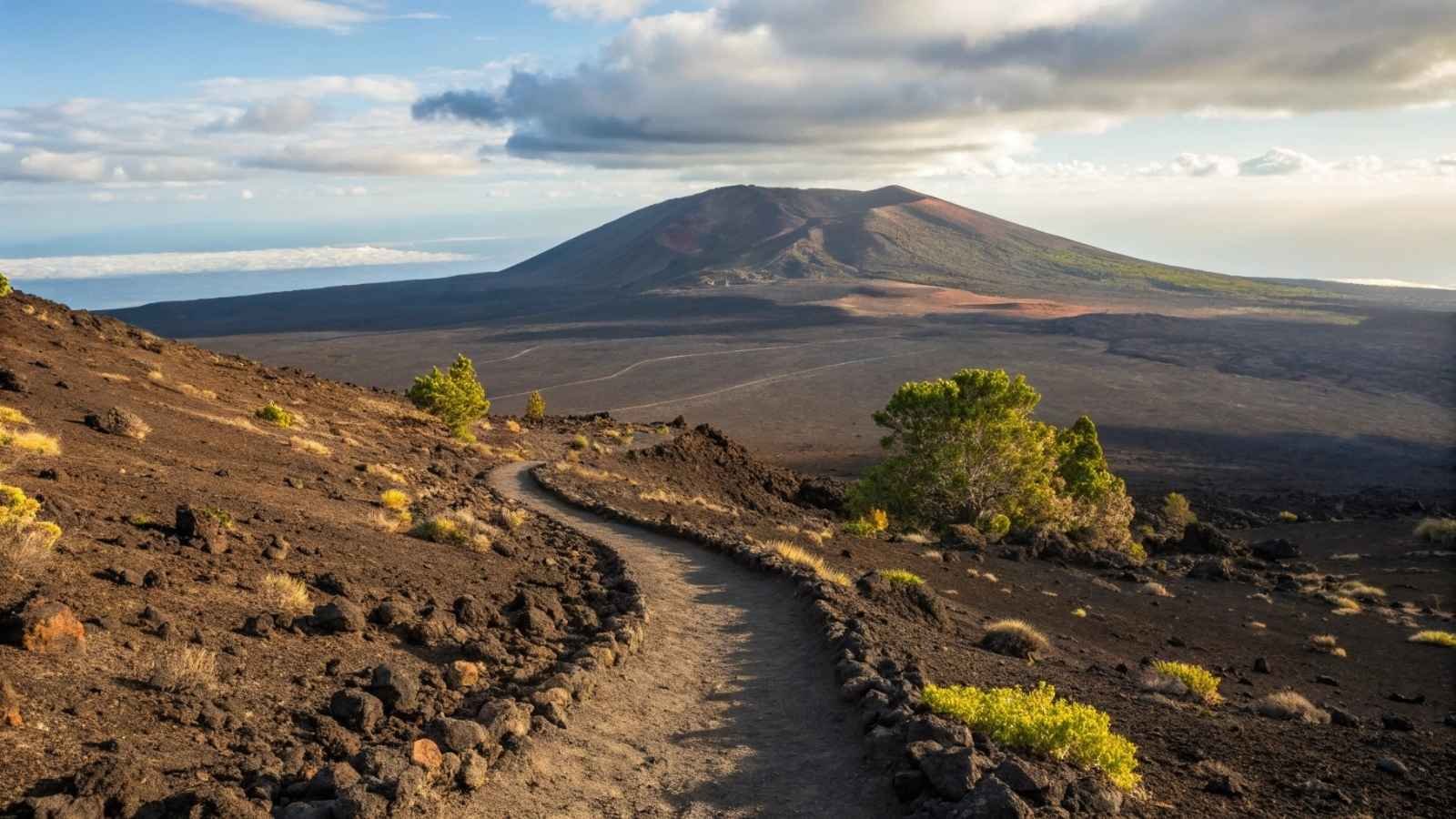
You would think that a trail on one of the biggest volcanoes on Earth would be packed with hikers. The shock, however, is that the Mauna Loa summit trail offers one of the loneliest and most remote hikes in any US national park, to be sure. Not only will you have far fewer people, but miles and miles of lava fields, sharp craters, and the silence and alien scenery.
This is not a lush Hawaiian jungle hike. The trail gains over 6,500 feet in elevation and often stretches above the clouds. What it lacks in vegetation, it makes up for in sheer elemental drama. You’re walking through geology in motion — a cracked, shifting expanse where earth and sky blur together in stunning ways. Reaching the summit at 13,681 feet is a physical and mental triumph.
Because of the altitude and exposure, this trail is for seasoned trekkers only. But those who brave it are rewarded with an experience that feels more Martian than tropical — a place where the concept of “crowds” vanishes completely.
Quick Info:
- Best Months to Visit: May to October (dry season)
- Length: ~13 miles one way (summit route)
- Trailhead Location: Mauna Loa Observatory Road
- Highlights: Crater views, volcanic terrain, sunrise summit
- Permit Needed: Yes, for overnight use
- Altitude Warning: Acclimatization is highly recommended
12. South Rim Trail – Black Canyon of the Gunnison National Park (CO)
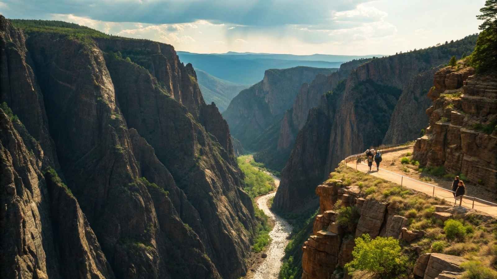
It doesn’t have to go down into the Black Canyon to experience its power. The South Rim Trail is a breathtaking view of such an incredibly steep, narrow gorge without anything to rappel or permits necessary. While other national park rim trails can feel more like scenic sidewalks, this one hugs a canyon so deep and dramatic it often stuns hikers into silence.
Best of all? It’s usually empty. While the park sees modest traffic, most people stick to overlooks or quick stops. That way, once you are on the trail, it’s just you, the cliffs, and the hum of the Gunnison River from thousands of feet above. The trail is fairly easy, so it works great for folks who appreciate a big view without a brutal hike.
The sharp drop-offs, changing light, and desert breeze give this hike a haunting, almost cinematic feel. And if you time it for golden hour, you’ll swear the canyon walls are glowing from within.
Quick Info:
- Best Months to Visit: April to October
- Length: 6 miles round trip
- Trailhead Location: Visitor Center or Tomichi Point
- Highlights: Sheer canyon views, solitude, photography
- Permit Needed: None for day hiking
- Note: Little shade — go early or late in the day
13. Upper Muley Twist Canyon – Capitol Reef National Park (UT)
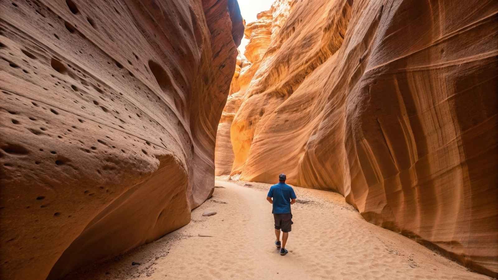
Just the name Muley Twist hints that this trail isn’t your average stroll. Tucked into Capitol Reef’s little-trafficked southern edge, Upper Muley Twist Canyon is a winding, wall-lined slot canyon that twists through red rock cathedrals and past natural arches. And somehow, despite its grandeur, you’ll probably have it all to yourself.
This is canyon country at its finest: high sandstone walls, sudden narrows, and scattered viewpoints that look out over the Waterpocket Fold — a massive geological wrinkle that defines the region. You can do this as a loop if you’re up for a bit of scrambling, or keep it mellow with an out-and-back route.
The trail is marked but feels wild. You’ll navigate slickrock, squeeze through narrow passageways, and maybe lose the path once or twice — but that’s part of the charm. It’s quiet out here. Still. The kind of silence that makes every boot scuff echo like a thunderclap.
Quick Info:
- Best Months to Visit: March to June, September to November
- Length: 9 miles loop or out-and-back
- Trailhead Location: Strike Valley Road (4WD may be required)
- Highlights: Slot canyons, red rock arches, panoramic views
- Permit Needed: None for day use
- Tips: Carry plenty of water; no services nearby
14. Boott Spur Trail – White Mountain National Forest (Mount Washington Area, NH)
While technically just outside a formal national park, Boott Spur Trail is part of a national forest and a less-traveled alternative to Mount Washington’s heavily trafficked Tuckerman Ravine. The payoff? All the alpine drama and summit views — minus the conga line of hikers.
The trail begins amid hardwood forest but quickly climbs into subalpine krummholz, where crooked trees bend from years of fierce wind. Soon, you’re walking above the clouds on a rocky spine with jaw-dropping views of Tuckerman Ravine, Mount Monroe, and the broader Presidential Range. It’s a heart-pounding hike, but without the crowd crush.
On a clear day, the views stretch deep into Maine and Vermont. On a cloudy one, the trail has a moody, mystical vibe. Either way, Boott Spur rewards with a true wilderness feel, even in one of New England’s most visited regions.
Quick Info:
- Best Months to Visit: June to September
- Length: 5.4 miles one way to the summit (loop options available)
- Trailhead Location: Pinkham Notch Visitor Center
- Highlights: Alpine hiking, sweeping views, quiet ridgelines
- Permit Needed: None
- Weather Warning: Conditions can change fast — check before hiking
15. Gaylor Lakes Trail – Yosemite National Park (CA)
Yosemite is not a long hike for solitude, you can do it in what direction to head to find it. The Gaylor Lakes, a high country gem most people never see (sitting very still near the road that leads into Tioga Pass) is that. WAHL: That is a blunder. A short but brisk pathway will guide you to untouched alpine lakes, derelict mining sheds and beautiful views of Dana Peaks and Mammoth
At just under 2 miles each way, it’s accessible — but because it starts at over 9,900 feet, it feels like a proper high-altitude adventure. The climb is quick and steep, but you’re rewarded almost immediately with cool, still lakes reflecting the sky and granite ridges that catch fire at sunset.
Unlike Yosemite Valley, there are no selfie-stick clusters here. Just crystal-clear water, pika calling from the rocks, and the hush of wind at 10,000 feet. It’s a reminder that Yosemite’s beauty doesn’t end at El Capitan — it just gets quieter the higher you go.
Quick Info:
- Best Months to Visit: July through September
- Length: 4 miles round trip
- Trailhead Location: Tioga Pass Entrance Station
- Highlights: Alpine lakes, mining history, high-elevation vistas
- Permit Needed: None for day hiking
- Altitude Caution: Can be a shock — pace yourself if unacclimated