Something about a trail that pulls you in—the crunch of gravel beneath your boots, the smell of pine after a rainstorm, that deep breath you didn’t realize you needed. These aren’t just hikes—they’re mile-by-mile experiences that leave you different than when you started.
Some take you to the edge of cliffs, others into quiet forests or across wildflower-filled valleys, but all of them offer that rare gift: space to feel alive. If you’ve ever stood still on a ridgeline to take it all in, you already know—this list isn’t about steps, it’s about stories worth walking.
1. Half Dome – California (Yosemite National Park)
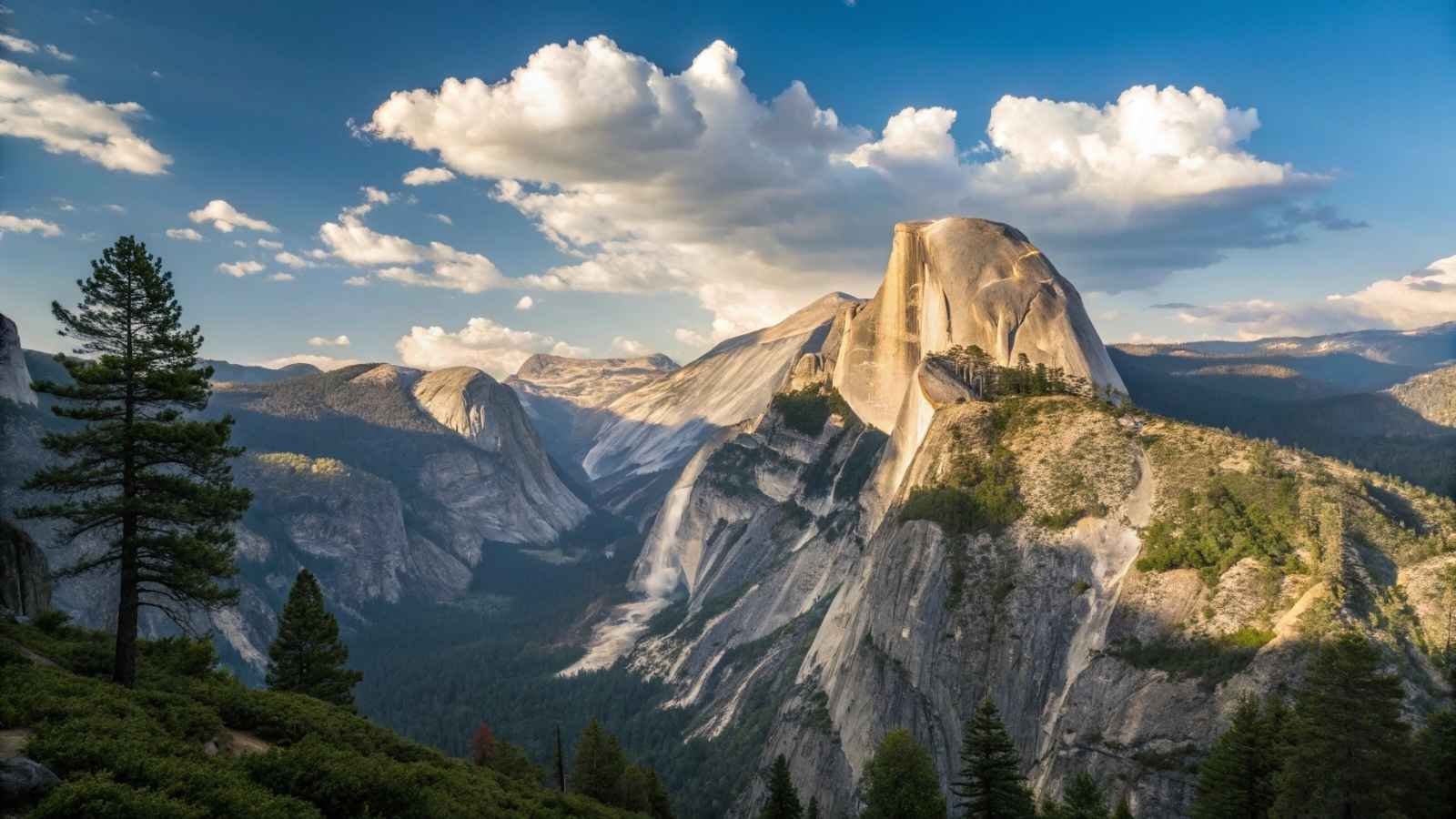
If there’s one trail that sits at the top of countless bucket lists, it’s Half Dome. This 17-mile round-trip hike is no walk in the park, but the payoff is nothing short of legendary. You start with mist-kissed waterfalls, wander through thick pine forests, and then—after several miles of uphill effort—face the final test: the cable ascent. These steel cables bolted into the granite dome take you up the last 400 feet, almost vertically. And yes, it’s every bit as intense as it sounds.
Once you’re standing on that summit, though, with panoramic views of Yosemite Valley, the High Sierra, and far-off peaks, you get it. The nerves, the leg cramps, the early morning start—they all vanish in that wind-swept silence. It’s one of those rare hikes where the destination truly outweighs the journey, even though the journey is pretty incredible too.
Permits are required, and there’s a lottery system in place due to its popularity. That should tell you something. But if you’re up for a challenge and you’re not afraid of heights, Half Dome is the crown jewel of American day hikes.
Quick Facts:
- Best Months to Visit: Late May to October (when cables are up)
- Distance: 17 miles round trip
- Elevation Gain: 4,800 feet
- Permit Required: Yes (via a lottery)
- Difficulty: Strenuous
- Must-Pack: Gloves for the cables, 3–4 liters of water, sunscreen, headlamp for early starts
2. The Kalalau Trail – Hawaii (Kauai)
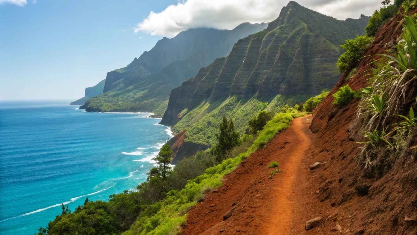
Tucked into the lush, dramatic cliffs of Kauai’s Nā Pali Coast, the Kalalau Trail is a stunner in every sense of the word. This 22-mile out-and-back trail is known for its sweeping cliffside views, jungle canopies, waterfalls, and secluded beaches. But don’t be fooled by the paradise vibes—this is a rugged hike that demands respect.
The real treat comes when you reach Kalalau Beach, a remote stretch of sand bordered by towering cliffs and reachable only by trail or boat. Spending a night here under the stars, with waves lapping nearby and zero cell service, feels like you’ve dropped off the edge of the modern world.
Weather can make or break this trail. When dry, it’s magical. But when wet, the muddy paths and stream crossings can get downright dangerous. Still, for those willing to commit, Kalalau delivers a once-in-a-lifetime wilderness experience wrapped in one of the most beautiful landscapes on Earth.
Quick Facts:
- Best Months to Visit: May to September (dry season)
- Distance: 22 miles round trip
- Elevation Gain: 5,000+ feet
- Permit Required: Yes (even for day hikes past Hanakāpīʻai Beach)
- Difficulty: Difficult to strenuous
- Must-Pack: Water purification, lightweight camping gear, dry bags (for river crossings)
3. The Appalachian Trail (Smokies Section) – Tennessee/North Carolina
The Appalachian Trail is 2,190+ miles long, but one of its most memorable segments runs through the Great Smoky Mountains National Park, straddling the Tennessee-North Carolina border. In this section, you’ll pass through mossy spruce-fir forests, high ridgelines, and some of the most biodiverse woodlands in North America.
You don’t have to thru-hike to experience the magic here. The stretch from Clingmans Dome to Davenport Gap, about 70 miles, gives you a taste of the variety: quiet balds with 360-degree views, mist-draped forests that feel enchanted, and nights in rustic shelters surrounded by nothing but owls and crickets.
The Smokies are special in every season. Fall brings blazing foliage, spring erupts with wildflowers, and winter offers a snow-dusted serenity that’s hauntingly beautiful. If you’re craving a long-distance trek with history, beauty, and trail culture, this part of the A.T. is as classic as it gets.
Quick Facts:
- Best Months to Visit: April to June, September to November
- Distance: Varies (Clingmans Dome to Davenport Gap is ~70 miles)
- Elevation Gain: 15,000+ feet over full segment
- Permit Required: Yes (for overnight backcountry camping)
- Difficulty: Moderate to strenuous
- Must-Pack: Bear canister or hang system, layered clothing, shelter reservation
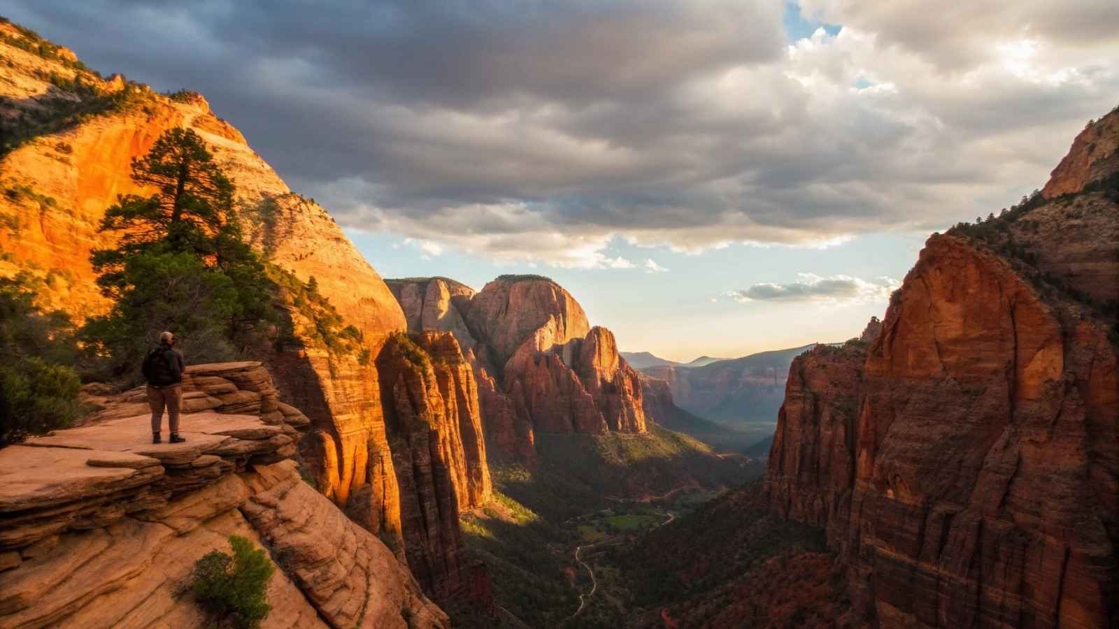
4. The Narrows – Utah (Zion National Park)
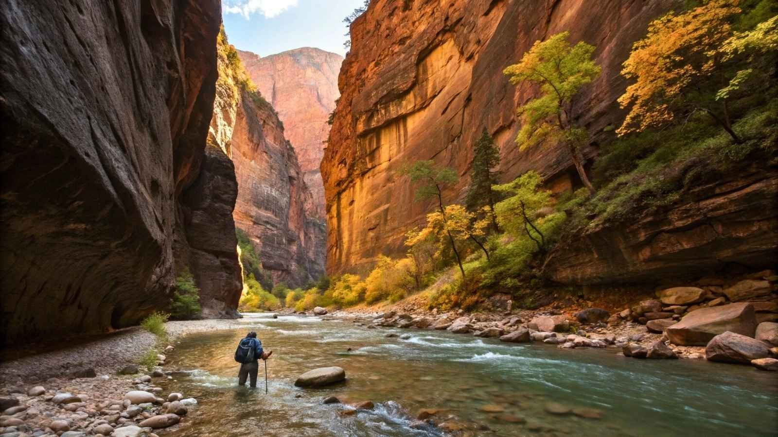
Ever wanted to hike through a river in a glowing sandstone canyon? That’s exactly what you do in The Narrows, one of Zion’s most iconic and immersive hikes. You’re not just walking beside a river—you’re walking in it, wading through cool water as canyon walls rise 1,000 feet on either side.
It’s an unforgettable sensory experience. The filtered light dances on the canyon walls, the sound of water echoes around you, and each bend unveils a new jaw-dropping chamber. There’s no official “end point” if you’re doing the bottom-up route, so you can turn around whenever you like.
Because the Virgin River is your trail, conditions change often, especially during spring runoff or monsoon season. But catch it on a calm summer day, and this hike becomes a spiritual walk through nature’s architecture—no exaggeration.
Quick Facts:
- Best Months to Visit: June to October
- Distance: Up to 9.4 miles round trip (bottom-up)
- Elevation Gain: Minimal, but variable due to water
- Permit Required: Only for top-down thru-hike
- Difficulty: Moderate (water depth, footing)
- Must-Pack: Water shoes, trekking pole, dry bags, waterproof layers
5. Mount Katahdin via Knife Edge – Maine
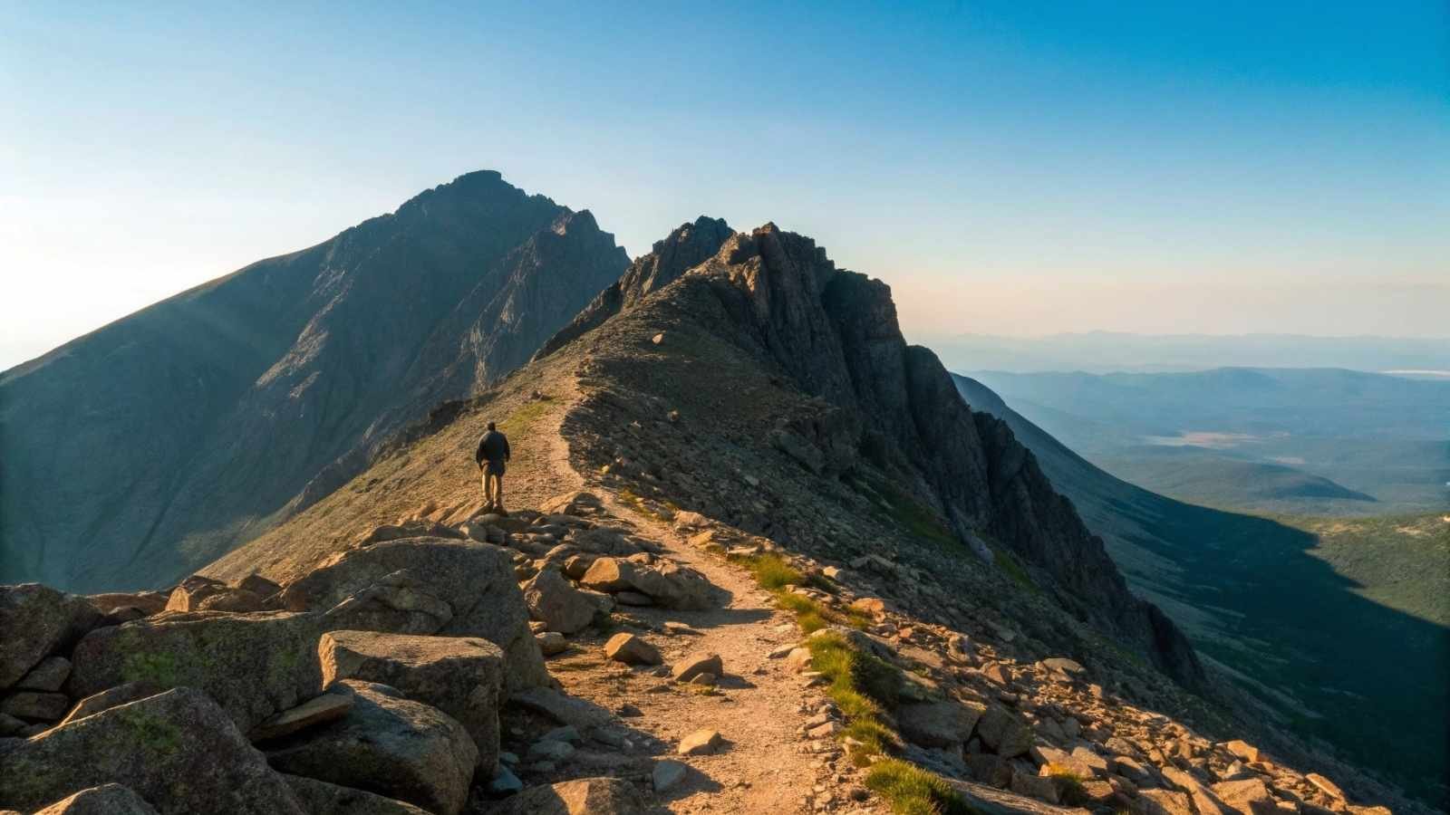
Katahdin isn’t just Maine’s highest peak—it’s a rite of passage. As the northern terminus of the Appalachian Trail, it marks either the triumphant finish or the legendary start of a months-long journey for many hikers. But even as a standalone climb, the Knife Edge Trail to the summit is downright epic.
Knife Edge is exactly what it sounds like: a narrow, exposed ridge with sheer drop-offs on both sides. You’ll scramble across boulders, cling to the rock with all fours, and carefully pick your way across sections barely wider than a balance beam. It’s intimidating—but unforgettable.
Once you reach the summit, the views are just the icing on a very wild cake. Surrounded by alpine lakes, forests, and endless sky, Katahdin feels remote, raw, and rugged in all the right ways. Just check the weather—this one turns dangerous fast.
Quick Facts:
- Best Months to Visit: July to early October
- Distance: ~10.5 miles round trip (varies by route)
- Elevation Gain: ~4,000 feet
- Permit Required: Day-use parking reservations
- Difficulty: Strenuous and exposed
- Must-Pack: Layers, sturdy footwear, gloves for scrambling, strong nerves
6. Grinnell Glacier Trail – Montana (Glacier National Park)
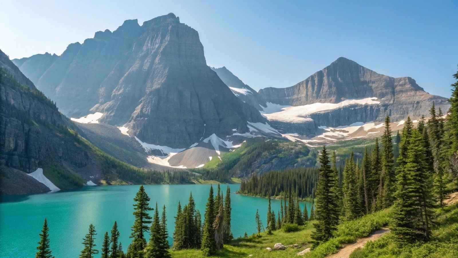
Few trails in the U.S. combine alpine drama, glacial views, and abundant wildlife quite like the Grinnell Glacier Trail in Glacier National Park. This hike starts scenic and gets better with every step. Turquoise lakes, cascading waterfalls, and wildflower meadows set the tone before the real showstopper: a close-up of Grinnell Glacier, backed by a wall of peaks and icefields.
It’s a moderately challenging trek, but the trail is well-maintained, and the climb is steady rather than steep. As you gain elevation, the view opens up to jaw-dropping panoramas of Lake Josephine and Grinnell Lake, shining like melted sapphires below. On the way, you might spot mountain goats, bighorn sheep, or even the occasional bear from a safe distance.
There’s something undeniably powerful about standing in front of a glacier that’s been carving through rock for thousands of years. Grinnell doesn’t just offer beauty—it offers perspective.
Quick Facts:
- Best Months to Visit: July to mid-September
- Distance: ~10.5 miles round trip (from trailhead, shorter if taking boat shuttle)
- Elevation Gain: ~1,600 feet
- Permit Required: No (but park entry pass required)
- Difficulty: Moderate
- Must-Pack: Bear spray, rain shell, binoculars for wildlife
7. The Enchantments – Washington (Alpine Lakes Wilderness)
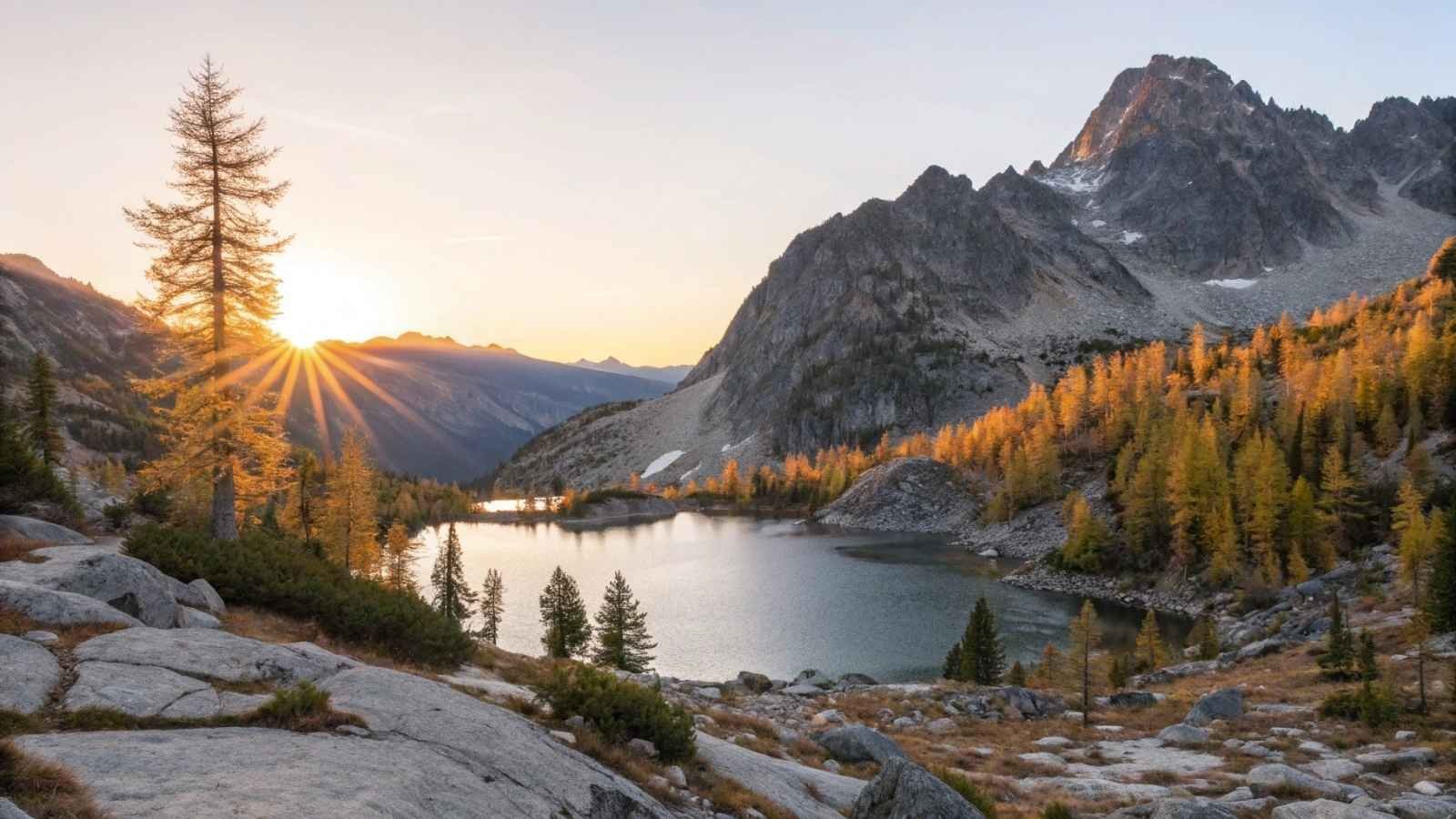
The name says it all—The Enchantments are pure alpine magic. This area in Washington’s Alpine Lakes Wilderness is packed with crystalline lakes, granite peaks, golden larches, and mountain goats that seem to pose like seasoned trail models. It’s a challenging hike, but the payoff is an absolute dream.
There are two main ways to do it: as a through-hike over 18 miles via Aasgard Pass (brutal but beautiful) or as a multi-day backpacking trip if you can snag one of the famously hard-to-get permits. Either way, the core Enchantments basin—where the real magic happens—is your goal.
Fall is especially mesmerizing when the larches turn gold and reflect in the icy-blue lakes. This trail isn’t just one of Washington’s best—it’s one of the most photogenic and soul-stirring hikes in the U.S.
Quick Facts:
- Best Months to Visit: Mid-July to October (September = golden larches)
- Distance: ~18 miles point to point
- Elevation Gain: ~4,500 feet
- Permit Required: Yes (for overnight stays)
- Difficulty: Very strenuous
- Must-Pack: Trekking poles, layers, lots of water, camera!
8. Angels Landing – Utah (Zion National Park)
If you’ve ever seen a photo of hikers gripping chains with red cliffs all around, odds are it was Angels Landing. This iconic Zion hike offers big thrills and even bigger views—and yes, those chains are very real. The final half-mile is a narrow ridge climb with drop-offs on both sides, earning it a spot on just about every hiker’s must-do (and must-prepare-for) list.
Before the adrenaline-pumping finish, the trail takes you up a series of switchbacks known as Walter’s Wiggles, with sweeping views of Zion Canyon growing with every step. Once you reach the summit, the reward is unbeatable—a bird’s-eye view of one of the Southwest’s most stunning landscapes.
It’s short by national park standards, but don’t let the mileage fool you. The exposure and crowds can make it intense, so time your visit smartly.
Quick Facts:
- Best Months to Visit: March to May, September to November
- Distance: 5.4 miles round trip
- Elevation Gain: ~1,500 feet
- Permit Required: Yes (timed-entry lottery system)
- Difficulty: Strenuous and exposed
- Must-Pack: Good shoes with grip, courage, water, and patience (for crowded chains)
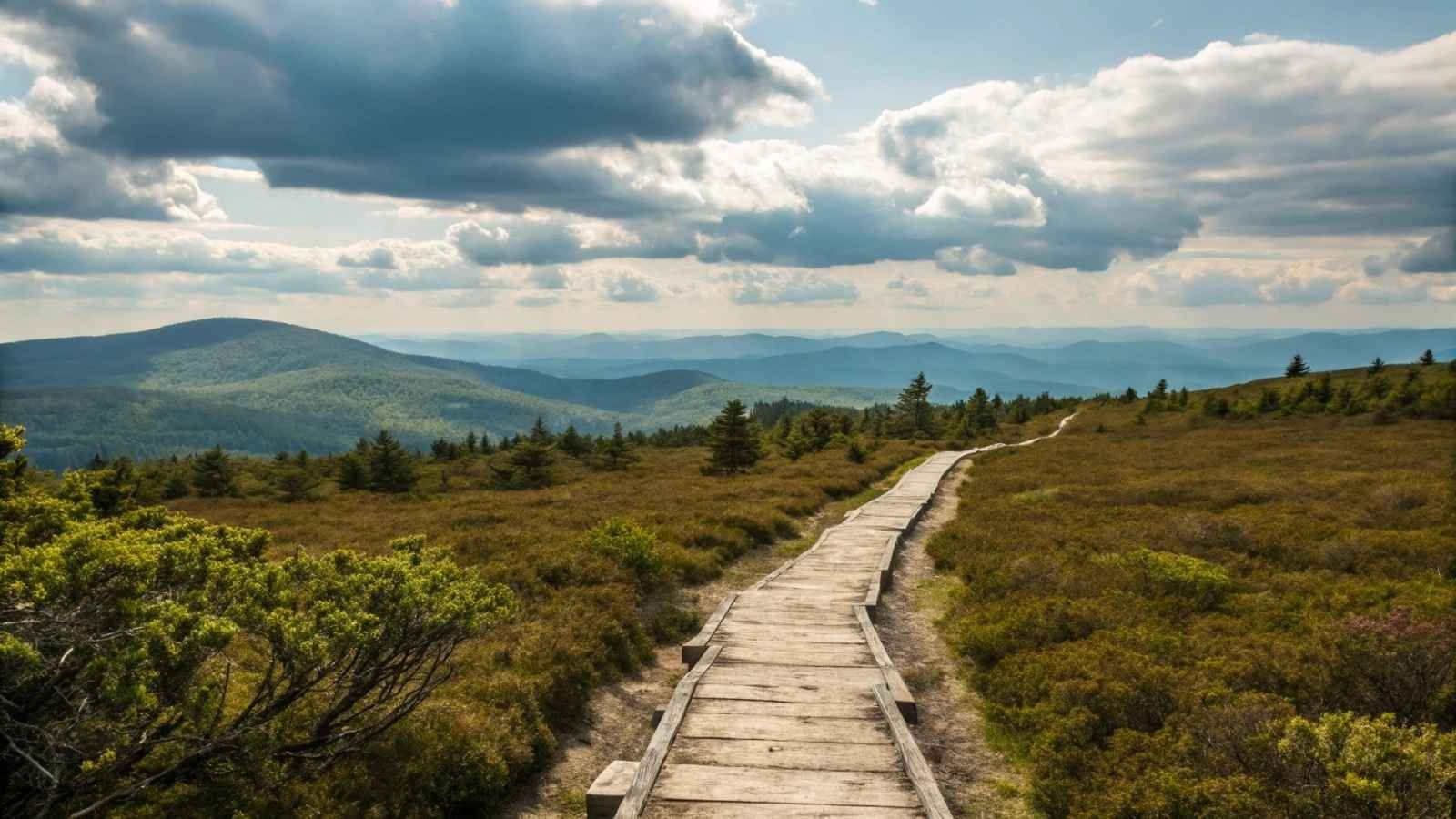
9. Highline Trail – Montana (Glacier National Park)
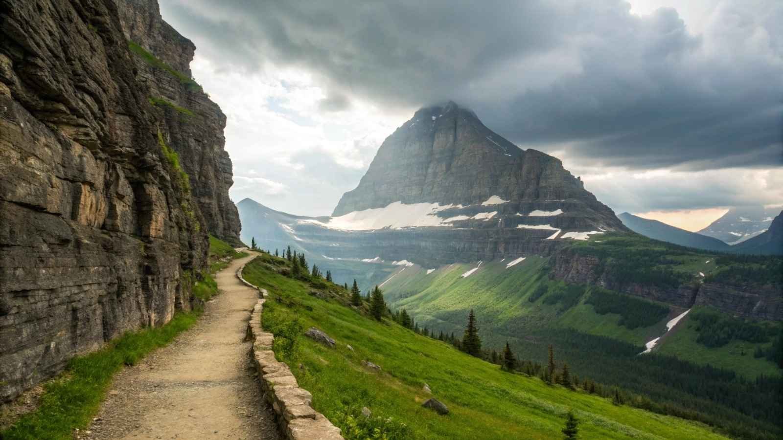
The Highline Trail is often described as the crown jewel of Glacier National Park, and it more than lives up to that title. What makes this hike so unique is that you’re practically walking the spine of the Continental Divide, with cliffs on one side and sweeping valley views on the other.
Starting from Logan Pass, the trail hugs dramatic ledges (with safety cables) before opening up into alpine meadows filled with wildflowers, marmots, and mountain views that stretch for miles. The full trail can take you to the Granite Park Chalet and down to The Loop, making it an exhilarating one-way journey (shuttle recommended).
It’s long, but not overly steep, which makes it one of the most accessible long hikes with high rewards in the country. You’ll feel like you’re walking on top of the world the entire way.
Quick Facts:
- Best Months to Visit: Mid-July to September
- Distance: 11.8 miles (point to point)
- Elevation Gain: ~800 feet (gain), ~2,000 ft loss (to The Loop)
- Permit Required: No (but national park entry pass required)
- Difficulty: Moderate
- Must-Pack: Sun protection, bear spray, shuttle timing info
10. Franconia Ridge Loop – New Hampshire (White Mountains)
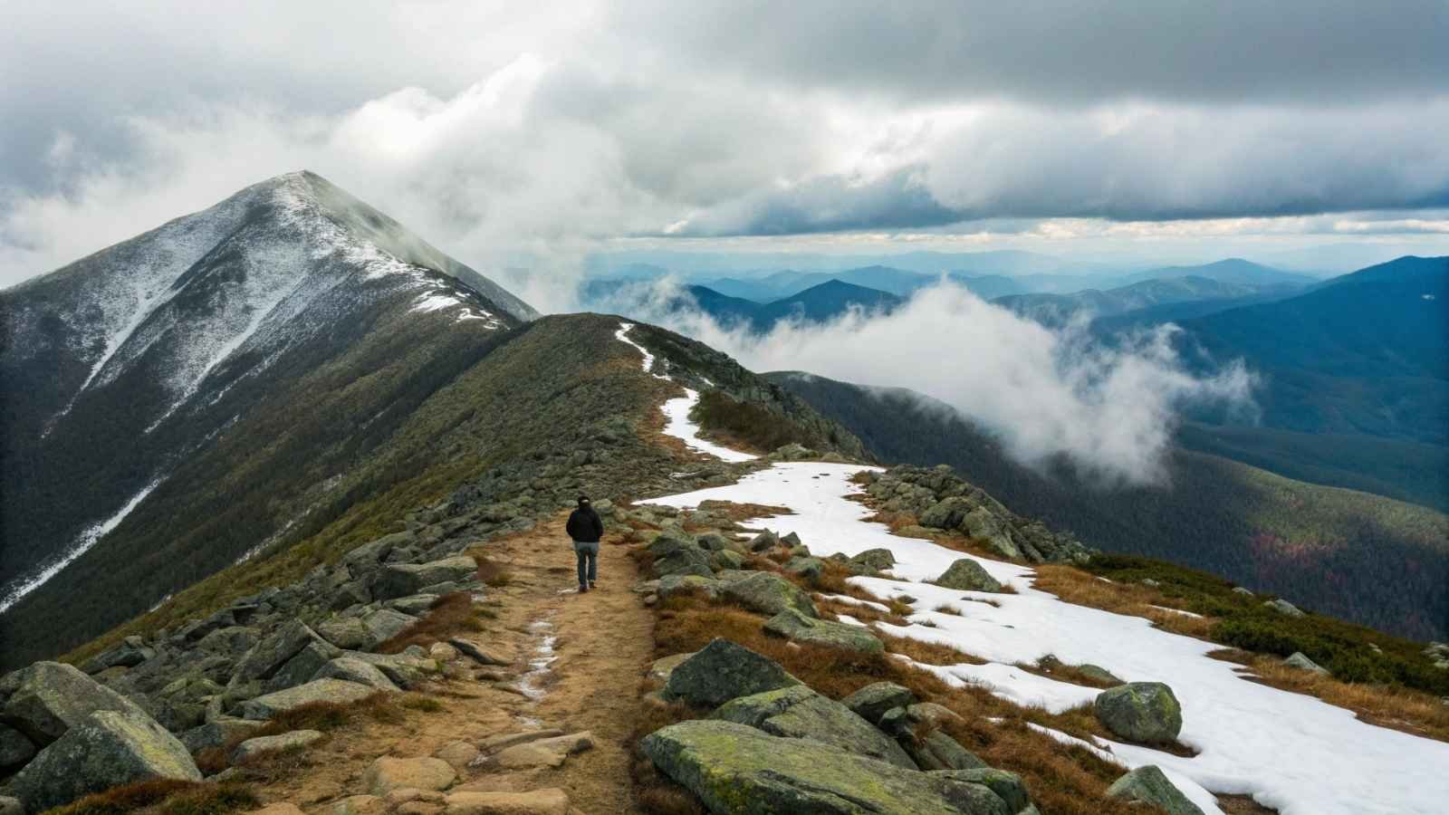
There’s something timeless about the White Mountains, and the Franconia Ridge Loop captures it all in one perfect, sky-walking loop. This 8.5-mile hike takes you across a knife-edge ridge that feels like you’re floating between clouds and mountains.
The climb up is tough but scenic, passing waterfalls and forested paths before you break above the tree line and walk a stretch of the Appalachian Trail across Mount Lafayette, Mount Lincoln, and Little Haystack. On a clear day, the views roll out for dozens of miles in every direction.
This trail is a rite of passage for New England hikers. It’s challenging, exposed, and awe-inspiring—especially when the foliage is on fire in early fall. You’ll earn every step, but you’ll remember every view.
Quick Facts:
- Best Months to Visit: June to October (September for fall colors)
- Distance: 8.5-mile loop
- Elevation Gain: ~3,800 feet
- Permit Required: No (but parking fills fast)
- Difficulty: Strenuous
- Must-Pack: Windbreaker, map (fog is common), layers
11. Harding Icefield Trail – Alaska (Kenai Fjords National Park)
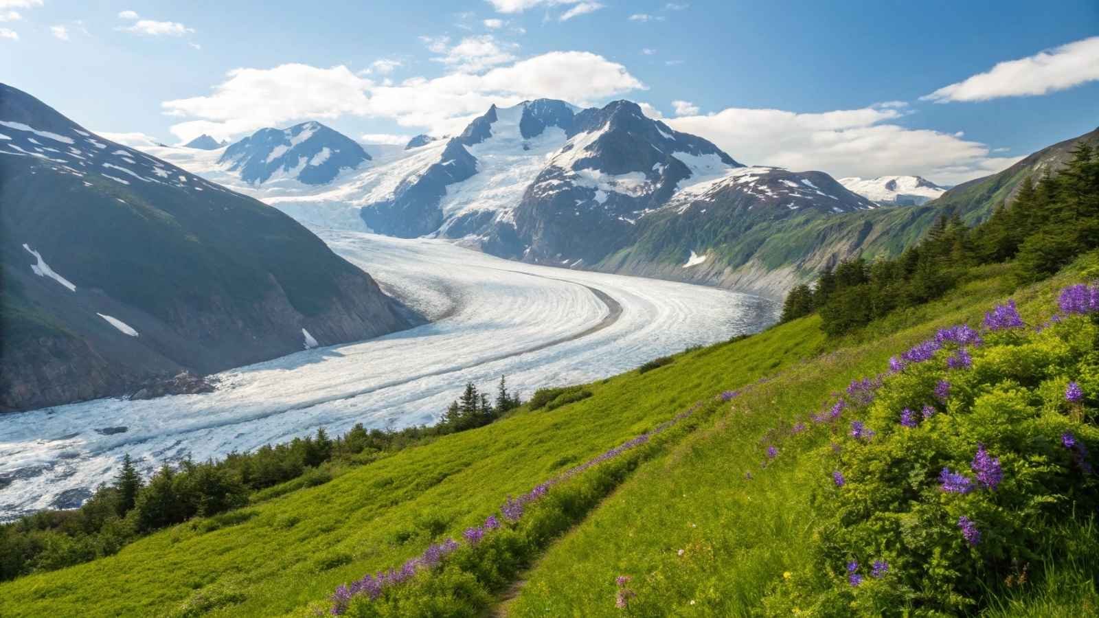
There are few places in America where you can stand on solid ground and gaze into the Ice Age, but that’s exactly what you get on the Harding Icefield Trail. This Alaskan gem climbs steadily above the Exit Glacier, eventually revealing a jaw-dropping horizon of ice that stretches as far as the eye can see.
The transition is dramatic: You start among alder bushes and thick spruce, gradually trading green for gray as you rise above the treeline. And then, bam—a sea of white unfolds below you, ancient and unbothered. It’s eerie, humbling, and almost otherworldly.
The weather here can turn fast, and wildlife (yes, including bears) is a very real part of the experience. But that’s what makes it so exhilarating—this isn’t just a hike; it’s a raw, full-sensory encounter with Alaska’s wild heart.
Quick Facts:
- Best Months to Visit: Mid-June to early September
- Distance: ~8.2 miles round trip
- Elevation Gain: ~3,500 feet
- Permit Required: No
- Difficulty: Strenuous
- Must-Pack: Bear spray, waterproof gear, layers, snacks for the summit view
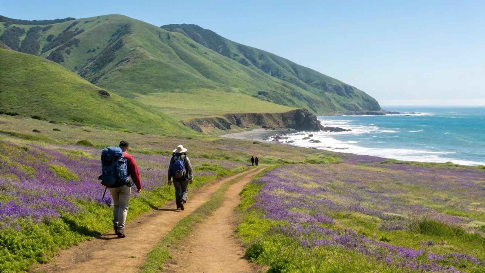
12. Lost Coast Trail – California (King Range National Conservation Area)
Most California hikes are crowded, but not this one. The Lost Coast Trail lives up to its name by offering something increasingly rare: utter solitude in a place so beautiful it feels like it should be world-famous. This is one of the few coastal hikes in the lower 48 where your boots touch wild sand and your view is nothing but ocean, cliffs, and sky.
The trail hugs the remote stretch of Northern California coastline where the mountains drop directly into the Pacific. Seals nap on driftwood. Waves crash against rocky outcrops. And you? You’re weaving between beach, bluff, and tide zones, carrying everything you need on your back.
But make no mistake—this trail is wild. Parts are only passable during low tide, and there’s zero cell service or infrastructure. That said, if you’re craving remoteness and the sound of waves as your only bedtime lullaby, this is your trail.
Quick Facts:
- Best Months to Visit: May to October
- Distance: ~25 miles point to point (usual northern section)
- Elevation Gain: Moderate but rugged terrain
- Permit Required: Yes (Wilderness permit + bear canister required)
- Difficulty: Moderate to strenuous
- Must-Pack: Tide chart, bear canister, waterproof bags, extra socks
13. Teton Crest Trail – Wyoming (Grand Teton National Park)
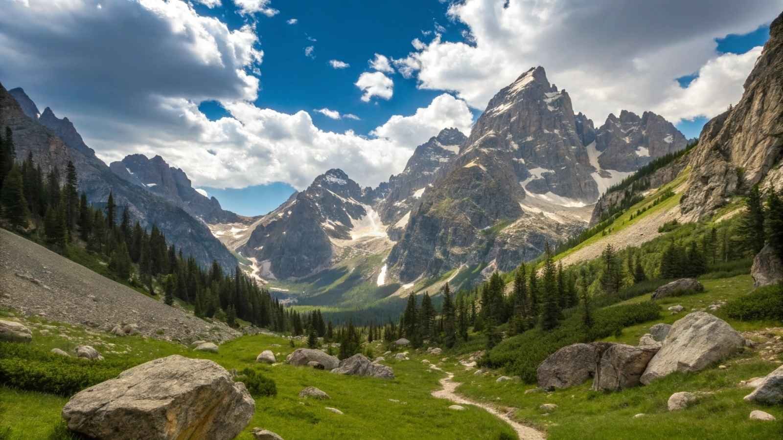
If you’re looking for a hike that feels like a storybook—with towering granite peaks, alpine lakes, wildflower-strewn meadows, and the chance to camp beneath a blanket of stars—then the Teton Crest Trail is your grand finale. This multi-day trek weaves through the very best of Grand Teton National Park, often offering jaw-dropping scenery with surprisingly few crowds.
What sets it apart is the sheer variety. One moment you’re hiking across open ridgelines with sweeping views of the Tetons, the next you’re dipping into lush valleys and passing waterfalls, moose, or maybe even a backcountry ranger who tips his hat like you’re in a Western.
It’s no walk in the park—you’ll need permits, planning, and a decent pack—but by the time you descend back into civilization, you’ll swear you’ve lived a small adventure worthy of its own memoir.
Quick Facts:
- Best Months to Visit: Mid-July to early September
- Distance: ~40 miles (can vary by route)
- Elevation Gain: ~8,000 feet total over several days
- Permit Required: Yes (high demand for backcountry permits)
- Difficulty: Strenuous (multi-day with altitude)
- Must-Pack: Tent, bear spray, layered gear, water filter, detailed map